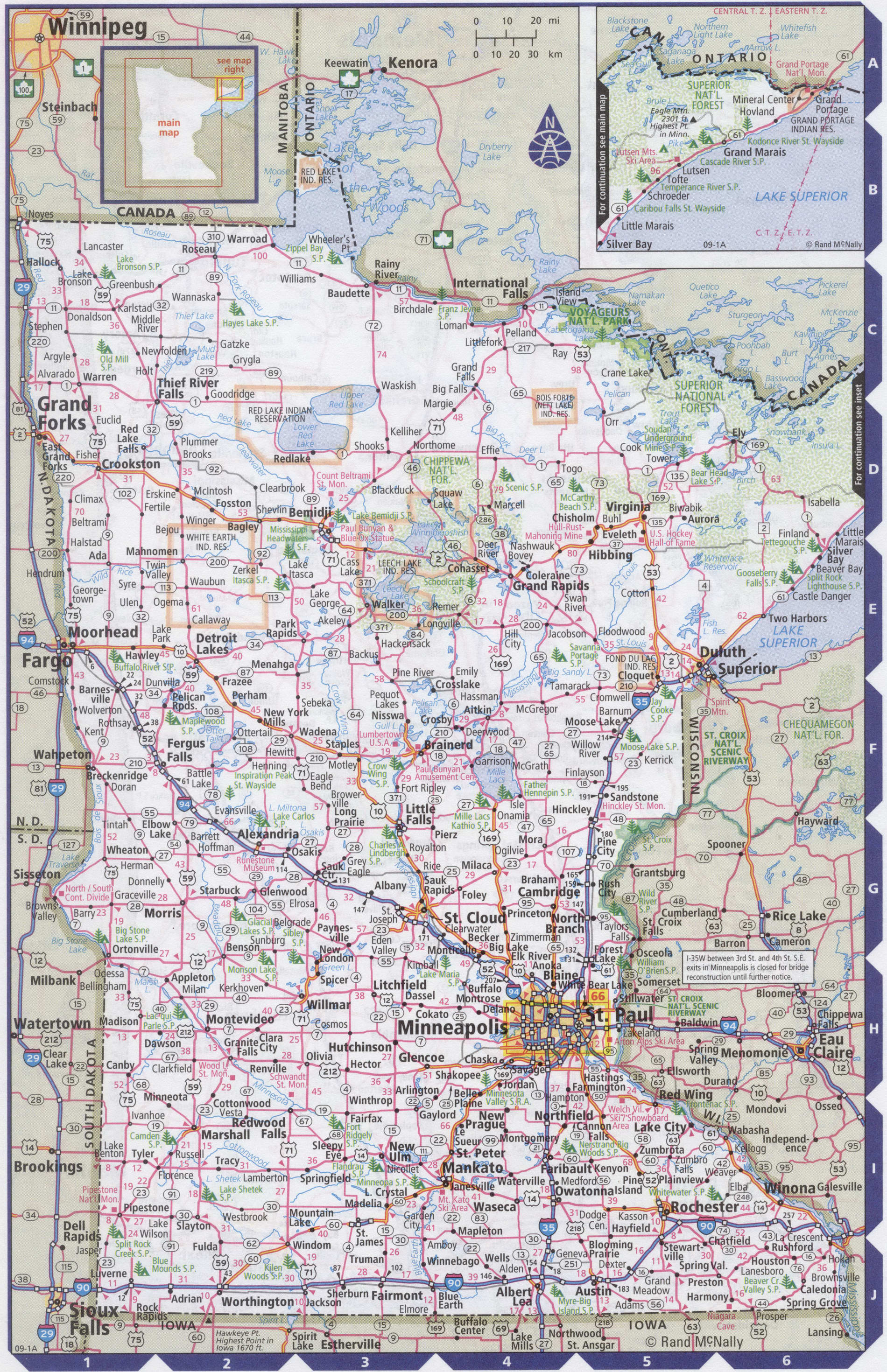
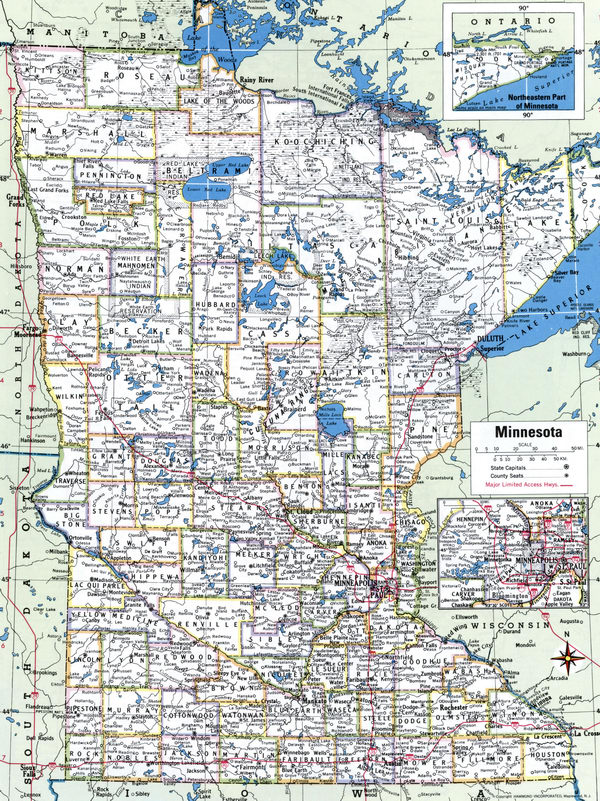
Map of Minnesota state with cities and counties
Maps of Minnesota state with cities and counties, highways and roads
Detailed maps of the state of Minnesota are optimized for viewing on mobile devices and desktop computers. This page contains four maps of the state of Minnesota:
- The first is a detailed road map - Federal highways, state highways, and local roads with cities;
- The second is a roads map of Minnesota state with localities and all national parks, national reserves, national recreation areas, Indian reservations, national forests, and other attractions;
- The third is a map of Minnesota state showing the boundaries of all the counties of the state with the indication of localities-administrative centers of the counties;
- The fourth is a Google satellite map of Minnesota state, where you can view the location of all the interesting places in the state in interactive mode.
You will evaluate which of the presented maps is most useful for you. It may be convenient for you to compare information from all four sources.
All maps can be freely used-downloaded as a file or printed on paper. Using our maps, you can get directions along highways and local roads for sightseeing trips to the main attractions of the state of Minnesota:
Works by Picasso and Henry Moore at the Walker Art center in Minneapolis.
The Frederick Weissman Museum of art in Minneapolis.
Minneapolis is second only to new York in terms of seats in theaters.
Mall of America one of the largest shopping complexes in the world is located near Bloomington.
Downtown in St. Paul is a pedestrian zone equipped with Skyways, that is, glass pedestrian crossings.
Xcel Energy Center is a multi-purpose indoor arena located in Saint Paul, Minnesota, USA. It is a home arena
the Minnesota wild of the National hockey League. The capacity for hockey is 18 thousand people.
The Target Center is a sports arena in Minneapolis, Minnesota. The arena hosts its home matches for the National team the Minnesota Timberwolves basketball Association and the Minnesota lynx women's national basketball Association team.
Hubert H. Humphrey Metrodome or simply "Metrodome" is an indoor multi-sport stadium in downtown Minneapolis, Minnesota.
Home arena for the NFL's Minnesota Vikings and MLB's Minnesota twins. The stadium has a capacity of 46,500 spectators.
The state's largest airport is Minneapolis / St. Paul Wald and Chamberlain international airport.
based in the Minneapolis/St. Paul Metropolitan area, the largest commercial airport in the five States of the Upper Midwest - Minnesota, Iowa, North Dakota, South Dakota, and Wisconsin.
Flight time from New York to Minneapolis airport approximately 2 hours 30 minutes.
Highways and roads map of Minnesota state with cities

Map of Minnesota state with national parks, reserves, recreation areas, and Indian reservations
Map of Minnesota state counties
Google satellite map of the U.S. state of Minnesota showing all attractions

