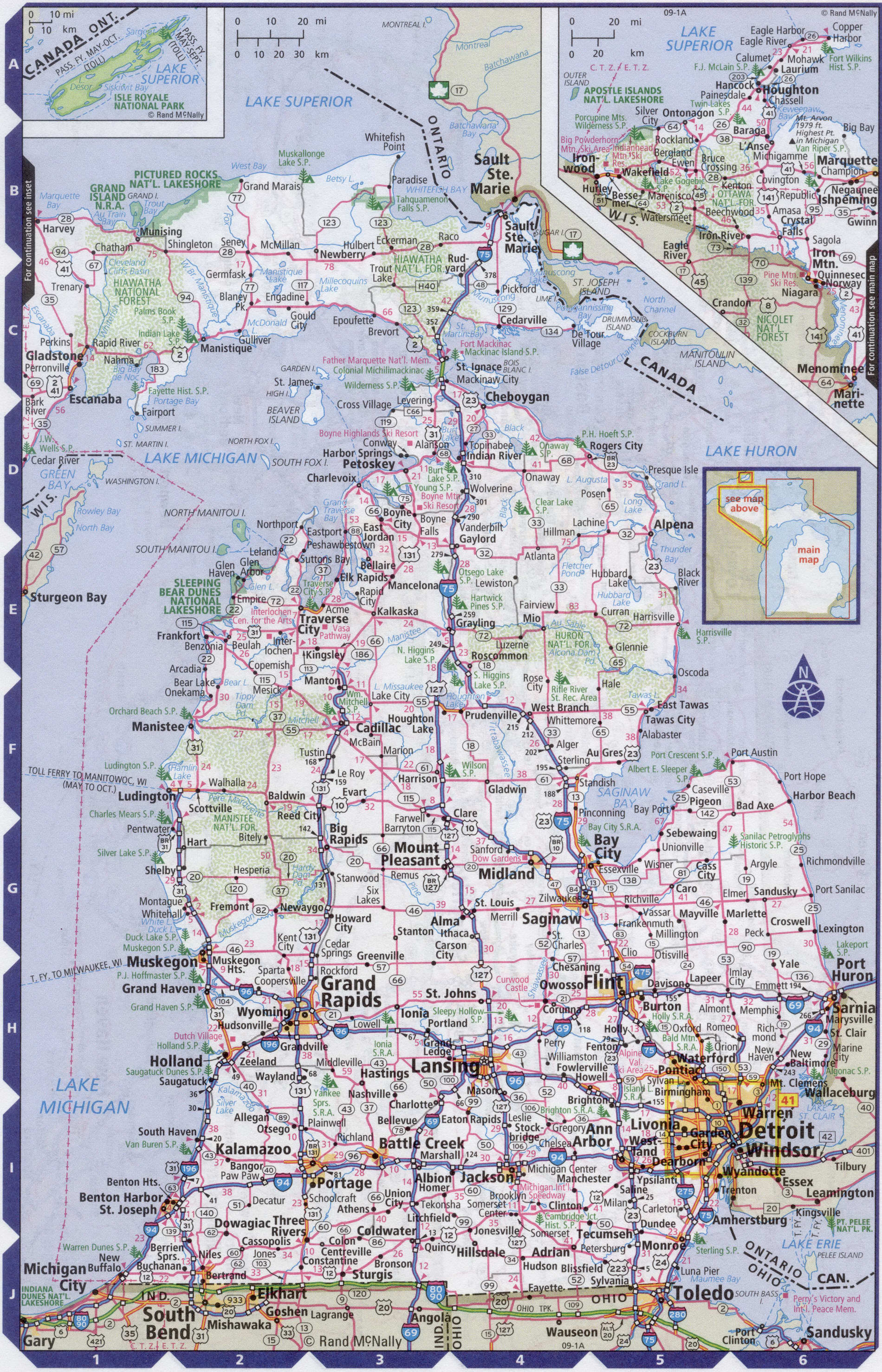
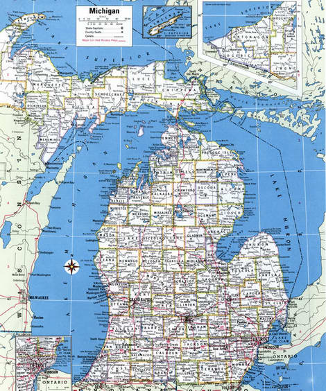
Map of Michigan state with cities and counties
Maps of Michigan state with cities and counties, highways and roads
Detailed maps of the state of Michigan are optimized for viewing on mobile devices and desktop computers. This page contains four maps of the state of Michigan:
- The first is a detailed road map - Federal highways, state highways, and local roads with cities;
- The second is a roads map of Michigan state with localities and all national parks, national reserves, national recreation areas, Indian reservations, national forests, and other attractions;
- The third is a map of Michigan state showing the boundaries of all the counties of the state with the indication of localities-administrative centers of the counties;
- The fourth is a Google satellite map of Michigan state, where you can view the location of all the interesting places in the state in interactive mode.
You will evaluate which of the presented maps is most useful for you. It may be convenient for you to compare information from all four sources.
All maps can be freely used-downloaded as a file or printed on paper. Using our maps, you can get directions along highways and local roads for sightseeing trips to the main attractions of the state of Michigan:
Conservation Park pictured rocks of Rocks is located along the Upper lake from city Munising to the Grand Marais, You will see the natural arch, waterfalls, dunes and colorful rocks.
Tahquamenon famous waterfalls of Michigan.
It is worth visiting at least one of the Islands of the state: on lake Michigan, North and South Manitou, on Upper lake - Isle Royal and Grand-Island, in the waters of lake Huron-Bois-Blanc-island.
In Detroit, you can visit one of the four major gambling clubs.
The Detroit Symphony orchestra.
In gardemarine island are noteworthy Fort Michilimackinac.
Little Caesars Arena is an indoor multi-purpose arena located in Detroit, Michigan. Capacity of the arena for hockey
the population is 19500 people. It is the home stadium for the Detroit Red wings of the National hockey League and the Detroit pistons from the National basketball Association.
Detroit Metropolitan Wayne County Airport is the main state-owned international airport in the Detroit Metropolitan area. An airport it is located in the vicinity of Detroit, in the city of Romulus (Michigan, USA). The busiest airport in the state and one of the most the busiest in the country. It serves more than 160 flight destinations. The second largest hub for Delta Air Lines. The airport has four main lanes, two terminals, 129 boarding gates. Flight time from New York to Detroit airport by direct flight approximately 1 hour 50 minutes.
Highways and roads map of Michigan state with cities

Map of Michigan state with national parks, reserves, recreation areas, and Indian reservations
Map of Michigan state counties
Google satellite map of the U.S. state of Michigan showing all attractions

