Maps of Midwestern United States
Maps of Midwest region of the United States
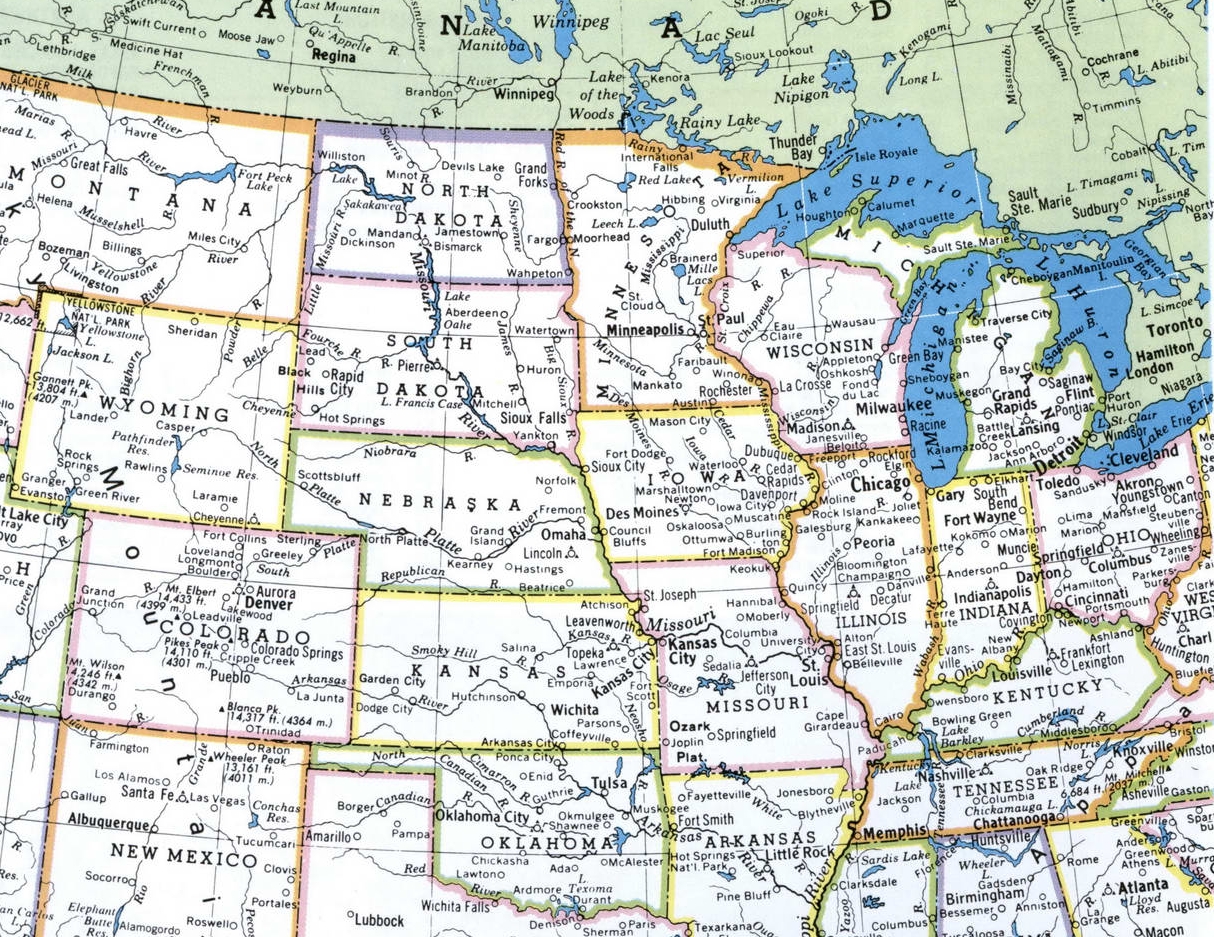
Detailed maps of Midwest region of the United States of America.
The northeast Central States sub-region (Wisconsin, Illinois, Indiana, Michigan, and Ohio).
The Northwest Central States sub-region (Iowa, Kansas, Minnesota, Missouri, Nebraska, North Dakota, and South Dakota).
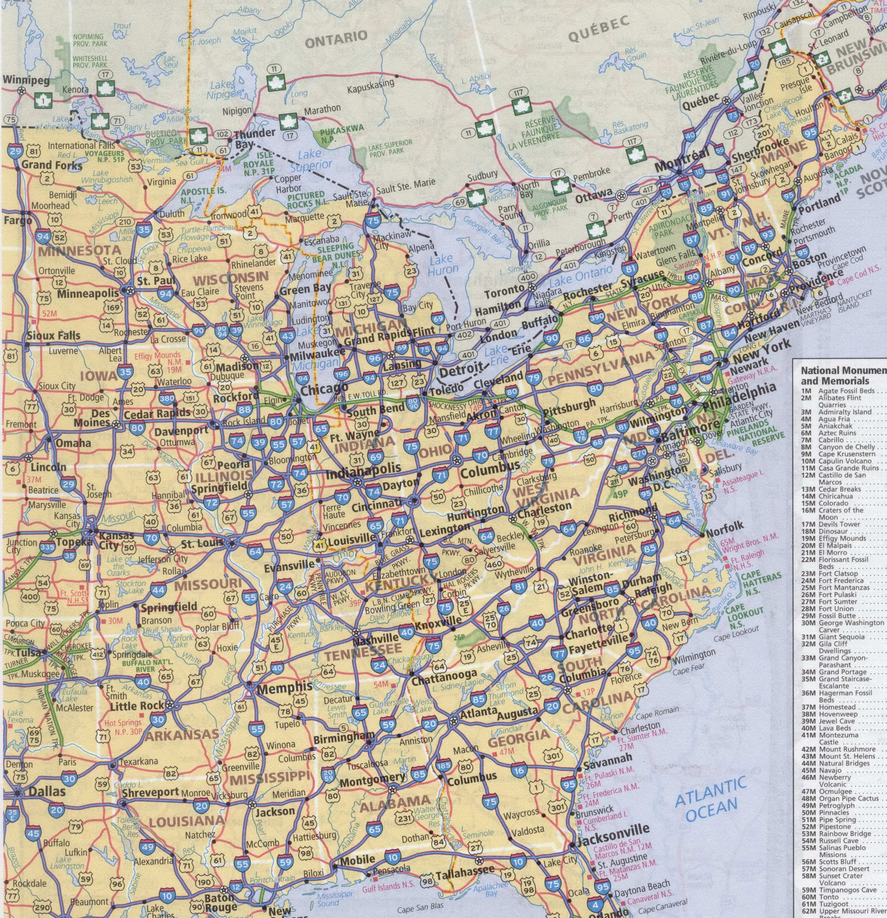
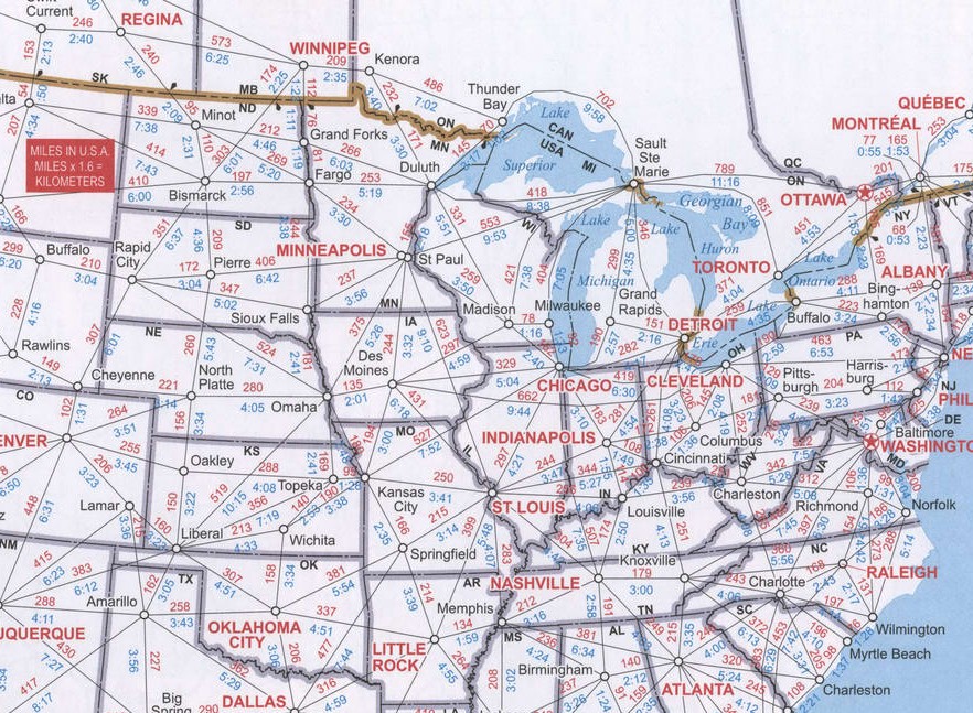
The page provides the four cards of the Middle West USA: detailed map of the region Midwest , the road map Midwest USA, satellite Google map of the Midwest USA, the chart distances on highways between cities of the Midwest. All maps are high quality and optimized for viewing on mobile devices, so you can see the smallest details.


Map roads of Middle West region of the United States of America

Google map of Middle Western region of the United States of America.