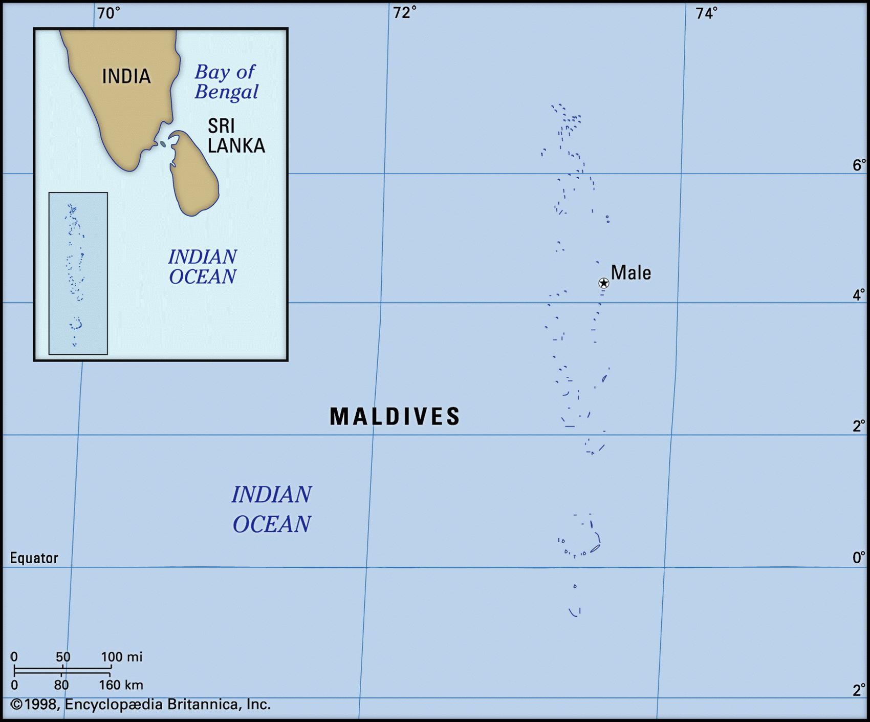
Map of Maldives and geographical facts
Where Maldives on the world map. Map of Maldives
Map of Maldives with cities. Where Maldives is on the world map. The main geographical facts about Maldives - population, country area, capital, official language, religions, industry and culture.

Maldives Fact File
Official name Republic of the Maldives
Form of government Republic with single legislative body (Citizens Council)
Capital Male
Area 300 sq km (116 sq miles)
Time zone GMT + 5 hours
Population 320,000
Projected population 2015 453,000
Population density 1,066.7 per sq km (2,758.6 per sq mile)
Life expectancy 62.9
Infant mortality (per 1,000) 61.9
Official language Divehi
Other languages Arabic, English, Hindi
Literacy rate 93.2%
Religions Predominantly Sunni Muslim
Ethnic groups Sinhalese, Dravidian, Arab, African
Currency Rufiyaa
Economy Tourism, fishing, manufacturing
GNP per capita US$ 3,870
Climate Tropical, with wet season May to August
Highest point Unnamed location on Wilingili 24 m (79 ft)
Map reference Page 216
The Maldive Archipelago consists of an 800 km (500 mile) string of nearly 2,000 islands and atolls (202 of them inhabited) southwest of India's southern tip, Cape Comorin. Made up of tiny islets ringed by white sands and clear blue lagoons, they have recently been developed as tourist resorts and receive up to 300,000 visitors each year. Long ago, their first visitors were probably Dravi-dians from southern India, in around 400 bc. Centuries later, the islands seem to have been taken over by people from Sri Lanka—Divehi, the national language, is a form of Sinhalese, one of the official languages on Sri Lanka. In 1153 the king of the Maldives ordered his
subjects to adopt Islam in place of Buddhism: today the people are mainly Sunni Muslims and there are 689 mosques. For the next 800 years the islands were ruled as a Muslim sultanate, though there was a brief period, between 1558 and 1573, of Portuguese control from Goa. The British established a protectorate in 1887, the islands achieved independence in 1965, and the sultan was deposed in 1968. Since then government has been in the hands of a small group of influential families, and by 1995 the president then in office, a wealthy businessman, had survived three attempted coups. Younger political contenders who have tasted democracy abroad are pressing for a more open regime.
The atolls of the Maldives are coral reefs which have grown up around the peaks of a submerged volcanic mountain range. None of them rise more than 1.8 m (6 ft) above sea level. There is concern that if the greenhouse effect causes a rise in sea levels, some may be submerged. Apart from that, the islands lose their natural protection due to the depletion of the reef—coral lime is often used as building material. Adequate rainfall supports a variety of tropical vegetation, and palm and breadfruit trees occur naturally.
Food crops include coconuts, bananas, mangoes, sweet potatoes, and spices. Agriculture plays a role in the economy, though constrained by the small amount of cultivable land, and most staple foods must be imported. In the lagoons and the open sea fish are plentiful. Bonito and tuna are leading exports, fishing being the second leading growth sector of the economy. Manufacturing, consisting mainly of garment production, boat building, and handicrafts, accounts for 15 percent of gross domestic product. Since the 1980s tourism has been the leading growth sector, and now accounts for more than 60 percent of foreign exchange receipts. At present more than 90 percent of tax revenue comes from import duties and tourism-related taxes.