Map of Nevada state with cities and counties
Maps of Nevada state with cities and counties, highways and roads
Detailed maps of the state of Nevada are optimized for viewing on mobile devices and desktop computers. This page contains four maps of the state of Nevada:
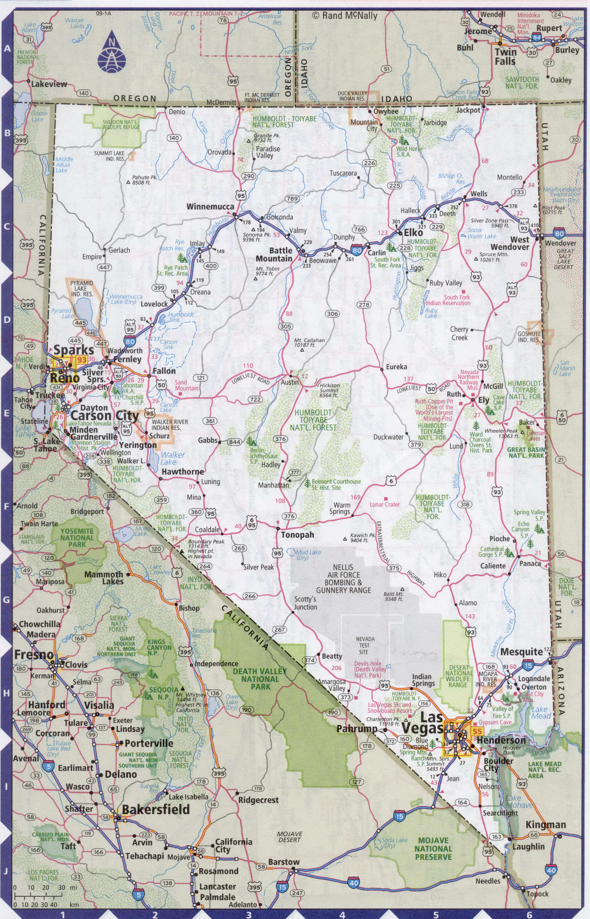
- The first is a detailed road map - Federal highways, state highways, and local roads with cities;
- The second is a roads map of Nevada state with localities and all national parks, national reserves, national recreation areas, Indian reservations, national forests, and other attractions;
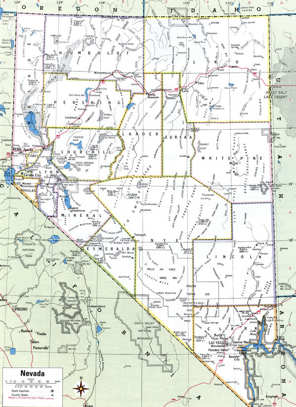
- The third is a map of Nevada state showing the boundaries of all the counties of the state with the indication of localities-administrative centers of the counties;
- The fourth is a Google satellite map of Nevada state, where you can view the location of all the interesting places in the state in interactive mode.
You will evaluate which of the presented maps is most useful for you. It may be convenient for you to compare information from all four sources.
All maps can be freely used-downloaded as a file or printed on paper. Using our maps, you can get directions along highways and local roads for sightseeing trips to the main attractions of the state of Nevada:
The city of Las Vegas in the Mojave desert is famous for entertainment centers, casinos, luxury hotels and restaurants. In Las Vegas, it is worth noting the casino "treasure Island" and "Luxor", the circus "New York in miniature", more than three hundred are open in the city night entertainment venues.
The main natural attraction is the Grand Canyon.
Resorts on the shores of lake Tahoe.
In winter, lake Tahoe becomes a ski resort.
Big Pool national Park.
Close to the city of Reno is Pyramid lake.
A national Park with the terrifying name Death Valley.
The state's largest airport is McCarran international airport (Las Vegas international airport). Located 8 kilometers to South of downtown Las Vegas. McCarran ranked 14th among the world's largest airports in terms of passenger traffic, serving 47 million people in a year. The flight time from New York to Las Vegas airport is approximately 5 hours and 15 minutes.
Highways and roads map of Nevada state with cities

Map of Nevada state with national parks, reserves, recreation areas, and Indian reservations
Map of Nevada state with counties
Detailed large scale map counties of Nevada state
Google satellite map of the U.S. state of Nevada showing all attractions

