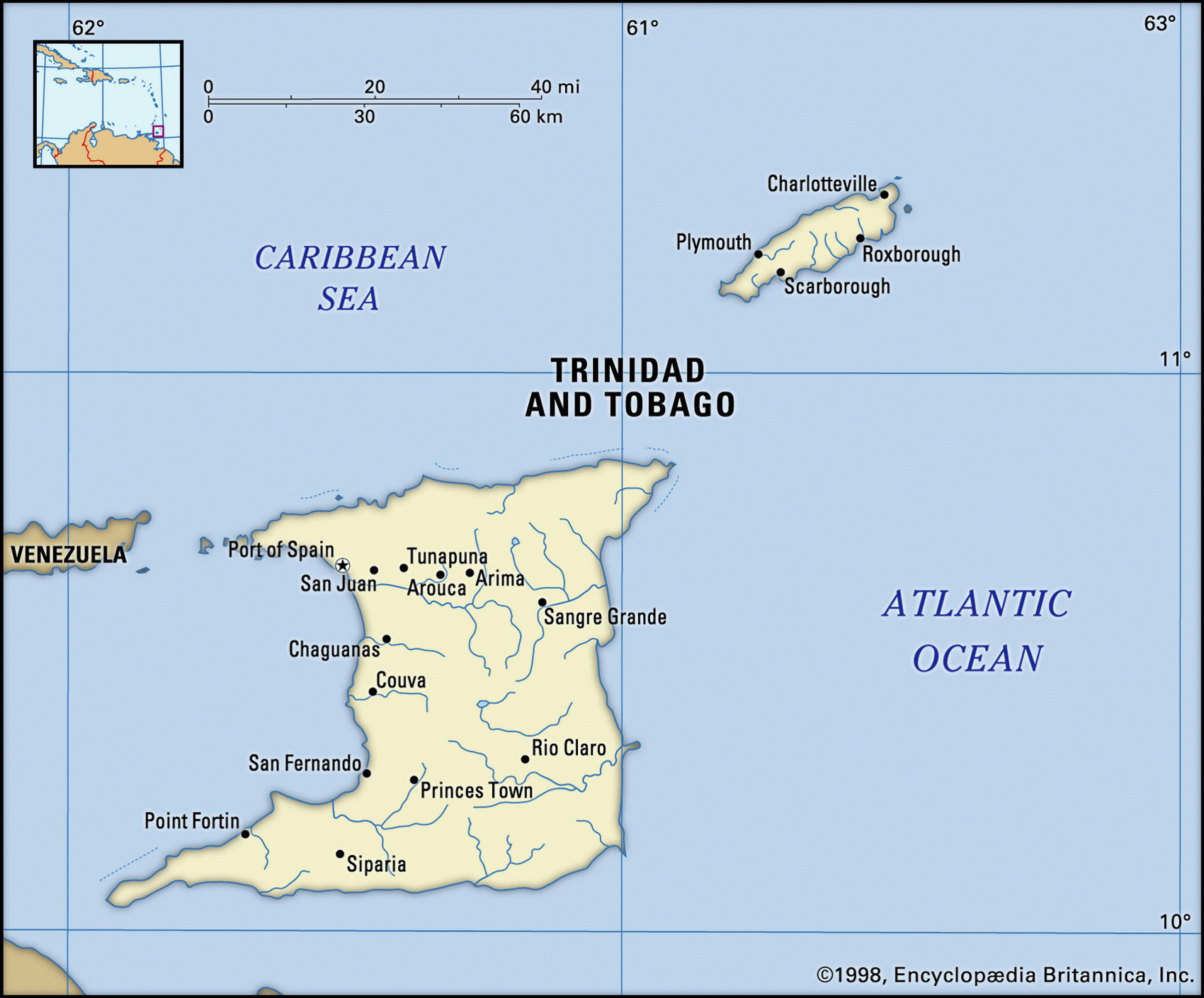
Map of Trinidad and Tobago and geographical facts
Map of Trinidad and Tobago. Trinidad and Tobago on the world map
Map of Trinidad and Tobago with cities. Where Trinidad and Tobago is on the world map. The main geographical facts about Trinidad and Tobago - population, country area, capital, official language, religions, industry and culture.

Trinidad and Tobago Fact File
GNP per capita US$ 9,000
Official name Republic of Trinidad and Tobago
Form of government Republic with two legislative bodies (Senate and House of Representatives)
Capital Port of Spain
Area 5,130 sq km (1,981 sq miles)
Time zone GMT - 4 hours
Population 1,164,000
Projected population 2015 1,392,000
Population density 226.9 per sq km (587.6 per sq mile)
Life expectancy 68.6
Infant mortality (per 1,000) 24.2
Official language English
Other languages Hindi, French, Spanish
Literacy rate 94 %
Religions Roman Catholic 32.2%, Hindu 24.3%, Anglican 14.4%, other Protestant 14%, Muslim 6C, other 9.1 %
Ethnic groups African 43%, East Indian 40%, mixed 14%, European 1 %, Chinese 1 %, other 1 °A
Currency Trinidad and Tobago dollar
Economy Services 73%, industry 15%, agriculture 12%
Climate Tropical, with wet season June to December Highest point El Cerro del Aripo 940 m (3,084 ft) Map reference Page 427
Trinidad is a square-shaped Caribbean island at the south end of the Windward Island chain, only 11 km (7 miles) off the coast of Venezuela. Along with Tobago it is the most prosperous island in the West Indies, oil and asphalt forming the basis of its wealth. It was visited by Columbus in 1498 and then held by the Spanish for three centuries before becoming a British possession after it was seized in 1797. The island's sugar plantations were initially worked by African slaves, and then after the abolition of slavery in 1834 East Indian and Chinese labor was imported. Today, in rural districts, some villages are mainly Afro-Trinidadian, some mainly Asian. Since gaining independence in 1962, Trinidad has been vexed by racial and ethnic complications, notably "Black Power" in 1970 and an attempted coup by black Muslim extremists in 1990. In 1995 the first prime minister from the Asian community was sworn in.
Unlike the Caribbean islands to the north, Trinidad is geologically an extension of South America across the Gulf of Paria. It is traversed by three mountain ranges (northern, central and southern) with El Cerro del Aripo in the Northern Range, and is drained by the Caroni, Ortoire and Oropuche Rivers. The Caroni Swamp is notable for the immense variety of its butterflies. The rest of the island is mostly low-lying, fringed with mangrove swamps. Tobago Island is a detached piece of the Northern Range, with volcanic uplands, that lies 34 km (21 miles) to the northeast of Trinidad. Tourism is concentrated on Tobago, which is renowned for its wildlife.
The strength of Trinidad's economy is its oil sector, and its large petroleum reserves. But living standards have fallen since the boom years of 1973 to 1982 and the country's prospects depend largely on the success of efforts towards diversification and on economic reforms. The floating of the exchange rate, capital market liberalization, and the partial privatization of such state operations as the main airline are among recent government initiatives.