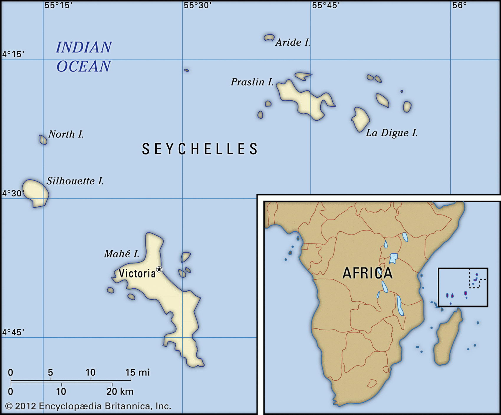
Map of Seychelles and geographical facts
Seychelles on the world map. Map of Seychelles
Map of Seychelles with cities. Where Seychelles is on the world map. The main geographical facts about Seychelles - population, country area, capital, official language, religions, industry and culture.

Seychelles Fact File
Official name Republic of Seychelles
Form of government Republic with single legislative body (People's Assembly)
Capital Victoria
Area 455 sq km (176 sq miles)
Time zone GMT + 4 hours
Population 81,000
Projected population 2015 87,600
Population density 178 per sq km (460.2 per sq mile)
Life expectancy 71.5
Infant mortality (per 1,000) 16.0
Official languages English, French, Creole
Literacy rate 58%
Religions Roman Catholic 90%, Anglican 8%, other 2 %
Ethnic groups Seychellois (mixture of Asian,African,European) 93.8%,Malagasy 3.1 %,Chinese 1.6%,British 1.5%
Currency Seychelles rupee
Economy Services 80 %, agriculture 10 %, industry 10 % GNP per capita US$ 7,800
Climate Tropical, with wet season December to May Highest point Morne Seychellois 905 m (2,969 ft) Map reference Pages 372, 373
The Seychelles are a group of four large and 36 small granite islands, plus a scattering of about 65 coralline islands, in the Indian Ocean northeast of Madagascar. Some 98 percent of the population live on the four main islands, the great majority on tropical and mountainous Mahe. Uninhabited when occupied by the French in 1742, the Seychelles were ceded to the British at the time of the Napoleonic Wars, and became a crown colony in 1903. After independence in 1976 the islands were ruled for fifteen years as a one-party socialist state, and North Korean military advisors were hired to guard against attempted coups. The first open elections were held in 1993 and the previous government party has since stayed in office.
The granite islands consist of a mountainous central spine—sometimes consisting of bare, eroded rock—surrounded by a flat coastal strip with dense tropical vegetation. In the areas cleared for farming vanilla, tobacco, tea, cinnamon and coconuts (for copra) are grown for export, along with food crops such as cassava, sweet potatoes, and bananas. Most food, however, is imported. The outer coralline islands are flat, waterless, and sparsely inhabited, having a total population of only 400. Short droughts periodically occur; though catchments collect some rainwater, there are no natural sources of supply. The Seychelles lie outside the cyclone belt, which is important for an economy depending on tourism.
The island's only natural resources are fish, copra, and cinnamon trees, which in earlier times provided a bare subsistence. Since independence in 1976, however, with the vigorous promotion of the tourist industry, per capita output has increased sevenfold. In recent years foreign investment has been encouraged in order to upgrade hotels and other services. Visitors find many attractions—the unique wildlife includes a rare giant land turtle and the colorful green sea turtle found on the coral reefs. The country's vulnerability in relying so heavily on tourism was shown during the Gulf War, when visitor numbers dropped sharply. The government is moving to reduce over-dependence on this sector by promoting farming, fishing, and small-scale manufacturing, including furniture-making, coconut-fiber rope-making, printing, and the re-export of petroleum products.