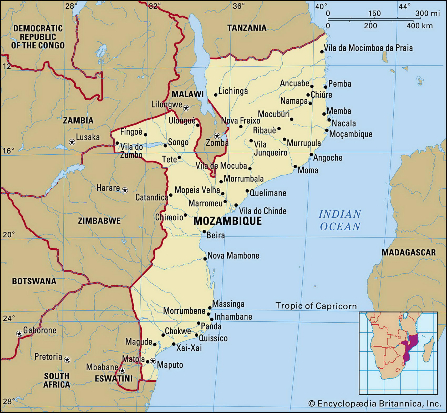
Map of Mozambique and geographical facts
Mozambique on the world map. Map of Mozambique
Map of Mozambique with cities. Where Mozambique is on the world map. The main geographical facts about Mozambique - population, country area, capital, official language, religions, industry and culture.

Mozambique Fact File
Official name Republic of Mozambique
Form of government Republic with single legislative body (Assembly of the Republic)
Area 801,590 sq km (309,494 sq miles)
Time zone GMT + 2 hours
Population 19,608,000
Projected population 2015 23,526,000
Population density 24.5 per sq km (63.4 per sq mile)
Life expectancy 35.5
Infant mortality (per 1,000) 138.6
Official language Portuguese
Other languages Indigenous languages
Literacy rate 42.3 %
Religions Indigenous beliefs 50%, Christian 30%, Muslim 20%
Ethnic groups Indigenous tribes (including Shangaan, Chokwe, Manyika, Sena, Makua) 99.7%, other 0.3%
Currency Metical
Economy Agriculture 85%, services 8%, industry 7%
GNP per capita US$ 900
Climate Mainly tropical: wet season December to March
Highest point Monte Binga 2,436 m (7,992 ft) Map reference Pages 369, 371
Lying on the southeast coast of Africa facing Madagascar, Mozambique is divided in two by the Zambeze River. This division is also found in its social and political life: people in the north support the Renamo party, while south of the river they support Frelimo. Visited by Vasco da Gama in 1498 and colonized by the Portuguese in search of gold, Mozambique remained a slave-trading center until the 1850s.
A long war of liberation against Portugal led to independence in 1975 and brought the Marxist Frelimo (Mozambique liberation front) to power. Frelimo's one-party regime was then challenged by a guerilla movement, Renamo, supported by South Africa. The ensuing civil war, aggravated by famine, led to nearly 1 million deaths. By 1989 Mozambique was world's poorest country. That year Frelimo renounced Marxism. At multi-party elections in 1994 it won by a narrow majority.
A considerable amount of rain falls in the north; south of the Zambeze conditions are much drier. North of Maputo, the only natural harbor, is a wide coastal plain where there are coconut, sugar, and sisal plantations, and small landholders grow maize and peanuts. Inland, the terrain rises to the high veld.
Economically, Mozambique faces a huge task of reconstruction and the government is trying to redistribute large areas of land that were seized by the state to peasants. Agricultural output is only 75 percent of its 1981 level and grain is imported. Industry is operating at less than half capacity. There are substantial agricultural, hydro-power and petroleum resources as well as deposits of coal, copper and bauxite but these are largely undeveloped.
Lake Malawi (Lake Nyasa), near Chilumba, looking toward Mozambique (above). The massive Victoria Falls on the Zambeze River in Zimbabwe (below).