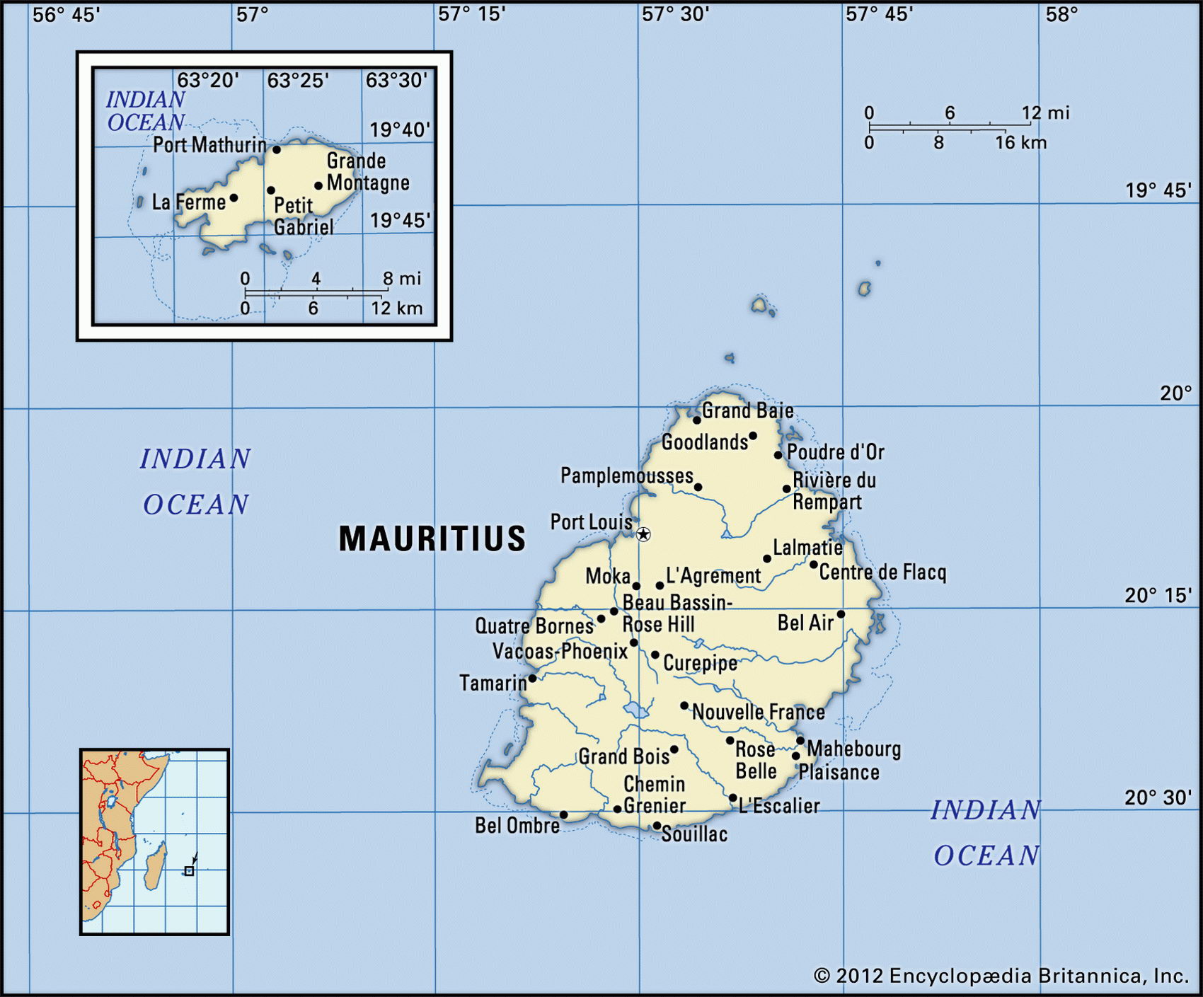
Map of Mauritius and geographical facts
Mauritius on the world map. Map of Mauritius
Map of Mauritius with cities. Where Mauritius is on the world map. The main geographical facts about Mauritius - population, country area, capital, official language, religions, industry and culture.

Mauritius Fact File
Official name Republic of Mauritius
Form of government Republic with single legislative body (Legislative Assembly)
Capital Port Louis
Area 1,860 sq km (718 sq miles)
Time zone GMT + 4 hours
Population 1,201,000
Projected population 2015 1,301,000
Population density 645.7 per sq km (1,672.7 per sq mile)
Life expectancy 71.5
Infant mortality (per 1,000) 16.7
Official language English
Other languages Creole, French, Hindi, Urdu, Bojpoori, Hakka
Literacy rate 82.9 %
Religions Hindu 52%, Christian (Roman Catholic 26%, Protestant 2.3%) 28.3%, Muslim 16.6%, other 3.1 %
Ethnic groups Indo-Mauritian 68%, Creole 27%, Sino-Mauritian 3%, Franco-Mauritian 2%
Currency Mauritian rupee
Economy Services 51 %, agriculture 27%, industry 22 %
GNP per capita US$ 10,800
Climate Tropical, moderated by trade winds
Highest point Piton de la Petite Riviere Noire 828 m (2,717 ft)
Map reference Pages 372, 373
Famous as the home of the now-extinct flightless bird, the dodo, the Republic of Mauritius consists of one large and several smaller islands 800 km (500 miles) east of Madagascar. Mauritius was uninhabited when visited by the Portuguese and the Dutch between the fifteenth and seventeenth centuries. It was first settled by the French, after 1715, who brought African slaves for the sugar plantations. In 1810 it was taken over by the British, who brought in numerous indentured laborers from India. These colonial origins produced two distinct communities, one Afro-French Creole (27 percent), the other English-speaking and Indian (73 percent), who compete for influence and power. Independence within the British Commonwealth was granted in 1968 and Mauritius became a republic in 1992. Despite occasional unrest, the country has a record of political stability and economic growth. It attracts considerable foreign investment and has earned one of Africa's highest per capita incomes.
Fringed with coral reefs, the main island rises from coastal plains on its north and east to a plateau surrounded by rugged peaks—the remains of a giant volcano. The climate is tropical, but moderated by rain-bearing winds from the southeast. Sugarcane is grown on ninety percent of the cultivated land, and accounts, with derivatives such as molasses, for forty percent of export earnings. A by-product of the sugar industry, the cane-waste called bagasse, has been used to fuel power stations. Fast-flowing rivers descending from the plateau are used to produce hydroelectric power.
Industrial diversification (textile and garment manufacture now accounts for 44 percent of export revenue) and the development of a tourist industry (up to half a million visitors per year) have enabled Mauritius to transcend the low-income agricultural economy that existed at the time of independence. Since 1968 annual economic growth most years has been about five percent, life expectancy has been increasing and the infrastructure has improved.
Women agricultural workers walking beside a field of sugarcane in Mauritius (below left). Small town with a view of the Atlantic Ocean, Madeira (below right). The Pico de Teide on the island of Teneriffa (right page).