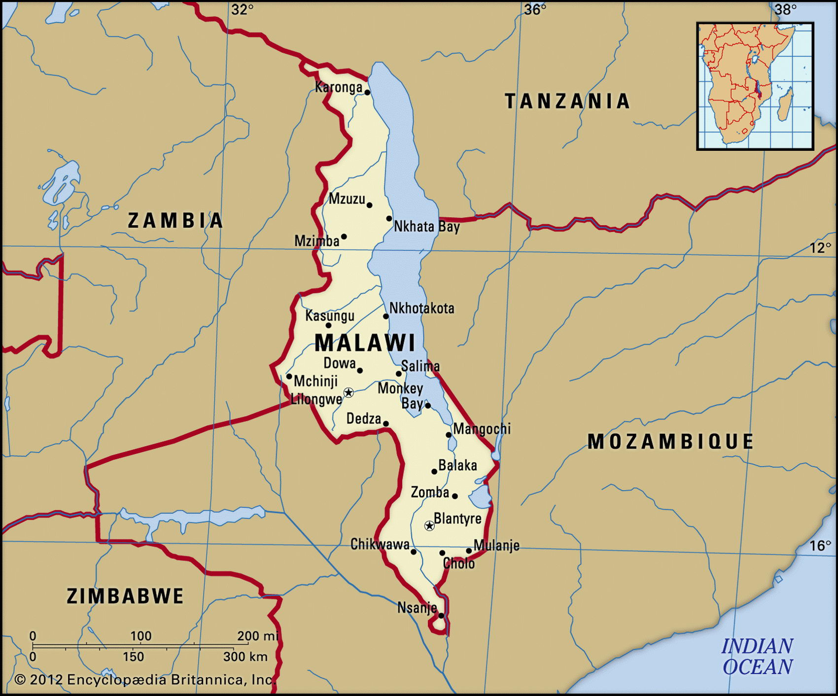
Map of Malawi and geographical facts
Malawi on the world map. Map of Malawi
Map of Malawi with cities. Where Malawi is on the world map. The main geographical facts about Malawi - population, country area, capital, official language, religions, industry and culture.

Malawi Fact File
Official name Republic of Malawi
Form of government Republic with single legislative body (National Assembly)
Capital Lilongwe
Area 118,480 sq km (45,745 sq miles)
Time zone GMT + 2 hours
Population 10,702,000
Projected population 2015 15,656,000
Population density 90.3 per sq km (233.9 per sq mile)
Life expectancy 36.6
Infant mortality (per 1,000) 120.0
Official languages Chichewa, English
Other languages Indigenous languages
Literacy rate 58%
Religions Protestant 55%, Roman Catholic 20%, Muslim 20%, indigenous beliefs 5%
Ethnic groups Indigenous tribes: Malavi (including Chewa, Nyanja, Tumbuke, Tonga) 58%, Lomwe 18%, Yao 13%, Ngoni 7%; Asian and European 4%
Currency Kwacha
Economy Agriculture 82%, services 15%, industry 3 %
GNP per capita US$ 660
Climate Tropical, with wet season November to April
Highest point Mt Mulanje 3,002 m (9,849 ft) Map reference Page 369
Malawi is a hilly and in places mountainous country at the southern end of Africa's Rift Valley, one-fifth of it consisting of Lake Malawi (Lake Nyasa). The lake contains 500 fish species which support a sizeable fishing industry. Most of the country's people are descended from the Capital Maputo Bantu who settled the area centuries ago. Arab slave-trading was suppressed by the incoming British in 1887-89, and in 1907 the country became the British Protectorate of Nyasaland. Independence in 1964 put Dr Hastings Banda in charge and he ruled dictatorially for thirty years. Cumulative difficulties, including drought and crop failures, some 800,000 refugees from Mozambique, and resentment at the apparent assassination of political opponents, led to Dr Banda's removal and Malawi's first multi-party elections in 1994.
At the southern end of Lake Malawi (Lake Nyasa) the Shire River runs through a deep, swampy valley flanked by mountains to the east. Most of the population lives in this southern region, growing maize as the main food crop and cultivating cash crops such as peanuts and sugarcane. The western central plateau rises northward to the Nyika Uplands, where rainfall is highest. In the Shire Highlands to the south, tea and tobacco are grown on large estates. Savanna grassland in the valleys gives way to open woodland, much of which has been cleared for cultivation. Wildlife is largely confined to reserves.
Agriculture provides more than ninety percent of exports. Reserves of bauxite and uranium exist, but not in commercially usable quantities. Hydro-electricity supplies only about three percent of total energy use—most needs are met from fuelwood, which is resulting in continued deforestation. The economy depends heavily on foreign aid.