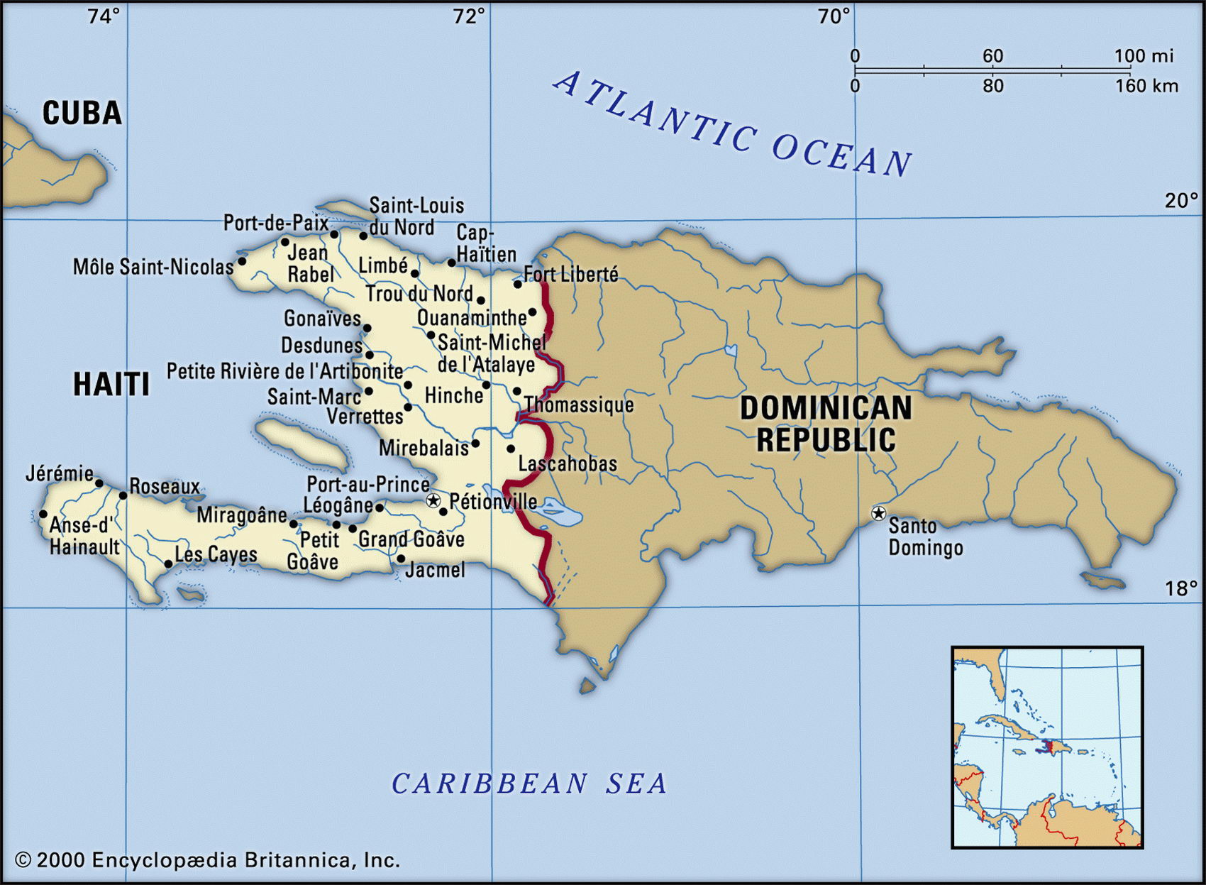
Map of Haiti and geographical facts
Map of Haiti with cities. Haiti on the world map
Map of Haiti with cities. Where Haiti is on the world map. The main geographical facts about Haiti - population, country area, capital, official language, religions, industry and culture.

Haiti Fact File
Official name Republic of Haiti
Form of government Republic with two legislative bodies (Senate and Chamber of Deputies)
Capital Port-au-Prince
Area 27,750 sq km (10,714 sq miles)
Time zone GMT-5 hours
Population 7,064,000
Projected population 2015 10,215,000
Population density 254.6 per sq km (659.3 per sq mile)
Life expectancy 49.6
Infant mortality (per 1,000) 93.4
Official language French
Other language French Creole
Literacy rate 45 %
Religions Roman Catholic 80% (most of whom also practice Voodoo), Protestant 16% (Baptist 10%, Pentecostal 4 %, Adventist 1 %, other 1 %), other 4 %
Ethnic groups African 95 %, mixed African-European 5%
Currency Gourd
Economy Agriculture 50%, services 44%, industry 6% GNP per capita US$ 1,700
Climate Mainly tropical; semiarid in eastern mountains; wet seasons April to June and August to November
Highest point Pic de la Selle 2,680 m (8,792 ft)
Map reference Page 429
Haiti lies in the Caribbean, east of Cuba. It is the western third of the island of Hispaniola, the Dominican Republic occupying the remainder. Visited by Columbus in 1492, it was used by the Spanish for sugarcane cultivation and was ceded to France in 1697. In the aftermath of the French Revolution it was the scene of a slave rebellion which led to the establishment, in 1804, of the world's first black republic. Since then the country has endured two centuries of instability, violence, dictatorship, military rule, and endemic poverty. Today Haiti is the poorest country in the western hemisphere. Under the brutal regime of the Duva-lier family, between 1957 and 1986, it became a police state enforced by a private militia called the Tontons Macoute. Recent years have seen faltering steps toward electoral democracy and modest civil service reforms, but political killings are still occurring under an apparently corrupt and ineffective judicial system. Violent unrest and international pressure brought about a change of government in 2004.
Two peninsulas enclose the central plain of the Artibonite River, and the bight of the Golfe de la Gonave beyond. Some 75 percent of Haiti's terrain is mountainous, the Massif du Nord providing the range which forms the northern peninsula, before extending east into the Dominican Republic where it becomes Hispaniola's Cordillera Central. The southern peninsula contains the Massif de la Hotte at its western end, and the Massif de la Selle in the east. The fertile lowland areas are densely populated, the largest of these being the Plaine du Nord. On the plains the major crop is sugarcane, coffee plantations being found on the higher land. The majority of the population is engaged in subsistence farming, growing cassava, bananas, and corn. Haiti's environmental problems are severe: one-third of its soil is seriously eroded, and extensive deforestation has occurred in the course of charcoal production.
Haiti is without strategic resources and, during a period of economic sanctions imposed to put pressure on the government in 1991, it was forced to find clandestine sources of oil. In addition to sugar refining, light industry includes flour and cement and the manufacture of textiles, shoes, and cooking utensils. The country's location, history, and culture proved attractive to tourists in the 1960s and 1970s, despite the repressive regime, but widespread crime has affected the industry in recent years.