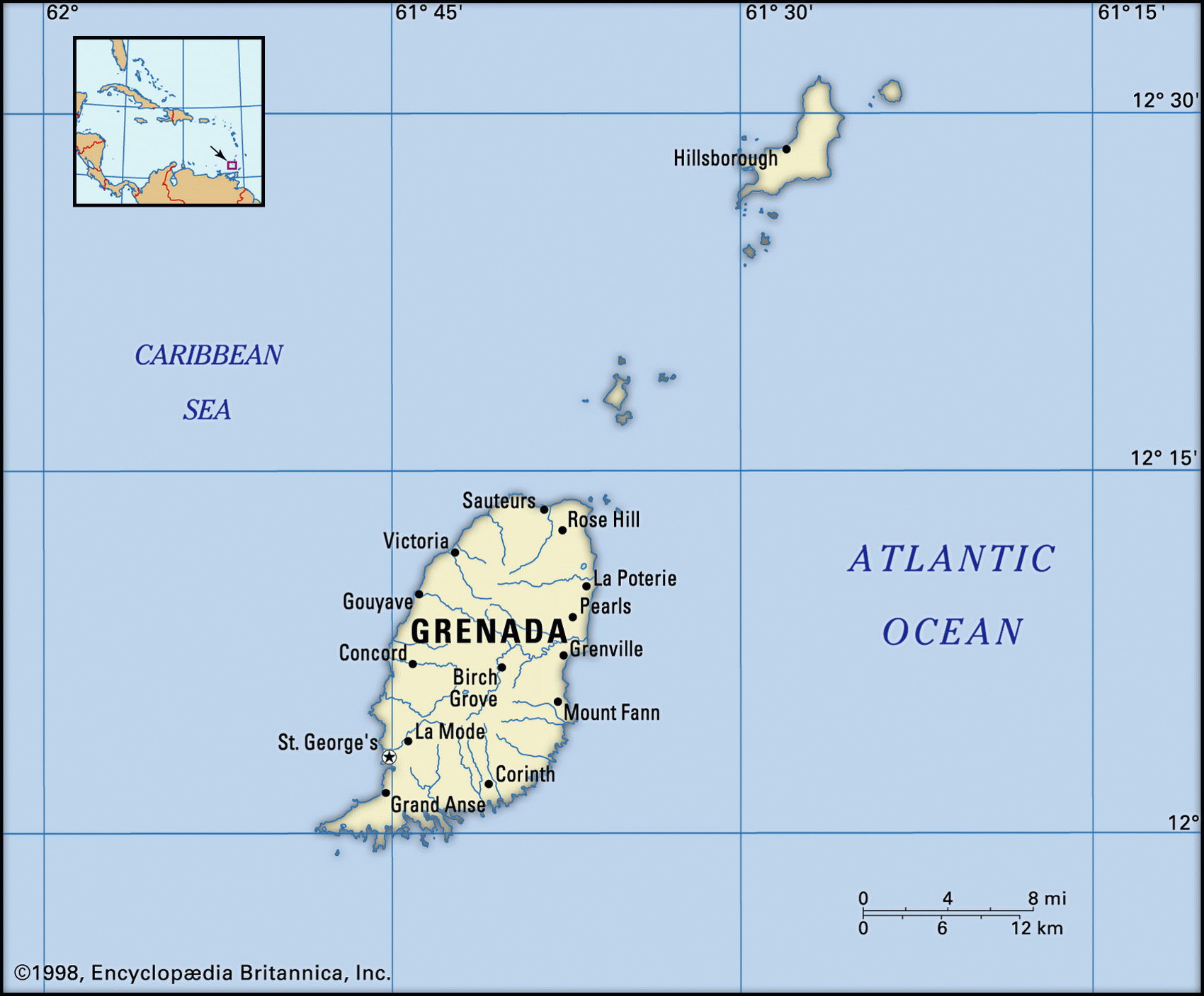
Map of Grenada and geographical facts
Map of Grenada with cities. Grenada on the world map
Map of Grenada with cities. Where Grenada is on the world map. The main geographical facts about Grenada - population, country area, capital, official language, religions, industry and culture.

Grenada Fact File
Official name Grenada
Form of government Constitutional monarchy with two legislative houses (Senate and House of Representatives)
Capital Saint Georges
Area 340 sq km (1 31 sq miles)
Time zone GMT-4 hours
Population 89,200
Projected population 2015 97,000
Population density 262.4 per sq km (680.9 per sq mile)
Life expectancy 64.5
Infant mortality (per 1,000) 14.6
Official language English
Other language French patois
Literacy rate 98 %
Religions Roman Catholic 64%, Protestant (including Anglican, Seventh Day Adventist, Pentecostal) 27%, other 9%
Ethnic groups African 84 %, mixed 12 %, East Indian 3%, European 1 %
Currency East Caribbean dollar
Economy Services 77%, agriculture 14%, industry 9%
GNP per capita US$ 4,750
Climate Tropical, moderated by trade winds
Highest point Mt Saint Catherine 840 m (2,756 ft)
Map reference Page 427
The state of Grenada consists of the island of Grenada, lying off the coast of Venezuela not far from Trinidad, and two small islands of the Southern Grenadines—Carriacou and Petite Martinique. The islands were visited by Columbus in 1498 but the original Carib Indian inhabitants fought off all invaders until French settlers arrived in the 1650s. Grenada then became a typical sugar-producing Caribbean island, with plantations worked by slaves brought from Africa. British since 1762, English is its official language, though some Grenadans still speak a French patois. It won independence in 1974 and in 1979 the country became communist after a bloodless coup. When the coup leader was murdered by fellow Marxists in 1983, the USA, with support from a number of other Caribbean countries, intervened to restore democratic elections. Since then power has been contested and has alternated between several different political parties, but the country has turned out to be a stable democracy. Economic recovery from the events of 1983, however, has been slow.
The most southerly of the Windward Islands, the main island of Grenada is volcanic in origin and has fertile soils. A forested mountain ridge runs north-south, cut by rivers, and there are a number of lakes, including the Grand Etang at an elevation of 530 m (1,739 ft). The western coastline is precipitous; the southern coastal landscape of beaches is gentler and includes some natural harbors. In recent years the government has become interested in developing eco-tourism but protection of key environmental sites remains a concern. Large resort projects have resulted in serious beach erosion.
Grenada is known in the Caribbean as "the spice island" and is—after Indonesia—the world's leading producer of nutmeg and mace, its main crop. Other exports include cocoa and bananas, but attempts to diversify the economy from an agricultural base have so far been unsuccessful. The farming practised by the rural population is mostly small scale, with the exception of a few cooperatives. The small manufacturing sector is based on food-processing and makes products such as chocolate, sugar, alcoholic beverages, and jam. Garments and furniture are also produced, mainly for export to Trinidad and Tobago. Tourism had largely ceased after the crisis of 1983 but gradually recovered—until the attacks on 11 September 2001. It has since suffered severely from a drop in tourism.