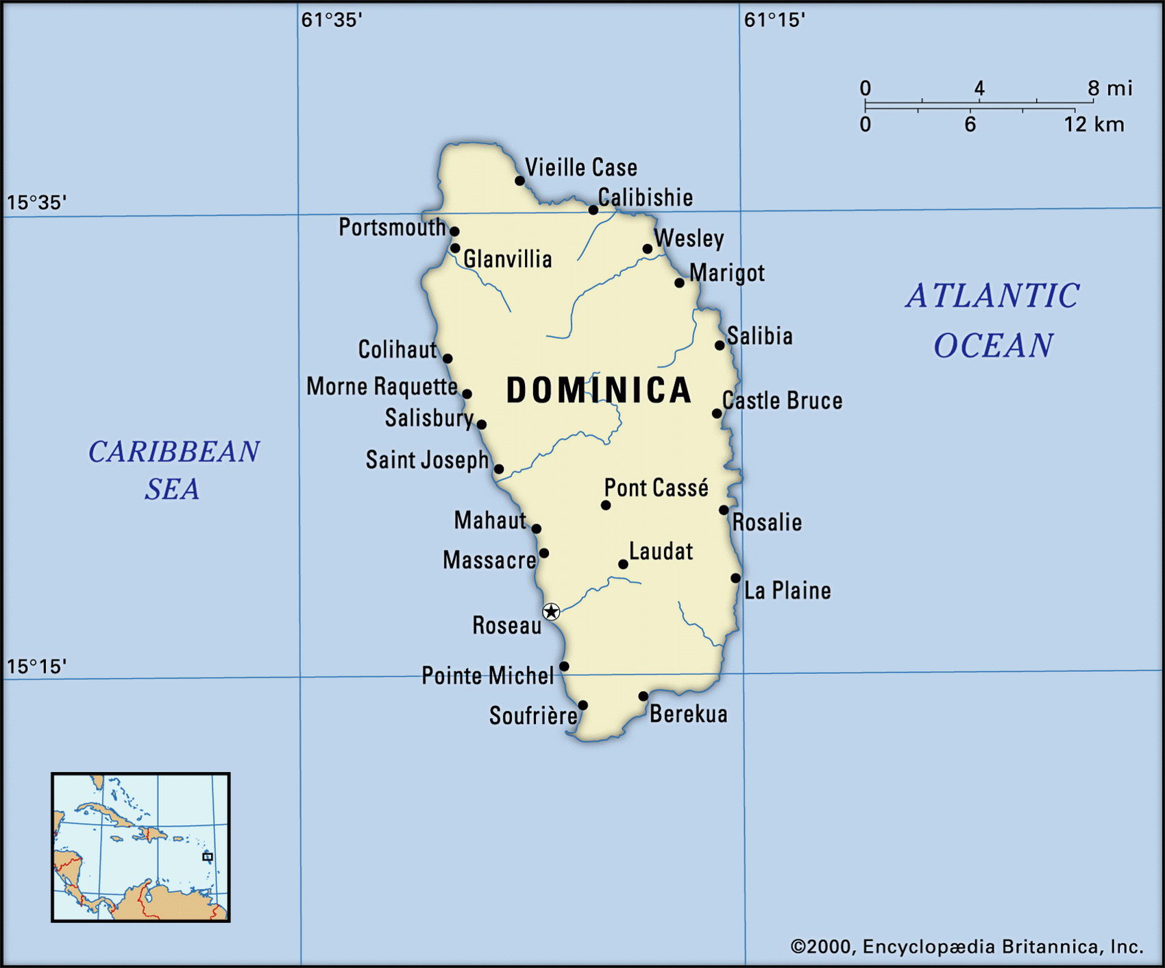
Map of Dominica and geographical facts
Map of Dominica with cities. Dominica on the world map
Map of Dominica with cities. Where Dominica is on the world map. The main geographical facts about Dominica - population, country area, capital, official language, religions, industry and culture.

Dominica Fact File
Area 750 sq km (290 sq miles)
Time zone GMT-4 hours
Population 70,200
Projected population 2015 70,000
Population density 93.6 per sq km (242.1 per sq mile)
Life expectancy 73.9
Infant mortality (per 1,000) 15.9
Official language English
Other language French Creole
Literacy rate 94c
Official name Commonwealth of Dominica
Form of government Parliamentary state with single legislative body (House of Assembly)
Capital Roseau
Religions Roman Catholic 77%, Protestant 15c other 6 %, none 2 %
Ethnic groups African 92%, mixed 6%, indigenous 1.5 %, European 0.5 %
Currency East Caribbean dollar
Economy Services 63%, agriculture 25%, industry 12%
GNP per capita US$ 3,700
Climate Tropical, moderated by trade winds
Highest point Morne Diablatins 1,447 m (4,747 ft) Map reference Page 427
Fought over for years by the English and the French, the Caribbean island of Dominica was mainly occupied by the British after 1759. Locally it is known as the "nature island" because of its extensive forests and wildlife. It is unusual in still having a community of about 3,000 Carib Indians, whose fierce ancestors, protected by the forests in the interior, held off European colonization for 250 years. In the eighteenth century African slaves were brought to the island as labor and their descendants form the majority of the population today. Independence came to Dominica in 1978. Soon after, it was devastated by a series of hurricanes, while two coup attempts complicated its political life. Today, in free elections, power is contested between three parties in a stable democracy.
The most mountainous of the Lesser Antilles, Dominica is a volcanic island with fertile soils and the second largest boiling lake in the world. A high ridge forms the backbone of the island, from which several rivers flow to an indented coastline. There are many vents and hot springs. The rich volcanic soil supports dense tropical vegetation over 41 percent of Dominica's surface; only nine percent of the land is arable. The climate is warm and humid, with a risk of hurricanes during the rainy season from June to October. During 1995 hurricanes ruined ninety percent of the banana crop. The wildlife to be seen in the Morne Trois Pitons National Park is an important tourist attraction.
Dominica's only mineral resource is pumice and it has to import all its energy. There is hydroelectric potential in the rivers of the interior. Bananas, citrus fruits, and coconuts are the main cash crops—bananas accounting for 48 percent of exports, and coconut-based soaps 25 percent. Other exports include bay oil and vegetables. The country has to import much of its food and is depending on the development of luxury tourism for economic growth. Ecotourism is increasing, with visitors coming to view rare indigenous birds and volcanic sulphur pools. The lack of an airport able to service jetliners makes the country less accessible than its neighbors for mass-market tourism.