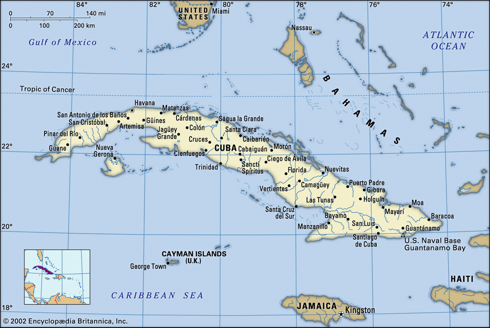
Map of Cuba and geographical facts
Map of Cuba with cities. Cuba on the world map
Map of Cuba with cities. Where Cuba is on the world map. The main geographical facts about Cuba - population, country area, capital, official language, religions, industry and culture.

Cuba Fact File
Official name Republic of Cuba
Form of government Communist state with single legislative body (National Assembly of People's Power)
Capital Havana
Area 110,860 sq km (42,803 sq miles)
Time zone GMT - 5 hours
Population 11,225,000
Projected population 2015 11,664,000
Population density 101.3 per sq km (262.2 per sq mile)
Life expectancy 76.6
Infant mortality (per 1,000) 7.3
Official language Spanish
Literacy rate 96.2 %
Religions Roman Catholic 40%, Protestant and African Spiritist 10%, non-religious 50%
Ethnic groups Mixed African-European 51 %, European 37%, African 11 %, Chinese 1 %
Currency Cuban peso
Economy Services 47%, industry 29%, agriculture 24%
GNP per capita US$2,300
Climate Tropical, moderated by trade winds; wet season May to October
Highest point Pico Turquino 1,974 m (6,476 ft)
Map reference Pages 428-29
The largest island in the Caribbean, Cuba is the size of all the others combined. Led by Fidel Castro, it is the only communist state in the Americas, and despite internal and external pressures remains politically unchanged after forty years. Cuba was visited by Columbus in 1492. It was at that time occupied by Arawak and Ciboney Indians. Under Spanish colonial rule sugar plantations worked by African slaves became the foundation of the island's economy— slavery was only abolished, under strong pressure from the Spanish government, in 1878. Gaining independence in 1898 but remaining under American tutelage until 1934, the country was run by a number of corrupt and gangster-ridden regimes until 1958, when Fidel Castro's army captured Havana. In 1976 the de facto monopoly of the Communist Party was formalized, with Castro, supported by his brother, making all decisions. Since the collapse of the Soviet system, on which Cuba had become economically dependent, times have been hard.
Cuba is only 193 km (120 miles) across at its widest point, but it stretches over 1,200 km (745 miles) from the Gulf of Mexico, at its western extremity, to the Windward Passage between Cuba and Haiti in the east. In addition to the main island, the much smaller island of Isla de la Juventud lies off the southwest coast. Less mountainous than the other islands in the Greater Antilles group, Cuba nevertheless has three distinct ranges—the Oriental (Sierra Maestra), the Central, and the Occidental (Sierra de los Organos). These cover roughly 25 percent of the territory east to west. The remaining 75 percent of Cuba's surface area consists of lowlands and basins. On the more fertile soils sugar plantations, rice fields, coffee plantations, and tobacco fields are found; livestock is run on the central savanna. Cuba's irregular coastline is lined with mangroves, beaches, and coral reefs. Despite deforestation the island still has considerable areas of woodland, ranging from tropical near-jungle to pines growing in upland areas. Cuba has a mostly hot climate and experiences heavy seasonal rainfall and periodic hurricanes.
Sugarcane remains the country's main cash crop, as it has for more than 100 years. Cuba is the world's third-largest sugar producer, and sugar represents almost fifty percent of the country's exports by value. Other crops are tobacco, rice, potatoes, tubers, citrus fruit, and coffee. There are also extensive timber resources, including mahogany and cedar. Cuba has the world's fourth-largest nickel deposits, and production is rising as a result of a joint venture with a Canadian company.
Its situation as one of the world's few remaining communist states has left Cuba isolated and with few trading partners. In addition, because the government has been unwilling to hold multiparty elections, the country has been subject to a severe embargo imposed by the USA. Poor sugar harvests and falling prices for sugar, receding tourism, devastations by cyclones, insufficient funds to pay for fuel, and mounting deficits have added to the country's difficulties in recent times.