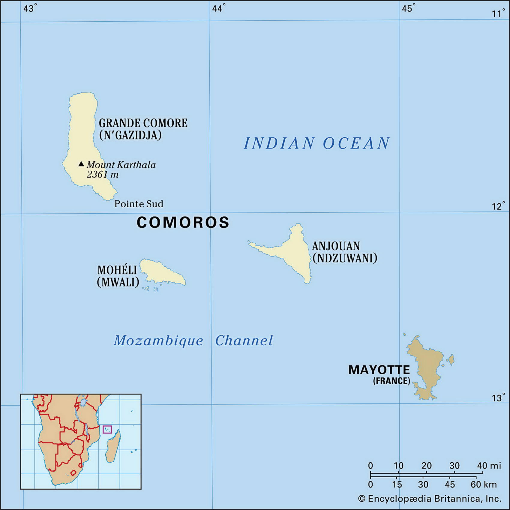
Map of Comoros and geographical facts
Comoros on the world map. Map of Comoros
Map of Comoros with cities. Where Comoros is on the world map. The main geographical facts about Comoros - population, country area, capital, official language, religions, industry and culture.

Comoros Fact File
Official name Federal Islamic Republic of the Comoros
Form of government Federal republic with single legislative body (National Assembly)
Capital Moroni
Area 2,170 sq km (838 sq miles)
Time zone GMT + 3 hours
Population 615,000
Projected population 2015 876,000
Population density 283.4 per sq km (733.9 per sq mile)
Life expectancy 60.8
Infant mortality (per 1,000) 81.8
Official languages Arabic, French
Other language Comoran (blend of Swahili and Arabic)
Literacy rate 57.3%
Religions Sunni Muslim 86%, Roman Catholic 14%
Ethnic groups Mixture of Malagasy, African, Malay and Arab groups
Currency Comoran franc
Economy Agriculture 80%, government 3%, other 17 %
GNP per capita US$ 710
Climate Tropical, with wet season November to May Highest point Kartala 2,360 m (7,743 ft)
Map reference Page 372
The Comoros are a group of islands in the Mozambique Channel, lying between northern Madagascar and the African coast. Some of the smaller ones are coral islets. The larger islands are volcanic, and three of the four largest constitute the Republic of the Comoros. (Another large island, Mayotte, chose to remain a French dependency but is claimed by the Comoros as indicated by the fourth star on the flag.)
For centuries, Indian and Arab traders have sailed across the Indian Ocean and worked their way along the coast of east Africa, visiting the Comoros as they went. The Comoran population reflects this history. There are large groups with African, Arab, Indonesian, and Madagascan backgrounds, and even a minority with Polynesian ancestors. France controlled the islands after declaring them a colony in 1912. They obtained their independence in 1975.
The island of Njazidja (formerly Grande Comore) consists mainly of a rocky lava plateau, rising at its southern end to the active volcano of Kartala. On the coast is the national capital, Moroni.
Because of the porous volcanic soils, rain quickly drains away, and despite heavy seasonal precipitation rainforests are only found on the mountain's upper slopes. On the island of Nzwani (formerly Anjouan) soils are more fertile, but clearing of land without proper terracing has led to serious erosion. The island of Mwali (formerly Moheli) is the smallest of the group. It has dense forests and fertile valleys.
Comoros has few natural resources. Subsistence agriculture is the traditional way of life, the main food crops being cassava, mountain rice, and sweet potato. Nevertheless, the islands are not self-sufficient in food, and rice accounts for ninety percent of all imports. Cattle and goats are kept—the latter are another cause of erosion. There are a few small hydroelectric plants; otherwise, fuel must be imported. Revenue-earning exports are vanilla, cloves, perfume oil, and copra.
The government is trying to diversify exports, privatize industrial enterprises, and reduce the high population growth rate, but its authority has been weakened by chronic political instability and several attempted coups. Foreign aid is likely to be needed for some time.