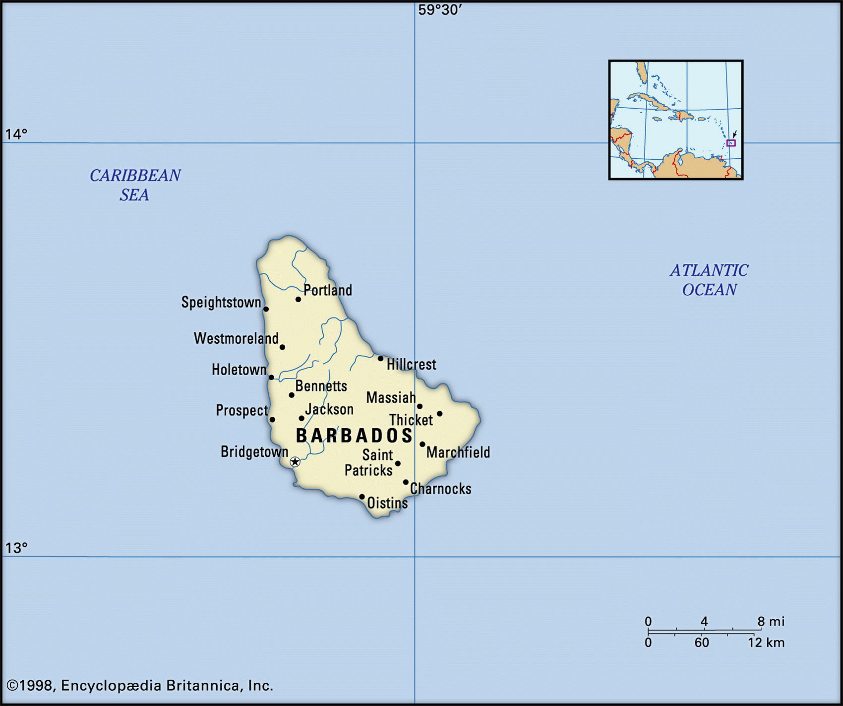
Map of Barbados and geographical facts
Map of Barbados with cities. Barbados on the world map
Map of Barbados with cities. Where Barbados is on the world map. The main geographical facts about Barbados - population, country area, capital, official language, religions, industry and culture.

Barbados Fact File
Official name Barbados
Form of government Parliamentary democracy with two legislative bodies (Senate and House of Assembly)
Capital Bridgetown
Area 430 sq km (166 sq miles)
Time zone GMT - 4 hours
Population 276,600
Projected population 2015 281,000
Population density 643.3 per sq km (1,666.3 per sq mile)
Life expectancy 73.5
Infant mortality (per 1,000) 11.7
Official language English
Other language English Creole
Literacy rate 97 Л c,
Religions Protestant 67% (Anglican 40%, Pentecostal 8%, Methodist 7%, other 12 °л Roman Catholic 4 %, none 17 %, other 12c.
Ethnic groups African 80%, European 4%, other (mixed African-European, East Indian) 16%
Currency Barbadian dollar
Economy Services 76%, industry 18%, agriculture 6%
GNP per capita US$ 14,500
Climate Tropical, with wet season June to November
Highest point Mt Hillaby 336 m (1,102 ft) Map reference Page 427
Northeast of Trinidad and 435 km (270 miles) off the coast of Venezuela, Barbados is the easternmost of the Caribbean Windward Islands. It is also one of the most orderly and prosperous. After becoming independent from the UK in 1966, power has alternated between two centrist parties, the Democratic Labour Party and the Barbados Labour Party. Both electoral results and freedom of expression are accepted features of Barbados life. Originally inhabited by Arawak Indians and later settled under the British in the seventeenth century, its population is mainly descended from African slaves brought to work on the sugar plantations. The governor-general of Barbados represents the British sovereign and the country has a strong colonial influence. Its neighbors sometimes refer to it as "little England."
The foundation of the island consists of coral deposits formed around a rocky core, and a fringe of coral reef has produced dazzling white beaches. Inland, the rolling terrain rises to hills in the north and center. About fifty percent of the land area is arable, sugar plantations accounting for 85 percent of the cultivated terrain. Barbados is sunnier and drier than many of its neighbors. There is a shortage of water. Surface water is negligible, though when it rains heavily gullies form natural reservoirs.
A small oil industry provides about one-third of the country's needs. Sugar refining is an important source of employment and revenue but has recently been overtaken by the rapid growth in tourism. Facilities are being upgraded to cope with the surge in visitors. Most arrive from Europe and North America and cruise-ship traffic is increasing. Recently, light industrial manufacture has been developed, much of it component assembly for export. The government has promised to build "a modern, technologically dynamic economy."