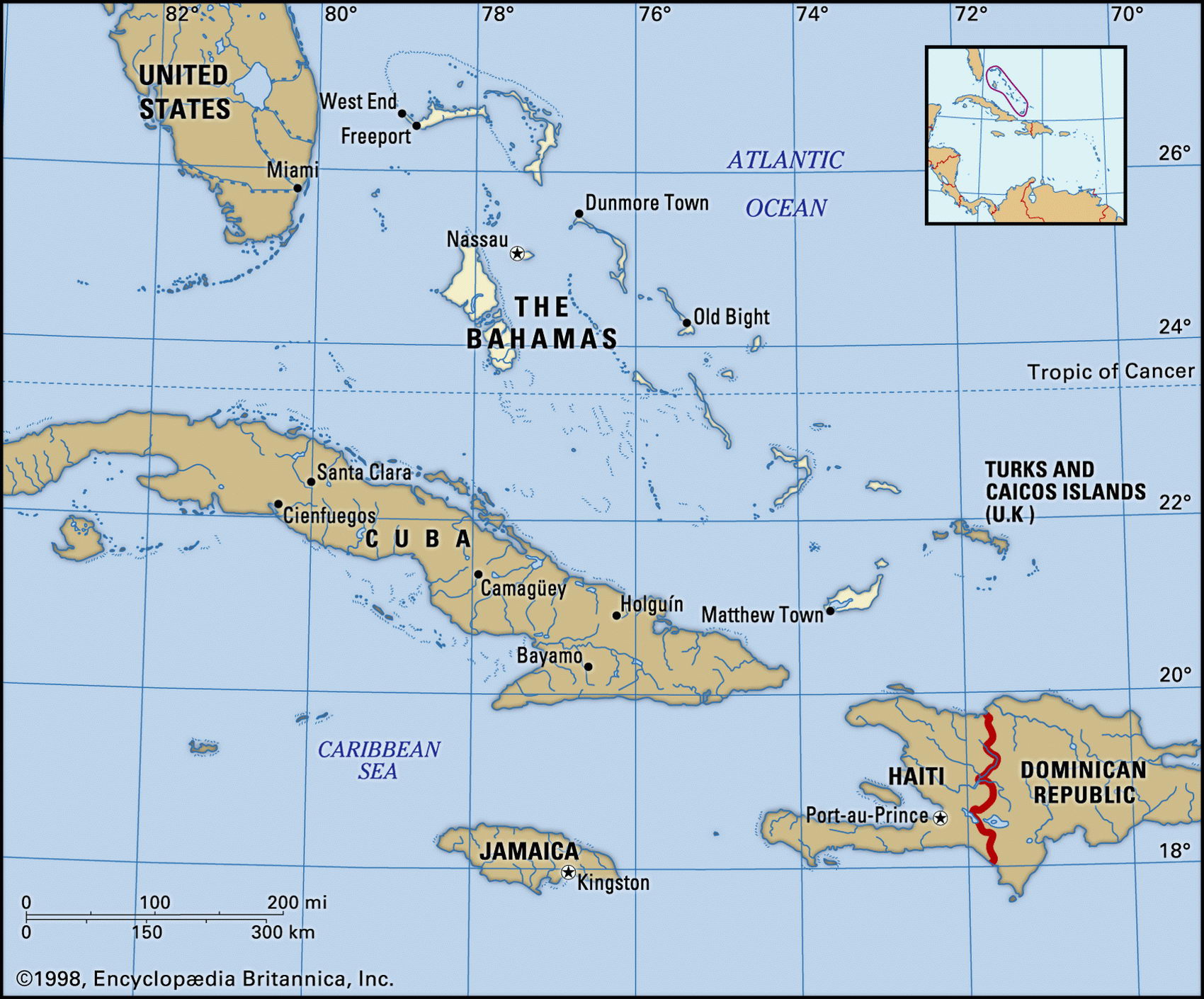
Map of Bahamas and geographical facts
Map of Bahamas with cities. Bahamas on the world map
Map of Bahamas with cities. Where Bahamas is on the world map. The main geographical facts about Bahamas - population, country area, capital, official language, religions, industry and culture.

Bahamas Fact File
Official name Commonwealth of the Bahamas
Form of government Constitutional monarchy with two legislative bodies (Senate and House of Assembly)
Capital Nassau
Area 13,940 sq km (5,382 sq miles)
Time zone GMT - 5 hours
Population 300,500
Projected population 2015 359,000
Population density 21.6 per sq km (55.8 per sq mile)
Life expectancy 69.9
Infant mortality (per 1,000) 17.1
Official language English
Other language Creole
Literacy rate 98.2%
Religions Baptist 32%, Anglican 20%, Roman Catholic 19%, Methodist 6%, Church of God 6%, other Protestant 12 %, other 5 %
Ethnic groups African 85%, European 15%
Currency Bahamian dollar
Economy Tourism 40%, government 30%, business services 10%, agriculture 5%, industry 4%, other 11 %
GNP per capita US$ 16,800
Climate Subtropical, with warm summers and mild winters
Highest point Mt Alverina 63 m (207 ft) Map reference Page 425
Off the southern tip of Florida in the western Atlantic, the Bahamas consists of 700 islands and about 2,400 cays. When Columbus landed here the islands were inhabited by Arawak Indians. The islands were claimed by Britain in 1690, but have had a checkered history since. A pirates' haven in the seventeenth century, they were held for short periods by the USA and Spain before Britain resumed control in 1783. They have been independent since 1983. The 25-year administration of Lynden Pindling ended in 1992 amid allegations of involvement in narcotics trafficking and money laundering. One of the most prosperous of the Caribbean's island states, the Bahamas has attracted many illegal immigrants from Haiti across the water. This influx has placed severe strain on government services. The increase of violent crimes also poses major problem.
All the islands are fragments of a large coralline limestone shelf. Most are only a few meters above sea level. Their coastlines are fringed with lagoons and coral reefs. Water is scarce. There are no rivers and rainfall disappears into the limestone. Much of the big islands are covered with pine forest. On the smaller islands people work mainly in fishing and agriculture.
Tourists come in large numbers: in 1995 there were more than 3,600,000 foreign arrivals. Tourism in turn has given rise to the manufacture of garments, furniture, jewelry, and perfume. All energy resources must be imported. Offshore banking, insurance, and financial services generate income and provide one of the region's highest standards of living. In addition, the Bahamas has a large open-registry fleet.