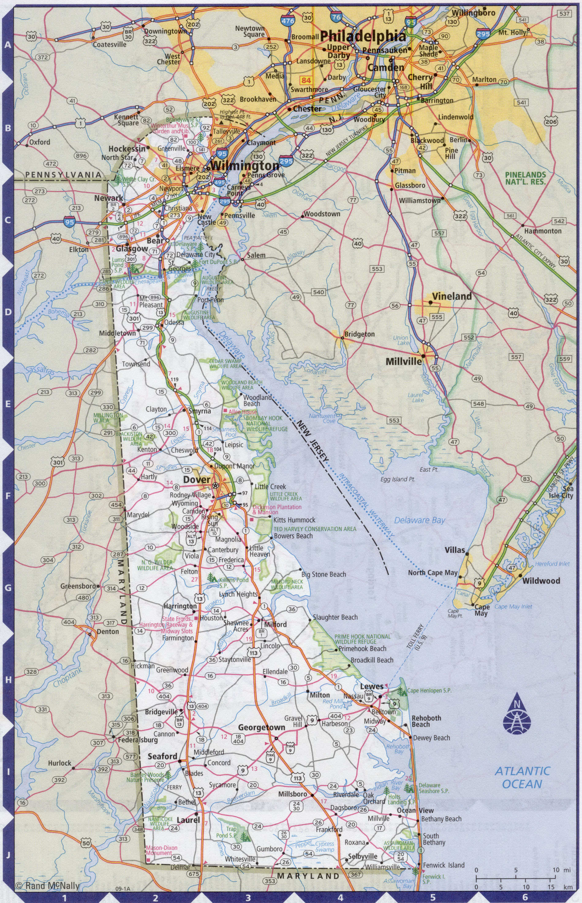
Map of Delaware state with cities and counties
Maps of Delaware state with cities and counties, highways and roads
Detailed maps of the state of Delaware are optimized for viewing on mobile devices and desktop computers. This page contains four maps of the state of Delaware:
- The first is a detailed road map - Federal highways, state highways, and local roads with cities;
- The second is a roads map of Delaware state with localities and all national parks, national reserves, national recreation areas, Indian reservations, national forests, and other attractions;
- The third is a map of Delaware state showing the boundaries of all the counties of the state with the indication of localities-administrative centers of the counties;
- The fourth is a Google satellite map of Delaware state, where you can view the location of all the interesting places in the state in interactive mode.
You will evaluate which of the presented maps is most useful for you. It may be convenient for you to compare information from all four sources.
All maps can be freely used-downloaded as a file or printed on paper. Using our maps, you can get directions along highways and local roads for sightseeing trips to the main attractions of the state of Delaware:
Biggs Museum of American art in Dover.
Wilmington Museum of art and Copeland sculpture Park.
The Scandinavian Church of Holy Trinity, built in the late seventeenth century.
Sandy beaches of Rehoboth beach.
Millsboro is famous for its Museum of native American culture.
Greenville attracts tourists with the mount Cuba mountain flora center and the three-hundred-year-old ferry.
Wilmington Airport (commonly known as New Castle County Airport , or to a lesser extent Wilmington / Philadelphia Regional Airport
it is the largest airport in Delaware. It is located five miles (8 km) South of Wilmington and about 30 miles (50 km) from Philadelphia. The flight time from new York to Philadelphia on a direct flight is approximately 1 hour.
Highways and roads map of Delaware state with cities

Map of Delaware state with national parks, reserves, recreation areas, and Indian reservations
Map of Delaware state counties
Google satellite map of the U.S. state of Delaware showing all attractions

