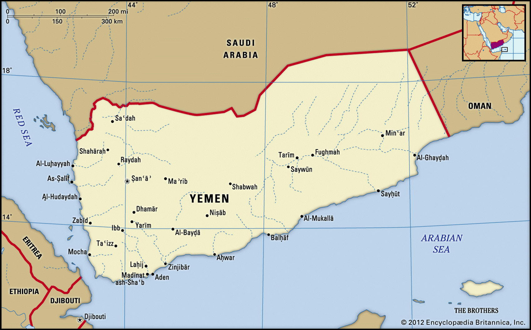
Map of Yemen and geographical facts
Where Yemen is on the world map
Map of Yemen with cities. Where Yemen is on the world map. The main geographical facts about Yemen - population, country area, capital, official language, religions, industry and culture.

Yemen Fact File
Official name Republic of Yemen
Form of government Republic with single legislative body (House of Representatives)
Capital San'a'
Area 527,970 sq km (203,849 sq miles)
Time zone GMT + 3 hours
Population 18,702,000
Projected population 2015 33,118,000
Population density 35.4 per sq km (91.7 per sq mile)
Life expectancy 60.6
Infant mortality (per 1,000) 66.8
Official language Arabic
Other language South Arab languages (e. g. Soqutri) Literacy rate 38 %
Religions Muslim: predominantly Sunni in the south, Shi'ite majority in the north
Ethnic groups Predominantly Arab; small mixed African-Arab and Indian minorities
Currency Yemeni rial
Economy Agriculture 63%, services 26%, industry 11 % GNP per capita US$ 820
Climate Mainly arid; humid in southwest and cooler in western highlands; drier in east
Highest point Jabal an-Nabi Shu'ayb 3,760 m (12,336 ft)
Map reference Page 220
Yemen occupies the southwestern corner of the Arabian Peninsula. Although its people have been Muslim for centuries it has deeply divided political allegiances and was two separate countries until 1990. North Yemen became independent of the Ottoman Empire in 1918, and in 1962 the Yemen Arab Republic (YAR) was proclaimed. The politics of the YAR tended to be conservative and Islamic. South Yemen came under British influence in 1839 and Aden became a vital port on the sea route to India. In 1967 the British withdrew from the region, and in 1969 the People's Democratic Republic of Yemen was proclaimed—the only Marxist state in the Arab world.
The north and south had been mutually hostile since independence, but a turning point came with the Soviet collapse in 1989. Having lost USSR support, South Yemen sought political union with the YAR. In 1990 the two countries became the Republic of Yemen. In 1994 an assassination attempt on a northern politician led to civil war and the south's attempted secession. An uneasy peace prevails.
The narrow Red Sea coastal plain of Tihama, extending south from Saudi Arabia, is generally barren: here, cotton-growing predominates. From the coast the land rises steeply to a comparatively fertile and well-cultivated interior. Around San'a' vines are cultivated and a variety of fruit crops are grown. The mountains overlooking San'a' rise to Jabal an-Nabi Shu'ayb, the highest point on the Arabian Peninsula. From these heights a number of rivers drain east toward the Ar Rub' al Khali (Empty Quarter) where they disappear into the sands. Along the coast of the Gulf of Aden a sandy plain rises inland to the rugged Yemen Plateau, which to the north slopes down to the uninhabited wastes of the Rub al-Khali. In this region ten percent of the mainly rural population are nomadic.
Despite oil and gas reserves, Yemen is weak economically. In the Gulf War of 1990-91 Yemen supported Iraq. As punishment, Saudi Arabia and Kuwait expelled hundreds of thousands of Yemeni workers. Their remittances ceased and they became a huge burden on the economy. The government then abandoned agricultural subsidies and farmers stopped growing food and export crops. Instead they planted a shrub called qat—a stimulant used by Yemenis that has no export value. High inflation and political conflicts make it difficult to implement long-range economic policies and reforms.