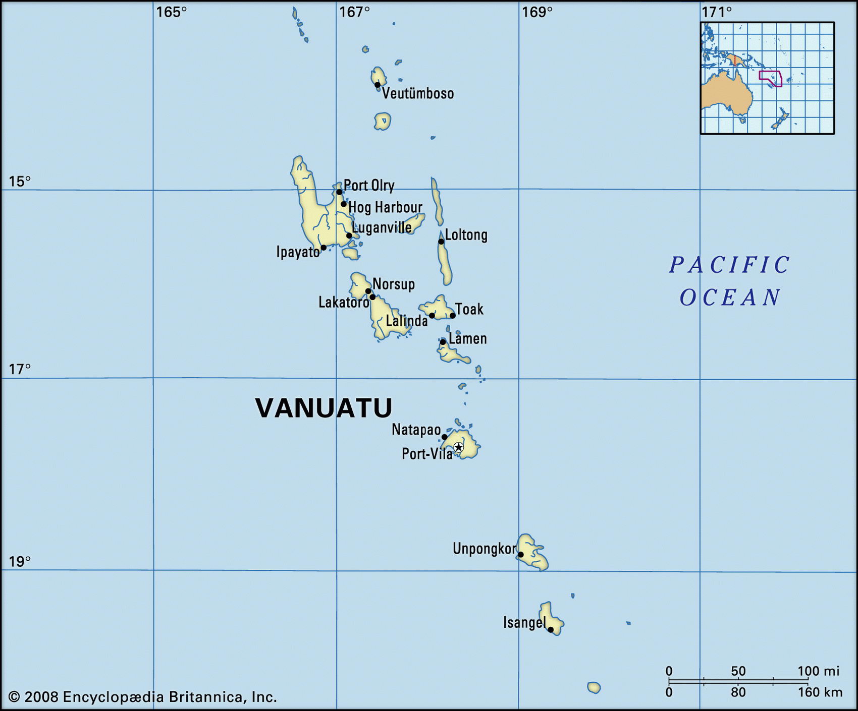
Map of Vanuatu and geographical facts
Where Vanuatu on the world map. Map of Vanuatu
Map of Vanuatu with cities. Where Vanuatu is on the world map. The main geographical facts about Vanuatu - population, country area, capital, official language, religions, industry and culture.

Fact File Vanuatu
Official name Republic of Vanuatu
Form of government Republic with single legislative body (Parliament)
Capital Port Vila
Area 14,760 sq km (5,699 sq miles)
Time zone GMT + 11 hours
Population 196,200
Projected population 2015 282,000
Population density 13.3 per sq km (34.4 per sq mile)
Life expectancy 61.3
Infant mortality (per 1,000) 59.6
Official languages English, French
Other language Bislama (ni-Vanuatu-pidgin), about 110 Melanesian languages
Literacy rate 53%
Religions Presbyterian 36.7%, Anglican 15%, Catholic 15%, indigenous beliefs 7.6%, Seventh-Day Adventist 6.2%, Church of Christ 3.8%, other 15.7%
Ethnic groups Melanesian 94%, French 4%, other (including Vietnamese, Chinese, Pacific Islanders) 2%
Currency Vatu
Economy Agriculture 75%, services 22%, industry 3%
Climate Tropical, moderated by trade winds Highest point Mt Tabwemasana 1,877 m (6,152 ft)
Map reference Pages 136, 141
Vanuatu is an archipelago in the South Pacific consisting of thirteen large islands and seventy islets. Part of Melanesia, it lies northeast of New Caledonia and west of Fiji. Inhabited since 5000 вс, it was first visited by Europeans when the Portuguese arrived in 1606. After Captain Cook explored the islands in 1774 he named them the New Hebrides, and they were jointly administered by France and Britain from 1887. In the late 1800s labor recruiters inveigled and sometimes kidnapped islanders for work on sugar plantations in Australia and Fiji. Aside from this, the islands remained isolated until the Second World War, when Espiritu Santo and Port Vila became major US military bases in the Pacific. In 1980 the archipelago became independent under the name Vanuatu. Since then, after surviving a secession attempt by a francophone movement on the island of Espiritu Santo, the country has had a volatile but democratic political life. Vanuatu is populated almost entirely by ethnic Melanesians speaking 110 distinct languages—the world's highest per capita density of language forms. The lingua franca is a form of pidgin known as Bislama.
Most of the islands are mountainous and volcanic in origin, with coral beaches and offshore reefs. The interior is forested, with limited land for coastal cultivation. Some 75 percent of the people live by subsistence farming, growing taro, yams, sweet potatoes, bananas, and cassava for food, as well as cash crops such as coconuts, cocoa, and coffee. Fishing is also important. Unlike most South Pacific islands, beef raising is of economic significance, livestock numbering some 130,000 head of cattle. Meat canning is an industry. Frozen beef and fish are exported. Other exports include copra, shells, coffee, and cocoa. Mineral deposits are negligible. Recently the government has emphasized tourist development (tourism is now the second largest earner of foreign exchange after copra), offshore banking, and foreign investment, advertising Vanuatu's potential as a finance center and tax haven. There is a "flag of convenience" shipping registry of some sixty ships from twenty countries.