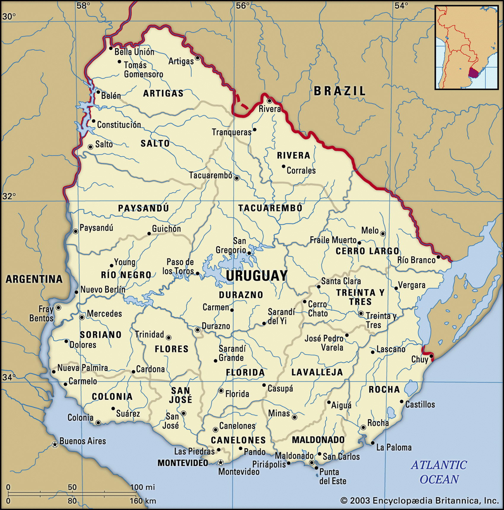
Map of Uruguay and geographical facts
Map of Uruguay. Where Uruguay is on the world map
Map of Uruguay with cities. Where Uruguay is on the world map. The main geographical facts about Uruguay - population, country area, capital, official language, religions, industry and culture.

Uruguay Fact File
Official name Eastern Republic of Uruguay
Form of government Republic with two legislative bodies (Senate and Chamber of Deputies)
Capital Montevideo
Area 176,220 sq km (68,038 sq miles)
Time zone GMT - 3 hours
Population 3,387,000
Projected population 2015 3,670,000
Population density 19.2 per sq km (49.8 per sq mile)
Life expectancy 75.7
Infant mortality (per 1,000) 14.3
Official language Spanish
Literacy rate 97.3%
Religions Roman Catholic 66Q. Jewish 2%, unaffiliated 30%, Protestant 2%
Ethnic groups European 88%, mixed indigenous-European 8%, African 4%
Currency Uruguayan peso
Economy Services 67%, industry 18<-agriculture 15%
GNP per capita US$ 9,200
Climate Temperate, with warm summers and mild winters
Highest point Cerro Catedral 514 m (1,686 ft) Map reference Page 459
Uruguay, the second-smallest country in South America, lies northeast of Argentina on the estuary of the River Plate (Rio de la Plata). Controlled for 150 years alternately by the Portuguese and the Spanish, Uruguay finally gained independence in 1828, after which came forty years of civil war. When peace was secured, waves of immigrants flocked to Uruguay from Spain and Italy, the cattle industry and meat exports expanded, investment poured in, and the country prospered. It may even have prospered too much: many benefits
and welfare provisions were introduced in the days of prosperity which in poorer times have proved difficult to pay for. An urban guerrilla movement known as the Tupamaros paralyzed the cities during the 1960s, provoking a repressive military crackdown and dictatorship. Democracy was restored in 1984.
Most of Uruguay is temperate and mild: it never snows and frosts are rare, though the pampero, a wind coming off the pampas to the south, can be cold and violent. Most of the country is covered with rich grasslands, a continuation of the Argentine pampas, where cattle and sheep are raised. Although ninety percent of Uruguay's land is suitable for cultivation, only some ten percent is currently used for agriculture, but this is enough to ensure that the country is largely self-sufficient in food. Uruguay's main river is the Negro, flowing east-west across the center of the country. On either side of the Negro the land rises to a plateau that marks the southern limits of the Brazilian Highlands. Water from the uplands feeds down the Negro into a large artificial lake, Lake Rincon del Bonete, which is used for hydroelectric power.
Uruguay's rural economy is based on sheep and cattle raising, and its industries are mainly based on animal products: meat processing, leather, and wool and textile manufacturing. The country is the second largest wool exporter in the world. But Uruguay is not rich in other resources: it has no petroleum or minerals except for agate, amethyst, gold deposits, and small quantities of iron ore. It is entirely dependent on imported oil. The ample supplies of hydroelectricity that are available help to offset this disadvantage, and only governmental regulatory constraints prevent industrial expansion.
Uruguay is at present undergoing a program of modernization, the most prominent issue being the privatization of the extremely large state sector (25 percent of the country's employees are currently civil servants) inherited from its more prosperous past. Tourism is booming, consisting mainly of visitors to Montevideo.
The Palacio Legislative! in Montevideo, Uruguay (below). The mizzen mast of the Great Britain on the harbor foreshore of Stanley in the Falkland Islands (right page top).