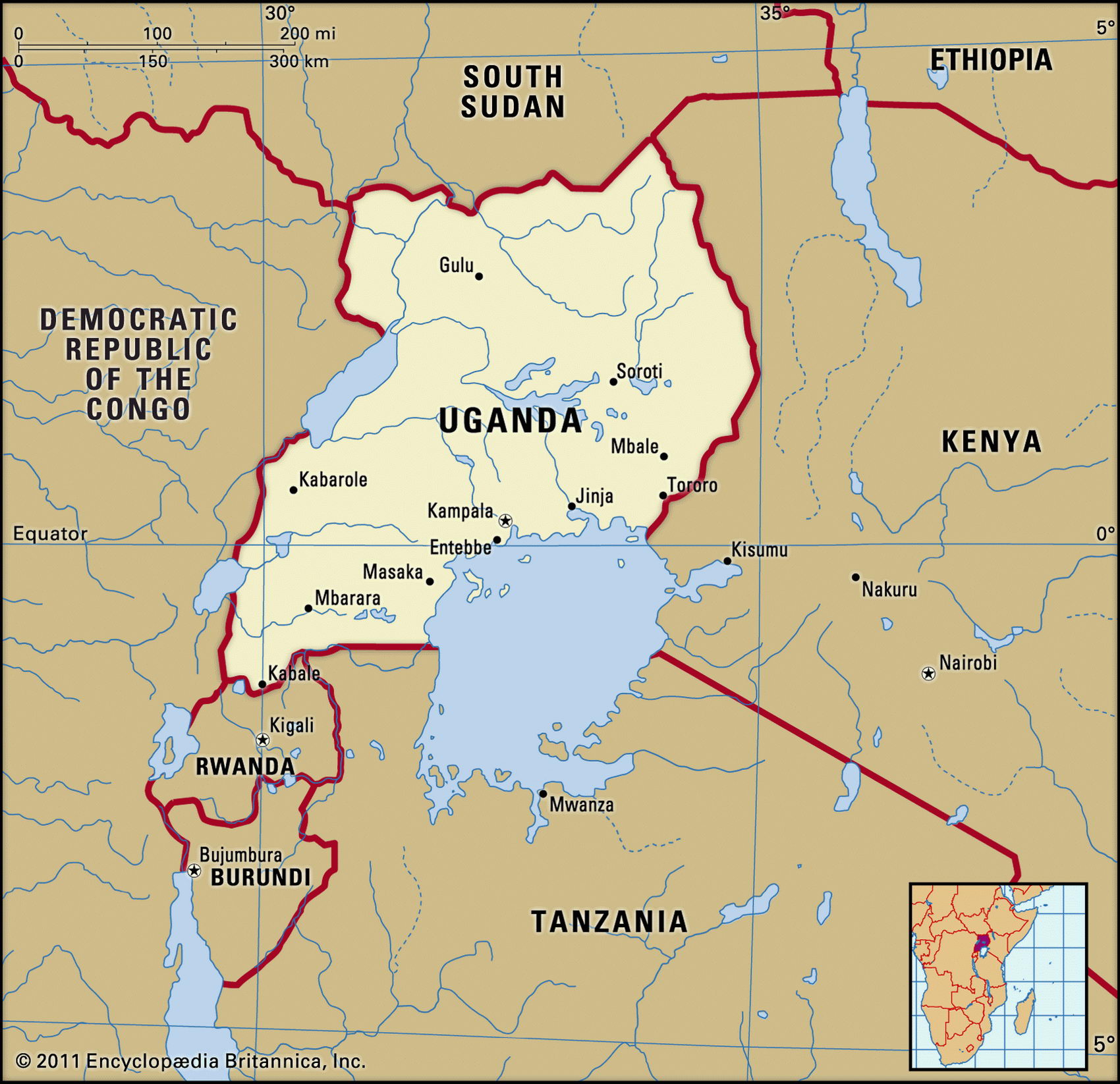
Map of Uganda and geographical facts
Uganda on the world map. Map of Uganda
Map of Uganda with cities. Where Uganda is on the world map. The main geographical facts about Uganda - population, country area, capital, official language, religions, industry and culture.

Uganda Fact File
Official name Republic of Uganda
Form of government Republic with single legislative body (National Assembly)
Capital Kampala
Area 236,040 sq km (91,135 sq miles)
Time zone GMT + 3 hours
Population 24,700,000
Projected population 2015 38,739,000
Population density 104.6 per sq km (271.0 per sq mile)
Life expectancy 43.8
Infant mortality (per 1,000) 89.4
Official language English
Other languages Luganda, Swahili, Bantu and Nilotic languages
Literacy rate 62.7%
Religions Roman Catholic 33%, Protestant 33%, indigenous beliefs 18%, Muslim 16%
Ethnic groups Indigenous tribal groups 99% (mainly Ganda, Teso, Nkole, Nyoro, Soga), other 1 %
Currency Ugandan shilling
Economy Agriculture 86%, services 10%, industry 4%
GNP per capita US$ 1,200
Climate Tropical, with two wet seasons March to May and September to November; semiarid in northeast
Highest point Mt Stanley 5,110 m (16,765 ft) Map reference Page 366
Extending north from Africa's largest body of water, Lake Victoria, the east African state of Uganda is a country of lakes and marshland. With a mild climate and varied resources—from fertile soil to freshwater fish to copper—it was once called "the pearl of Africa". After independence in 1962, however, its people suffered two decades of civil war, military coups, atrocities, and massacres, the worst period being the ten years under Idi Amin. It is estimated that between 1966 and Yoweri Museveni's takeover in 1986 more than half a million Ugandan inhabitants were killed.
The Museveni regime has overseen a return to peace and prosperity. Because the tribal basis of the old political parties was a cause of conflict, the government banned overt political activity, while inviting participation in a "one-party/no-party" policy of national unity. Multi-party elections in 1994, 1996, and 2001 returned and confirmed Museveni to power, but this taste of democracy created expectations of greater local autonomy. Some people are demanding the restoration of the region's traditional kingdoms.
Uganda's lake system is the source of the Nile. The pattern of lakes originates in the tilting and faulting of the Rift Valley, with the Ruwenzori Range on the western side of the country and the extinct volcano of Mt Elgon to the east. North of the lakes lies a savanna of trees and grassland, where farmers grow millet and sorghum for food, with cotton and tobacco as cash crops. Certain areas where cattle herding is impossible because of tsetse flies have been designated wildlife parks. Desert nomads live in arid Karamoja still further north. Coffee, tea, and sugarcane are grown in the south, which is the most fertile region and has the highest rainfall. This is the most densely settled part of the country, and is where the industrial center of Jinja is located, not far from Kampala, near the large Owen Falls hydroelectric plant.
Agriculture is the basis of the economy, with coffee the main export. Since 1986 the government has been engaged in raising producer prices for export crops, increasing prices for petroleum products (all oil must be imported), and raising civil service wages. Railways are being rebuilt. With the return of prosperity and public order, Indo-Ugandan entrepreneurs (expelled by the Obote and Amin regimes) are beginning to return from exile. The mining of gold and cobalt in the Ruwenzori region is also expected to resume.