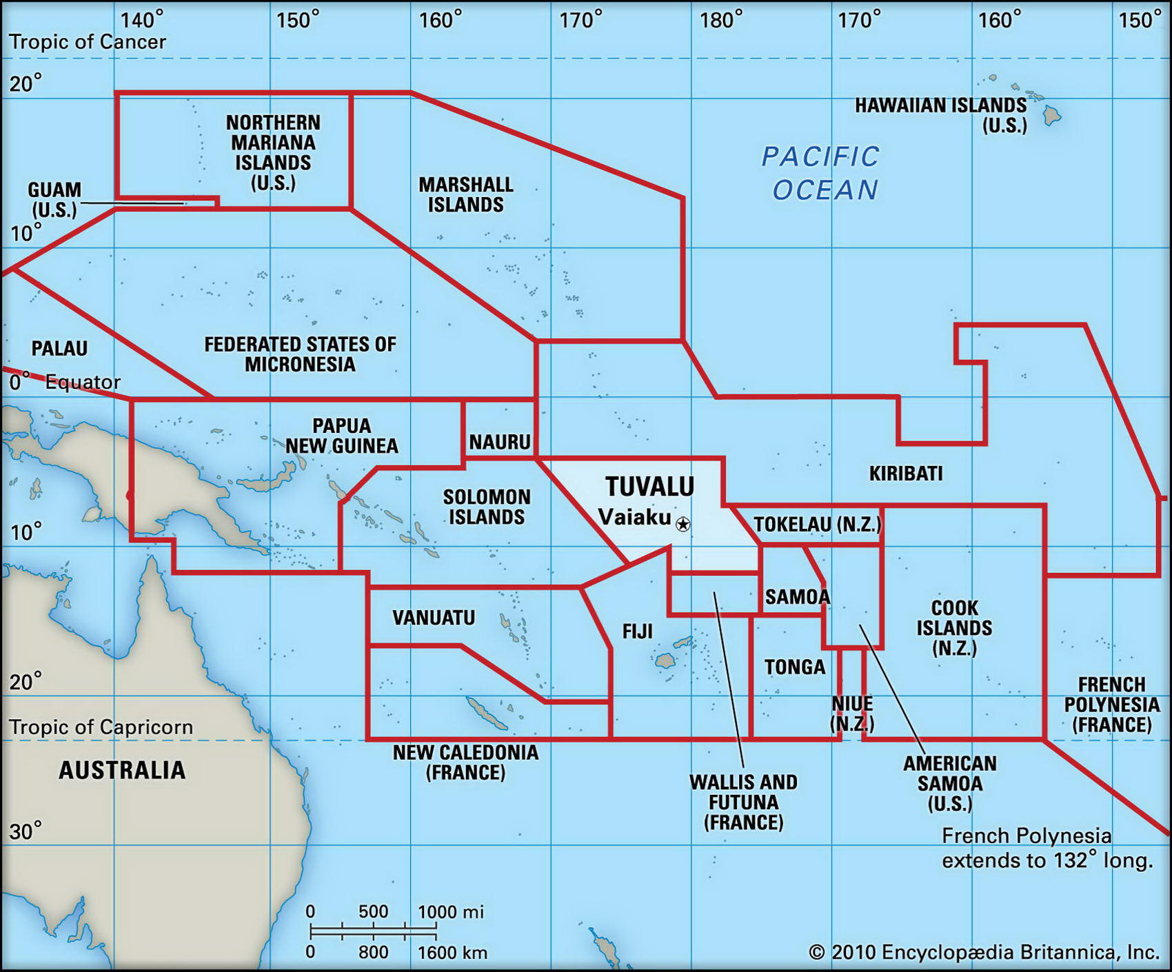
Map of Tuvalu and geographical facts
Where Tuvalu on the world map. Map of Tuvalu
Map of Tuvalu with cities. Where Tuvalu is on the world map. The main geographical facts about Tuvalu - population, country area, capital, official language, religions, industry and culture.

Fact File Tuvalu
Official name Tuvalu
Form of government Constitutional monarchy with single legislative body (Parliament)
Capital Funafuti
Area 26 sq km (10 sq miles)
Time zone GMT + 12 hours
Population 11,150
Projected population 2015 12,000
Population density 428.8 per sq km (1,115 per sq mile)
Life expectancy 67
Infant mortality (per 1,000) 22
Official languages Tuvaluan, English
Literacy rate 55%
Religions Church of Tuvalu (Congregationalist) 97%, Seventh-Day Adventist 1.4 %, Baha'i 1 %,
other 0.6%
Ethnic groups Polynesian 97%, other 3%
Currency Tuvaluan dollar, Australian dollar
Economy Agriculture and fishing 70%, services 28%, industry 2%
GNP per capita US$ 1,100
Climate Tropical, moderated by trade winds
Highest point Unnamed location on Niulakita 4.6 m (15 ft)
Map reference Page 139
Tuvalu is a tiny Pacific island state which holds the distinction of having the world's smallest economy. It consists of five coral atolls and four reef islands, none of which is more than 5 m (15 ft) above sea level, about midway
between Hawaii and Australia. Formerly known as the Ellice Islands (and once part of the British colony of the Gilbert and Ellice Islands), they were first populated by Polynesian migrants from Samoa and Tonga some time in the fourteenth century—the language used today is a Polynesian-Samoan dialect. Though the islands were sighted by the Spanish in the sixteenth century, further European contact did not take place until the eighteenth century, and it was not until 1826 that the whole group was finally discovered and mapped. In the 1860s labor recruiters known as "blackbirders" became active, either inveigling or abducting islanders for work on Fijian and Australian sugar plantations (the population fell from 20,000 in 1850 to 3,000 in 1880).
The abuses of the labor trade led the British government to annex the islands as a protectorate in 1892. Though brought together as a single administrative unit, the Micronesian Gilbertese and the Polynesian Tuvaluans were not comfortable with this arrangement, and in 1978 Tuvalu became an independent state closely linked with Britain.
Tuvalu's chain of coral islands is 579 km (360 miles) long, consisting north to south of the islands of Nanumea, Niutao, Nanumanga, Nui, Vaitupu, Nukufetau, Funafuti (the capital), Nukulaelae, and Niulakita. There are no streams or rivers on any of the islands, and groundwater is not drinkable. All water needs must be met by catchment systems with storage facilities. Although the soil is of poor quality, subsistence farming supports about seventy percent of the population. The limited range of food crops that can be cultivated, such as taro. must be grown in special pits dug out of the coral. Although the islands support no export crop other than coconuts, the area of the maritime Exclusive Economic Zone is 1.2 million sq km (500,000 sq miles). The rich fishing grounds within this zone are a source of revenue from license fees paid by fishing fleets from Taiwan, Korea, and the USA. Too small, remote, and lacking in amenities to be able to establish a tourist industry, government revenues come mainly from the sale of stamps and coins and from remittances: large numbers of Tuvalu men live and work abroad, some as seamen and others mining phosphate on Nauru. The value of imports exceeds exports by 200 to 1. Substantial income is generated by an international trust fund established in 1987 by Australia, New Zealand, and the United Kingdom, which is also supported by Japan and South Korea.