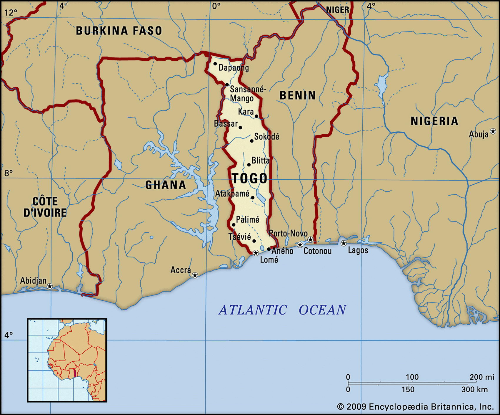
Map of Togo and geographical facts
Togo on the world map. Map of Togo with cities
Map of Togo with cities. Where Togo is on the world map. The main geographical facts about Togo - population, country area, capital, official language, religions, industry and culture.

Togo Fact File
Official name Republic of Togo
Form of government Republic with single legislative body (National Assembly)
Capital Lome
Area 56,790 sq km (21,927 sq miles)
Time zone GMT
Population 5,286,000
Projected population 2015 6,576,000
Population density 93.1 per sq km (241.1 per sq mile)
Life expectancy 54.0
Infant mortality (per 1,000) 69.3
Official language French
Other languages Ewe, Mina, Dagomba, Kabye
Literacy rate 51.7%
Religions Indigenous beliefs 70%, Christian 20%, Muslim 10%
Ethnic groups Indigenous (Ewe, Mina, and Kabye are the largest of 37 tribes) 99%, European and Syrian-Lebanese 1 %
Currency CFA (Communaute Financiere Africaine) franc
Traditional houses in Togo (above). A public voodoo ritual in eastern Ghana (below). Children in a canoe paddle through a village of stilt houses, situated on a river in Benin (right page).
Economy Agriculture 64%, services 30%, industry 6%
GNP per capita US$ 1,500
Climate Tropical, with wet seasons March to July and October to November; semiarid in north, with wet season April to July
Highest point Pic Baumann 986 m (3,235 ft)
Map reference Page 364
Togo is a small west African country squeezed between Ghana and Benin. It was colonized by Germany in 1884, later becoming French Togo-land. It became independent in I960. A deep social division exists between the Kabye people in the north and the majority Ewe of the south. The Ewe are generally better educated, and live in the more developed part of the country, but have no say in government. This is run by Africa's longest serving president, General Eyadema, a Kabye who has held this position since his coup in 1967. The first multi-party elections took place in 1993.
Most people live on the coast and the adjacent plains. Inland a mountain chain crosses the country north to south. The far northwest is mainly granite tableland. Roads connect the northern savanna with the railhead of Blitta, and the phosphate mining area with its port of Kpeme. The River Oti crosses in the northwest between Burkina Faso and Ghana, and the River Mono drains south into the Gulf of Guinea. About a quarter of the land is arable. The most fertile land—28 percent of the country—is forested; here slash-and-burn cultivation occurs.
Togo depends on subsistence agriculture. Food crops include yams, cassava, maize, beans, rice, and sorghum. The main export crops are coffee, cocoa, and cotton, which together generate about thrity percent of earnings. Cattle, sheep, and pigs are raised in the north. The annual fish catch is about 14,000 tonnes. Togo is normally self-sufficient in food, though drought has recently cut productivity, and the deforestation caused by slash-and-burn agriculture is causing concern. Phosphate mining is the most important industrial activity.