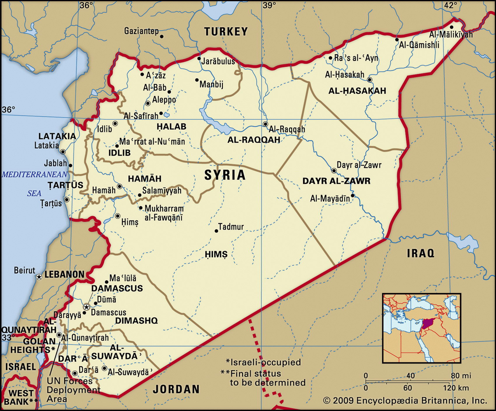
Map of Syria and geographical facts
Where Syria is on the world map
Map of Syria with cities. Where Syria is on the world map. The main geographical facts about Syria - population, country area, capital, official language, religions, industry and culture.

Syria Fact File
Official name Syrian Arab Republic
Form of government Republic with single legislative body (People's Council)
Capital Dimashq (Damascus)
Area 185,180 sq km (71,498 sq miles)
Time zone GMT + 2 hours
Population 17,156,000
Projected population 2015 23,206,000
Population density 92.6 per sq km (240.0 per sq mile)
Life expectancy 69.1
Infant mortality (per 1,000) 32.7
Official language Arabic
Other languages Kurdish, Armenian
Literacy rate 70.8%
Religions Sunni Muslim 74%, other Muslim
sects 16%, Christian 10%; tiny Jewish communities
Ethnic groups Arab 90%; Kurdish, Armenian and other 10 %
Currency Syrian pound
Economy Services 63%, agriculture 22%, industry 15%
GNP per capita US$ 3,200
Climate Temperate, with mild, wet winters and dry, hot summers; arid in interior
Highest point Jabal ash Shaykh 2,814 m (9,232 ft)
Map reference Pages 200, 225
Syria is in the eastern Mediterranean, with Iraq and Turkey to the east and north and Lebanon, Israel and Jordan to the west and south. Throughout history it has played a key role in the region. Over the years Egyptians, Hittites, Persians, Greeks, and Romans came and went. Converted to Islam when overrun by the Arabs in 634, the Syrians' capital Damascus became a major center during the Umayyad Dynasty. Crusaders seized much of Syria in the twelfth century, but were ousted by the Kurdish general Saladin. Under French control from 1920, Syria became independent in 1946. After various military coups and counter-coups the Ba'ath Party seized power in 1963, and from 1971 until his death in 2000 party leader Hafez al-Assad has ruled Syria with an iron fist. A member of the minority Alawite religious sect, he has faced resistance from other Muslims, notably the Sunni majority. But when the Sunni Muslim Brotherhood rose against Damascus in 1992 their revolt was crushed, with up to 20,000 deaths. Following the Second Gulf War in 1991 Syria received huge amounts of aid as a result of its unexpected support for the coalition against Iraq. As a member of the Security Council, however, it sternly opposed the Third Gulf War in 2003-
Syria's Mediterranean coast, well-watered from subterranean sources, is one of the country's most fertile, intensively farmed, and densely populated regions. Inland is the Ghab Depression, a rift valley flanked by two mountain ranges. Here the Orontes (A§I) River flows through gorges and wide valleys. To the south, the Heights of Hermon rise above the eastern slopes of the Anti-Lebanon Range (Jabal ash Sharqi). Snowmelt from the range provides water for Damascus. Inland lies the Syrian Desert (Badiyat ash Sham), crossed by the Euphrates River (Firat Nehri). Oil was discovered along the Euphrates in the 1980s. Power from the Euphrates barrage produces seventy percent of Syria's electricity.
Under the socialist Ba'ath Party most industry is government controlled. The main industries are textiles, food processing, beverages, tobacco, phosphate rock mining, petroleum, and cement. Oil, textiles, cotton, and agricultural produce are the main exports. The country has many weak government-owned firms and low productivity. Oil production has begun to ebb and unemployment is expected to rise as the more than sixty percent of the population that is under twenty years old enters the labor force. Syria's Gulf War aid windfall of $5 billion has been spent.