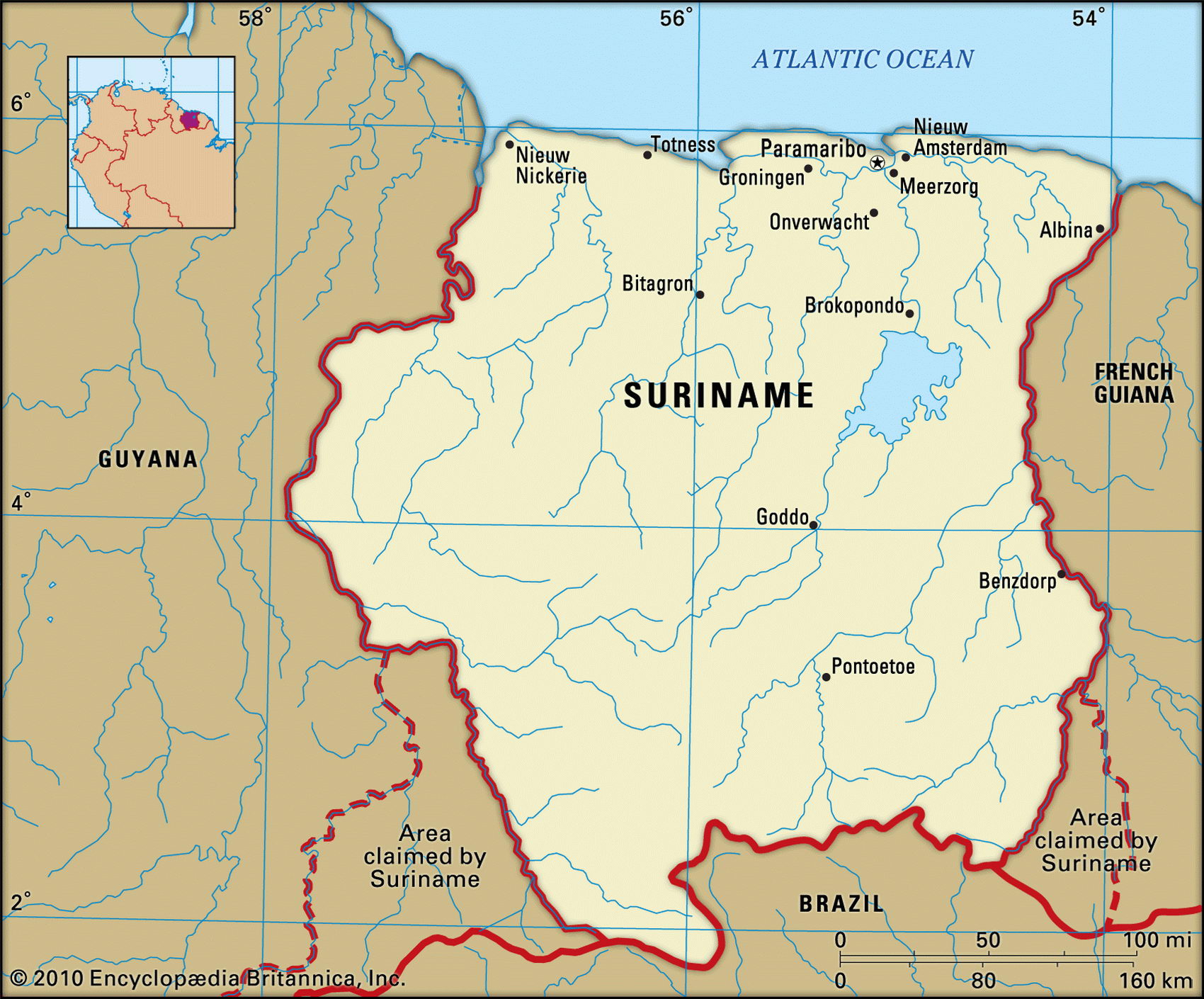
Map of Suriname and geographical facts
Suriname on the world map. Map of Suriname
Map of Suriname with cities. Where Suriname is on the world map. The main geographical facts about Suriname - population, country area, capital, official language, religions, industry and culture.

Suriname Fact File
Official name Republic of Suriname
Form of government Republic with single legislative body (National Assembly)
Capital Paramaribo
Area 163,270 sq km (63,038 sq miles)
Time zone GMT-3 hours
Population 437,000
Projected population 2015 437,000
Population density 2.7 per sq km (6.9 per sq mile)
Life expectancy 71.9
Infant mortality (per 1,000) 23.5
Official language Dutch
Other languages English, Sranang Tongo (Surinamese), Hindi, Javanese, Chinese
Literacy rate 93%
Religions Hindu 27.4%, Muslim 19.6%, Roman Catholic 22.8%, Protestant 25.2%, indigenous 5%
Ethnic groups Hindustani (East Indian) 37%, mixed European-African 31 %, Javanese 15%, African 10%, Amerindian 3%, Chinese 2%, European 1 %, other 1 %
Currency Suriname guilder
Economy Services 65 %, industry 22 %, agriculture 13%
GNP per capita US$ 3,500
Climate Tropical: hot and wet year-round Highest point Julianatop 1,230 m (4,035 ft) Map reference Page 452
Formerly known as Dutch Guiana, Suriname is a small country on the northeastern coast of South America. In 1667 two colonial powers exchanged territory: the Dutch gave the British New Amsterdam, which became New York. In return the British gave Suriname to the Dutch. From the Low Countries the new proprietors brought their dike-building skills to reclaim a narrow coastal strip, and soon sugar plantations took the place of marshes and mangrove swamps. At first African slaves were imported to do the work; later labor was brought from India, China, and Java, and these three immigrant groups have determined both the ethnic composition of the country as well as its political fate.
Since 1954 Suriname has had the status of an equal partner in the "Tripartite Kingdom of the Netherlands". This has benefited those who have fled the continual military coups and civil disturbance in Suriname, using their Dutch citizenship to enter the Netherlands in large numbers. As was the case in nearby Guyana, escaped African slaves established isolated settlements in the hinterland. Guerrilla uprisings in both 1986 and 1994 have made the descendants of these people an urban political force.
Inland of the cultivated coastal strip lies a zone of sandy savanna, and south of this a vast area of dense forest begins (92 percent of the nation's total land area). Suriname has the world's highest ratio of forested country and it is still virtually untouched as timber is not among the nation's exports. The forests stretch inland to the Guiana Highlands, which are an extension of the Tumucumaque Mountain Range in northeastern Brazil. Over time, weathered soils have been washed from the uplands down to the alluvial valleys below, providing the foundation of the thriving bauxite industry.
Bauxite accounts for fifteen percent of Suriname's gross domestic product and more than 65 percent of export earnings. Other exports include shrimp, fish, rice, bananas, citrus fruits, and coconuts. For most people rice is the staple food, supplemented by tropical fruits and vegetables.
Both ethnic conflict and economic crises have damaged the country's prospects for some years, although the campaign by guerrillas against the urban political elite seems to have faded for the present. Inflation was running at 600 percent in 1994 but since has dropped considerably and was at seventeen percent in 2002. The resumption of economic aid by the Netherlands has led to a greater confidence in Suriname's economy, but substantial progress is unlikely without major economic reform.