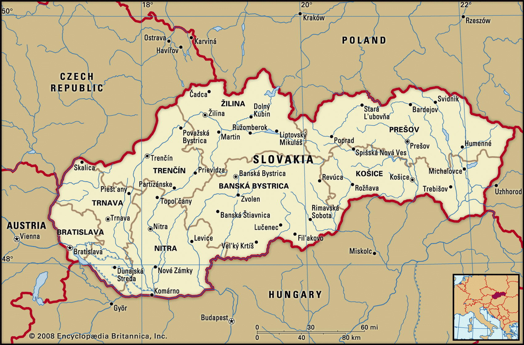
Map of Slovakia and geographical facts
Slovakia on the world map. Map of Slovakia
Map of Slovakia with cities. Where Slovakia is on the world map. The main geographical facts about Slovakia - population, country area, capital, official language, religions, industry and culture.

Slovakia Fact File
Slovakia Fact File
Official name Slovak Republic
Form of government Republic with single legislative body (National Parliament)
Capital Bratislava
Area 48,845 sq km (18,859 sq miles)
Time zone GMT+1 hour
Population 5,423,000
Projected population 2015 5,420,000
Population density 111 per sq km (287.6 per sq mile)
Life expectancy 74.2
Infant mortality (per 1,000) 8.8
Official language Slovak
Other language Hungarian, Czech
Literacy rate 99 %
Religions Roman Catholic 60.3%, Protestant 8.4%, Orthodox 4.1 %, other 27.2%
Ethnic groups Slovak 85.7%, Hungarian 10.7%, others include Gypsy, Czech 3.6%
Currency Koruna
Economy Services 44.3 %, industry 43.5 %, agriculture 12.2%
GNP per capita US$ 12,200
Climate Temperate, with cold winters and warm, wet summers
Highest point Gerlachovka 2,655 m (8,711 ft) Map reference Page 289
This small Central European country is bordered by Poland to the north, the Czech Republic to the northwest, Austria to the west, Hungary to the south, and Ukraine to the east. It is the smaller, less populous, and less industrially developed part of the former state of Czechoslovakia, which split peacefully in 1993 to form the two separate nations of Slovakia and the Czech Republic.
Ethnically distinct from their former compatriots, the Slovaks had lived for ten centuries under continuous Hungarian domination when in 1918 they merged with the Czechs to form a new, independent nation. At the beginning of the Second World War, Czechoslovakia was invaded by Germany and the Germans installed a pro-Fascist government in Slovakia. Soviet troops restored the pre-war status quo in 1945 and communists seized power in 1948, making the country effectively a Soviet satellite. In 1968 Soviet forces invaded to put down an attempt to establish democracy under the leadership of Czechoslovakia's First Secretary, Alexander Dubcek, a Slovak. Twenty-one years later a revival of nationalism and a weakened Soviet Union led to a successful declaration of independence and the establishment of democratic government. Since its separation from the Czech Republic, Slovakia has been governed by a single-chamber parliament whose 150 members, or deputies, are elected for a four-year term.
Except for lowland areas in the south and southeast, most of the country is ruggedly mountainous, with extensive forests and tracts of pastureland. In the north of the country the high Carpathian Mountains extend along the Polish border, and further south the Tatra Mountains, an offshoot of the Carpathians and the Slovakian Ore Mountains, run parallel across the center of the country. Ski resorts in the Tatra Mountains attract large numbers of tourists. The Danube, which forms part of the border with Hungary, flows through an extensive fertile plain. Most of Slovakia's agriculture, which employs more than one-tenth of the workforce, is centered here and in the lowland area further to the east. Wheat and potatoes are the principal crops, and sheep, cattle, and pigs are widely raised.
Slovakia is poorly endowed with mineral resources. There are significant deposits of lignite, but most of it is poor in quality. Industries, which employ about one in three workers, are centered mainly around the cities of Bratislava in the southwest and Kosice in the southeast. Significant industries are iron and steelmaking, and car and clothing manufacture. The move from a centrally controlled to a privatized market economy has proceeded fitfully, and the country has suffered economically from the loss of subsidies that it used to receive from the Czech Republic.