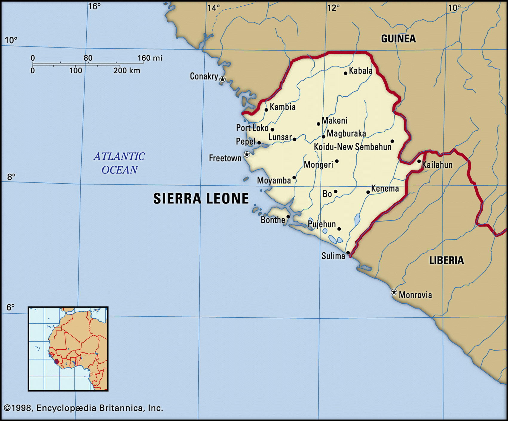
Map of Sierra Leone and geographical facts
Sierra Leone on the world map. Map of Sierra Leone
Map of Sierra Leone with cities. Where Sierra Leone is on the world map. The main geographical facts about Sierra Leone - population, country area, capital, official language, religions, industry and culture.

Sierra Leone Fact File
Official name Republic of Sierra Leone
Form of government Republic with single legislative body (House of Representatives)
Capital Freetown
Area 71,740 sq km (27,699 sq miles)
Time zone GMT
Population 5,615,000
Projected population 2015 7,115,000
Population density 78.3 per sq km (202.7 per sq mile)
Life expectancy 46.0
Infant mortality (per 1,000) 144.4
Official language English
Other languages Mande languages (including Malinke, Mende), Temne, Limba, Krio (Creole)
Literacy rate 31.4%
Religions Muslim 60%, indigenous beliefs 30%, Christian 10%
Ethnic groups 13 indigenous tribes 99%, other 1' Currency Leone
Economy Agriculture 70%, services 16%, industry 14%
GNP per capita US$ 500
Climate Tropical, with wet season April to November
Highest point Loma Mansa 1,948 m (6,391 ft) Map reference Page 364
Sierra Leone's capital, Freetown, was so named when the British government settled freed slaves there in 1787. Once the freed-slave settlers became a ruling class over the Africans already living in the country, deep social divisions opened. Many settlers, and foreign missionaries, were killed in a war with the indigenous Mende in 1898.
Once a British crown colony, and independent since 1961, Sierra Leone's recent history has been marked by military coups, ethnic factionalism, and violence. Since 1992, civil war has raged in the east and the south, thousands of lives have been lost and thousands of farms in the country's main grain growing areas abandoned. Liberian troops have been involved, and Libyan weapons. Child soldiers have been used by both sides. Following democratic elections in 2002 the government has slowly established its authority. However, the withdrawal of most UN peacekeepers in 2004 and the tenuous security situation in neighboring Liberia may present challenges to the continuation of Sierra Leone's stability.
Unlike most of west Africa, Sierra Leone is mountainous near the sea. These mountains are volcanic, and run southeast of Freetown on the Atlantic forming a thickly wooded peninsula (the Sierra Leone, or Lion Range). The peninsula interrupts a swampy coastal plain stretching north and south and dominated by mangrove forests. Rolling savanna uplands to the north, known as the Bolilands, were once the scene of government efforts to introduce large-scale mechanized rice cultivation. Rice is also grown in the seasonally flooded riverine grasslands of the southeast and in the swamps near Port Loco. Inland, to the northeast, the land rises to the Loma Mountains and the Tingi Hills. Rainfall on the coast is extremely high. The soils are heavily leached and weathered.
Subsistence farming dominates the agricultural sector, which employs about two-thirds of the population. Rice is the staple food crop and along with palm oil it is produced throughout Sierra Leone, except in the drier north. There, in the savanna, peanuts and cattle herding predominate. The country has substantial mineral resources, and the mining of diamonds, bauxite, and rutile or titanium ore provides essential hard currency. The economy is currently almost at a standstill because infrastructure has collapsed through neglect, and both the mining and agricultural sectors have been disrupted by civil war.