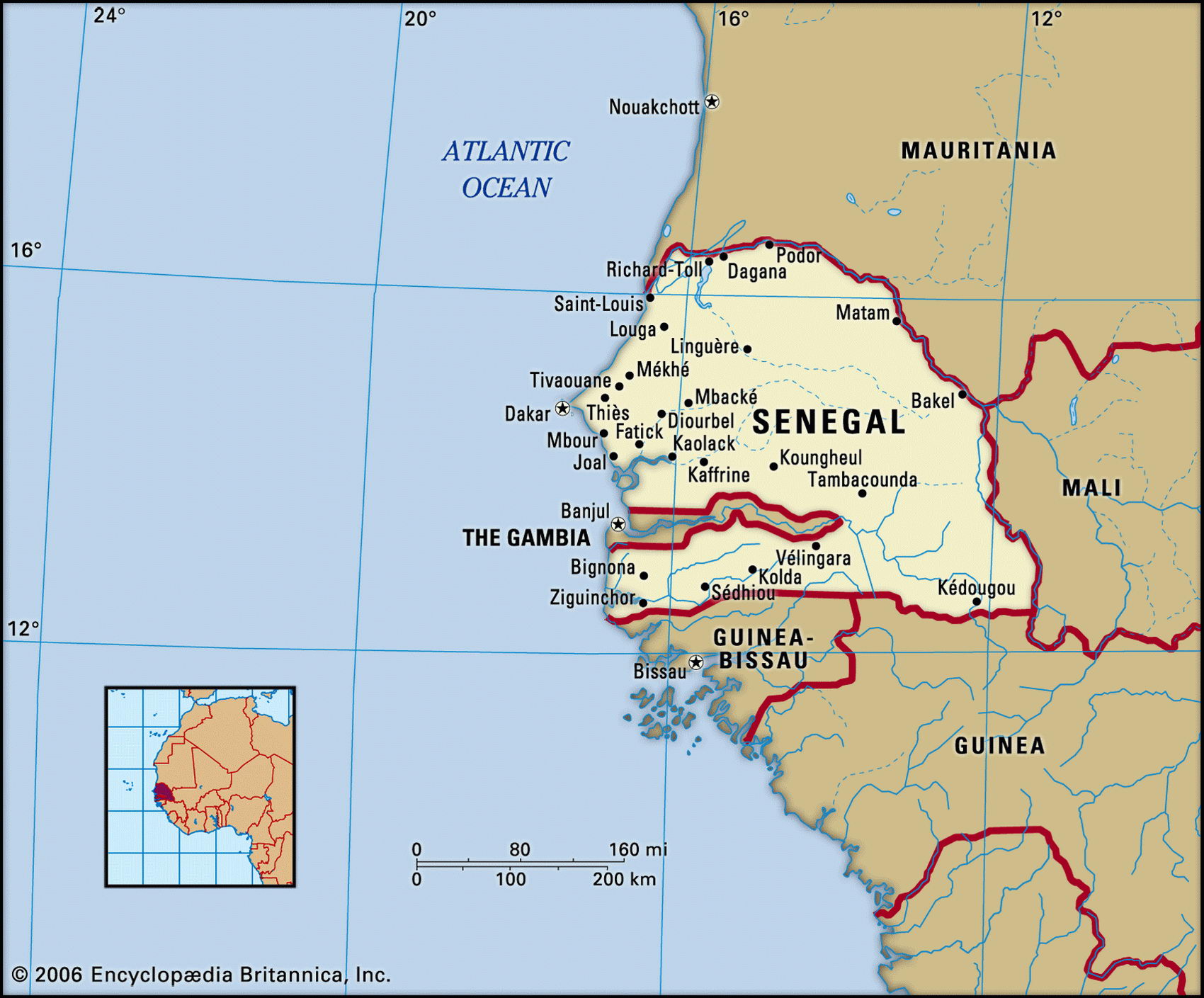
Map of Senegal and geographical facts
Senegal on the world map. Map of Senegal
Map of Senegal with cities. Where Senegal is on the world map. The main geographical facts about Senegal - population, country area, capital, official language, religions, industry and culture.

Senegal Fact File
Official name Republic of Senegal
Form of government Republic with single legislative body (National Assembly)
Capital Dakar
Area 196,190 sq km (75,749 sq miles)
Time zone GMT
Population 10,590,000
Projected population 2015 13,516,000
Population density 54 per sq km (139.8 per sq mile)
Life expectancy 62.9
Infant mortality (per 1,000) 55.4
Official language French
Other languages Wolof, Pulaar, Diola, Mandingo
Literacy rate 39.1 %
Religions Muslim 92%, indigenous beliefs 6%, Christian 2% (mainly Roman Catholic)
Ethnic groups Wolof 36%, Fulani 17%, Serer 17%, Toucouleur 9%, Diola 9%, Mandingo 9%, European and Lebanese 1 %, other 2 %
Currency CFA (Communaute Financiere Africaine) franc
Economy Agriculture 81 %, services 13%, industry 6%
GNP per capita US$ 1,580
Climate Tropical, with wet season June to October
Highest point Unnamed location in southeast 581 m (1,906 ft)
Map reference Page 364
Dakar, the capital of Senegal, lies on the westernmost point of west Africa and in the seventeenth and eighteenth centuries it was a major slave-trading base. French colonial control of Senegal was established during the suppression of the slave trade in the nineteenth century. As the administrative center of the huge region of French West Africa, an effective road network was established in Dakar, plus extensive port facilities and a large civil service.
Independence from France came in I960. Despite being a de facto one-party state for the next ten years, Senegal avoided military and dictatorial rule, and has recently liberalized its economic and political life. In 1982, Senegal joined with Gambia to form the nominal confederation of Senegambia. However, the envisaged integration of the two countries was never carried out, and the union was dissolved in 1989. Senegal's most serious problem is continuing armed revolt in the oil-rich southern province of Casamance, south of Gambia, a region that differs ethnically, economically, and geographically from the north.
Senegal is split by the near-enclave of Gambia and the Gambia River. To the north the land is drier, with sand dunes along the coast. Inland there are plains, savanna, and semidesert, where Fulani cattle-herders eke out an existence. South of Dakar and Cape Vert it is wetter and more fertile, with coastal mangrove swamps and forest inland. Sorghum is grown in the rainier areas of savanna bush-land, while south of Gambia rice is cultivated on the floodplain of the Casamance River— the most fertile part of the country.
Peanuts have long been the foundation of Senegal's economy and are grown on half the cultivated land. Efforts are being made to diversify, and sugarcane, millet, cotton, and rice are now cultivated. Other than the recently developed oil fields in Casamance, with the promise of more offshore, natural resources are few. Though its arrangements are democratic, Senegal's ruling party has been in power since the 1950s, creating a network of patronage through the civil service, the judiciary, and the state-owned industries. Long-overdue reforms are therefore not likely to happen in the foreseeable future. Senegal receives a considerable amount of foreign aid.
Fishermen at a beach in Gambia fix their boats (below). Market street in Serekunda, Gambia (center).