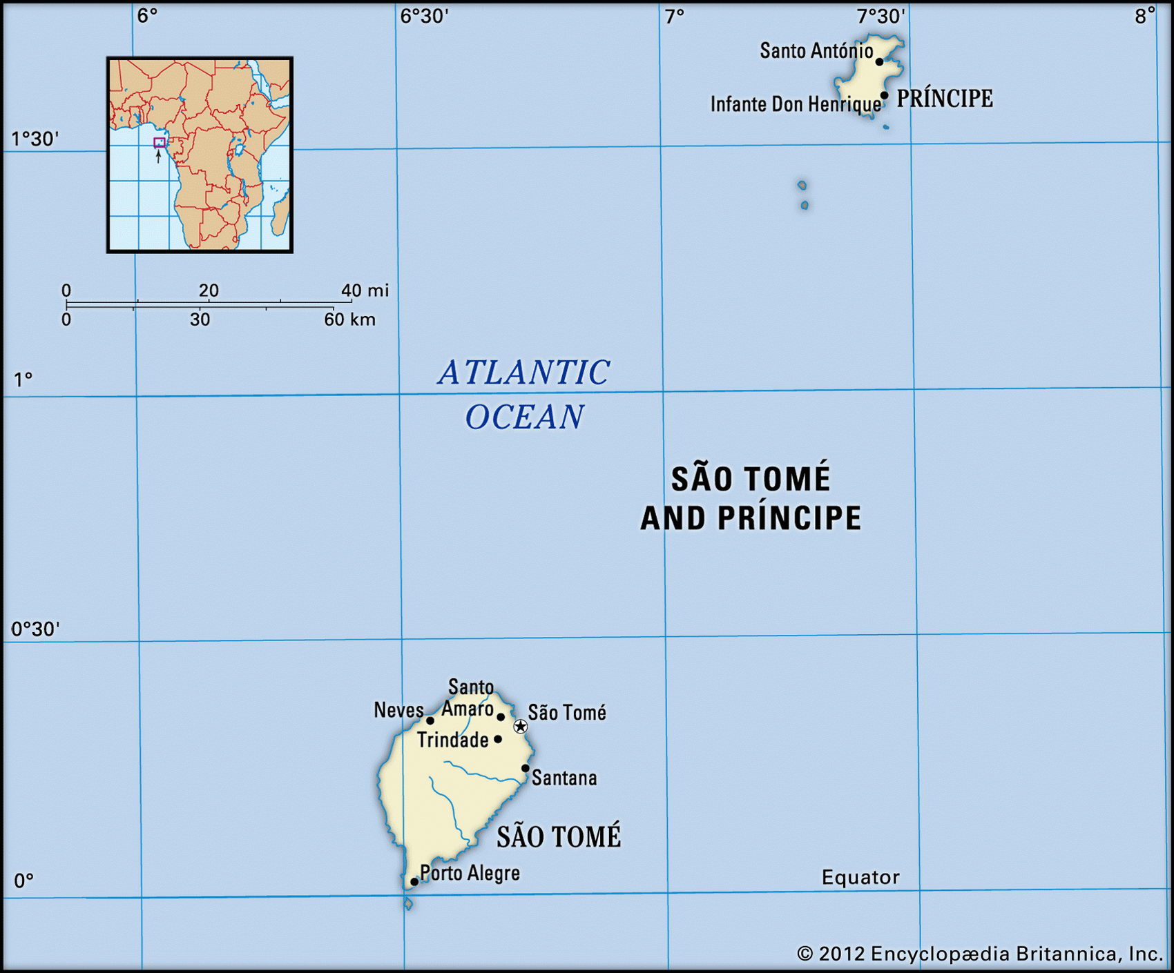
Map of Sao Tome and Principe and geographical facts
Sao Tome and Principe on the world map. Map of Sao Tome and Principe
Map of Sao Tome and Principe with cities. Where Sao Tome and Principe is on the world map. The main geographical facts about Sao Tome and Principe - population, country area, capital, official language, religions, industry and culture.

Sao Tome and Principe Fact File
Official name Democratic Republic of Sao Tome and Principe
Form of government Republic with single legislative body (National People's Assembly)
Capital Sao Tome
Area 960 sq km (371 sq miles)
Time zone GMT
Population 171,000
Projected population 2015 178,000
Population density 178.1 per sq km (460.9 per sq mile)
Life expectancy 65.9
Infant mortality (per 1,000) 47.5
Official language Portuguese
Other languages Crioulo (blend of Portuguese and West African languages)
Literacy rate 79.3%
Religions Roman Catholic 80%, Protestant and other 20%
Ethnic groups Predominantly mixed African-Portuguese, with various African minorities
Street scene in a provincial town in Equatorial Guinea (left top). This house in Sao Tome built in Portuguese colonial style has seen better days (left bottom). Cocoa is dried in Mekome Nkodje, Gabon (right page bottom).
Currency Dobra
Economy Mainly agriculture and fishing
GNP per capita US$ 1,200
Climate Tropical, with wet season October to May
Highest point Pico de Sao Tome 2,024 m (6,640 ft)
Map reference Pages 365, 373
Sao Tome and Principe are two islands lying off the coast of Gabon in the Gulf of Guinea. They were occupied in the 1520s by the Portuguese, who used slaves as laborers on the sugar plantations. The population now consists mainly of the Afro-Portuguese descendants of these first immigrants, plus contract laborers brought from Mozambique and Cape Verde to work on cocoa plantations in the nineteenth century. Following independence in 1975, a one-party Marxist regime was imposed. For a time the islands were allied to the Soviet bloc and Russian and Cuban military advisors were brought in. At a referendum in 1990, however, 72 percent of the people voted in favor of democratic government. Now the main concern of the government is to rebuild the country's relationship with Portugal and to secure beneficial working relationships with the EU and the USA. Nevertheless, the situation has not been stable. The leadership has changed frequently and there were two unsuccessful coup attempts in 1995 and 2003.
An extinct volcano, Sao Tome is the largest and most populous of the two main islands, some 440 km (273 miles) off the coast of Gabon. Low lying in the northeast and the southwest, it rises to Pico de Sao Tome in the volcanic highlands. The island of Principe lies about 150 km (100 miles) to the northeast. As well as the two main islands there are also a number of rocky islets—Caroco, Pedras, Tinhosas, and Rolas. On both Sao Tome and Principe, streams drain to the sea from mountainous interiors, up to seventy percent of which are densely forested. The climate is hot and humid, moderated to a certain extent by the cold Benguela current that flows up Africa's western shore.
Following independence in 1975 the cocoa plantations which formed the foundation of the country's economy deteriorated as a result of mismanagement aggravated by drought. By 1987 the production of cocoa had fallen to 3,500 tonnes from an annual output of 9,000 tonnes prior to 1975. While there has been some economic recovery in recent years, Sao Tome and Principe have had serious balance of payments problems. During the 1980s agriculture diversified into palm oil, pepper, and coffee but since then production has faltered. Deforestation and soil erosion are increasing causes for concern. Today, Sao Tome imports ninety percent of its food, all its fuel and most manufactured goods. The recent discovery of oil in the Gulf of Guinea, however, may very well have a significant impact on the country's economy.