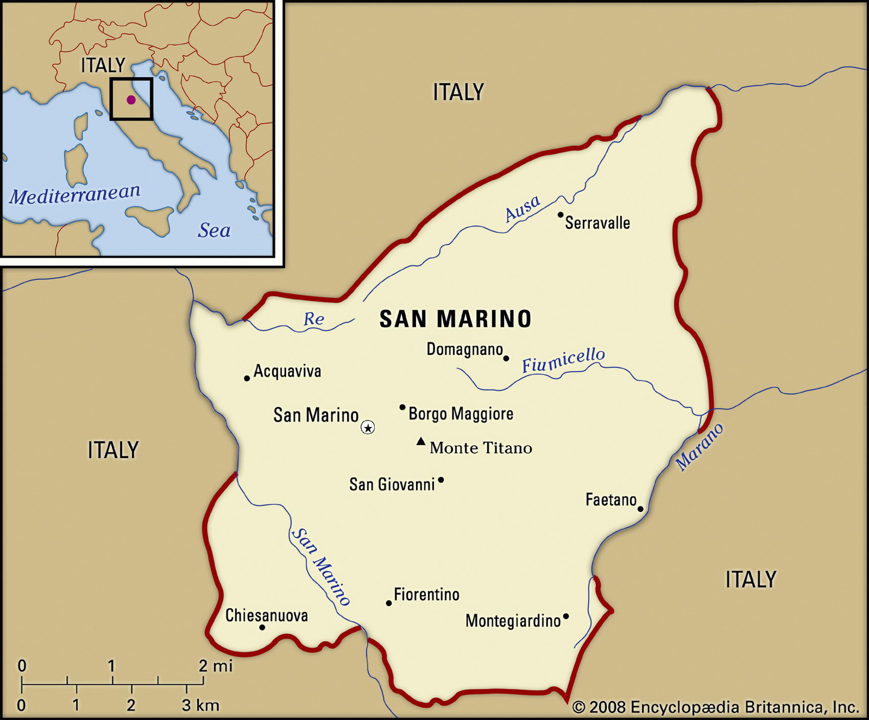
Map of San Marino and geographical facts
San Marino on the world map. Map of San Marino
Map of San Marino with cities. Where San Marino is on the world map. The main geographical facts about San Marino - population, country area, capital, official language, religions, industry and culture.

San Marino Fact File
Official name Republic of San Marino
Form of government Republic with single legislative body (Great and General Council)
Capital San Marino
Area 60 sq km (23 sq miles)
Time zone GMT + 1 hour
Population 27,700
Projected population 2015 31,000
Population density 461.7 per sq km (1,204.35 per sq mile)
Life expectancy 81.3
Infant mortality (per 1,000) 6.1
Official language Italian
Literacy rate 96 %
Religions Roman Catholic 95 %, other 5 %
Ethnic groups Sanmarinesi 87.1 %, Italian 12.4%, other 0.5%
Currency Euro
Economy Services 58%, industry 40%, agriculture 2%
GNP per capita US$ 34,600
Climate Temperate, with mild winters and warm summers
Highest point Monte Titano 739 m (2,425 ft) Map reference Page 294
Completely surrounded by Italian territory, most of the tiny state of San Marino sits on the slopes of Mount Titano in the Appenine Mountains, 20 km (12 miles) inland from the city of Rimini on the Adriatic coast of northern Italy. The republic takes its name from St Marinus who, so legend has it, arrived there with a group of followers in the fourth century ad and established a settlement. This makes it arguably the world's oldest surviving republic. Records of its existence can be traced back to the twelfth century. It became one of the many mini-states on the Italian Peninsula and was accorded papal recognition in 1631. The Sanmarinesi, as its inhabitants are known, offered refuge to Giuseppe Garibaldi when he passed through in 1849, pursued by his enemies. However, when the newly unified state of Italy was declared in 1861 the Sanmarinesi declined to join. San Marino fought with Italy in the First World War. In the Second World War it began by supporting Fascist Italy but later changed sides and was invaded by Germany. San Marino is a democratic republic with elections held every five years. Two Capitani regenti who are elected by the parliament and are in office for six months serve as heads of state. There is a single legislative body that consists of sixty members.
This picturesque little country is centered on the fortified medieval town of San Marino, where most of the population lives. On the lower slopes, beneath the rugged limestone peak, are thick forests, expanses of pasture-land and a string of ancient villages. Almost one-fifth of the land is used for agriculture. Cereals, olives, and vines are cultivated and sheep and goats are raised. Cheeses and wine are its principal agricultural products.
Since 1862 San Marino has had a friendship and cooperation treaty with Italy. It also shares its currency—since 2001 the Euro according to the Maastricht Treaty—and enjoys a standard of living roughly equivalent to that of its neighbor. About one in five Sanmarinesi workers are in the tourism industry, which caters to more than 2 million visitors each year, although many do not stay overnight but rather stay on the Adriatic Sea and take excursions into the ancient republic. Winemaking, textiles, and ceramics are significant industries. Even more important is the sale of the country's distinctive postage stamps, which are sought by collectors and account for up to ten percent of the country's revenues.