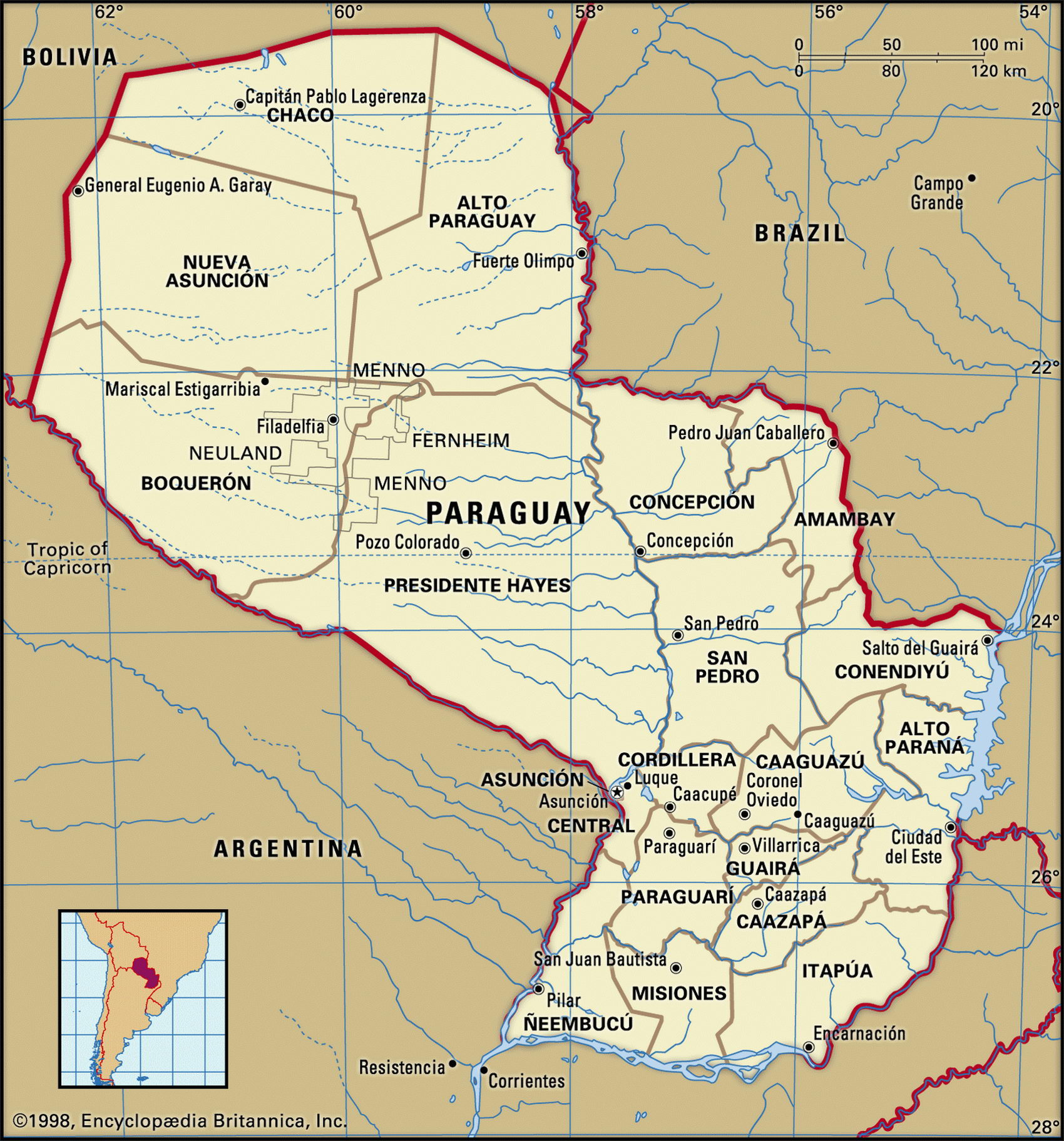
Map of Paraguay and geographical facts
Map of Paraguay with cities. Paraguay on the world map
Map of Paraguay with cities. Where Paraguay is on the world map. The main geographical facts about Paraguay - population, country area, capital, official language, religions, industry and culture.

Paraguay Fact File
Official name Republic of Paraguay
Form of government Republic with two legislative bodies (Senate and Chamber of Deputies)
Capital Asuncion
Area 406,750 sq km (157,046 sq miles)
Time zone GMT - 4 hours
Population 5,885,000
Projected population 2015 7,773,000
Population density 14.5 per sq km (37.5 per sq mile)
Life expectancy 74.2
Infant mortality (per 1,000) 28.8
Official language Spanish
Other language Guarani
Literacy rate 92.11
Religions Roman Catholic 90%; other (including Mennonite, Baptist and Anglican) 10%
Ethnic groups Mixed indigenous-European 95%; indigenous, European, Asian, and African 5%
Currency Guarani
Economy Agriculture 49%, services 30%, industry 21 %
GNP per capita US$ 4,600
Climate Subtropical; wet in east, semiarid in west
Highest point Cerro San Rafael 850 m (2,789 ft)
Map reference Pages 455, 458-59
Asmall landlocked country, Paraguay was originally the home of the Guarani Indians. It was settled by the Spaniards in 1537 who hoped to use the Guarani as laborers on their big estates. The strong influence of the Jesuits, however, largely prevented the exploitation of the indigenous people by settlers that occurred elsewhere in South America under Spanish Catholic rule, and a socially benign intermix took place. Today, 95 percent of the population are of combined Indian and Spanish descent.
Fully independent since 1813, Paraguay is best known in modern times for the severe regime imposed by General Stroessner between 1954 and 1989. Assuming power after a period of chronic upheaval—six presidents in six years and revolts that had left thousands dead—he brought economic and political stability, and greatly improved the national infrastructure. This was at the price of considerable repression, and the huge hydroelectric projects that were built on the Parana River incurred sizeable foreign debts.
Across the plains, south of Asuncion, the Parana River becomes a highway to the sea. Paraguay has some 3,100 km (1,900 miles) of navigable waterways, the most important being the Paraguay River which bisects the country north to south. To the west of Paraguay are the marshy, insect-infested plains of the Gran Chaco, but as the land rises toward the Bolivian border the Chaco changes to semidesert scrub. East of the river the land rises to a plateau forested with tropical hardwoods.
The economy of Paraguay has long been based on agriculture, and large numbers of people still live by means of subsistence farming. Cattle raising and the production of meat products remain the leading agricultural activities but cash crops such as cotton, soybeans, and timber are of increasing importance as a source of export income. Moreover, Paraguay's excess electricity capacity enables it to export power to Brazil.
The informal sector of the economy is also important. Small enterprises and street vendors flourish by importing and re-exporting consumer goods such as electronic devices, alcoholic beverages, and perfumes. While tourism is poorly developed, day-trippers pour in from Brazil and Argentina to buy these goods.