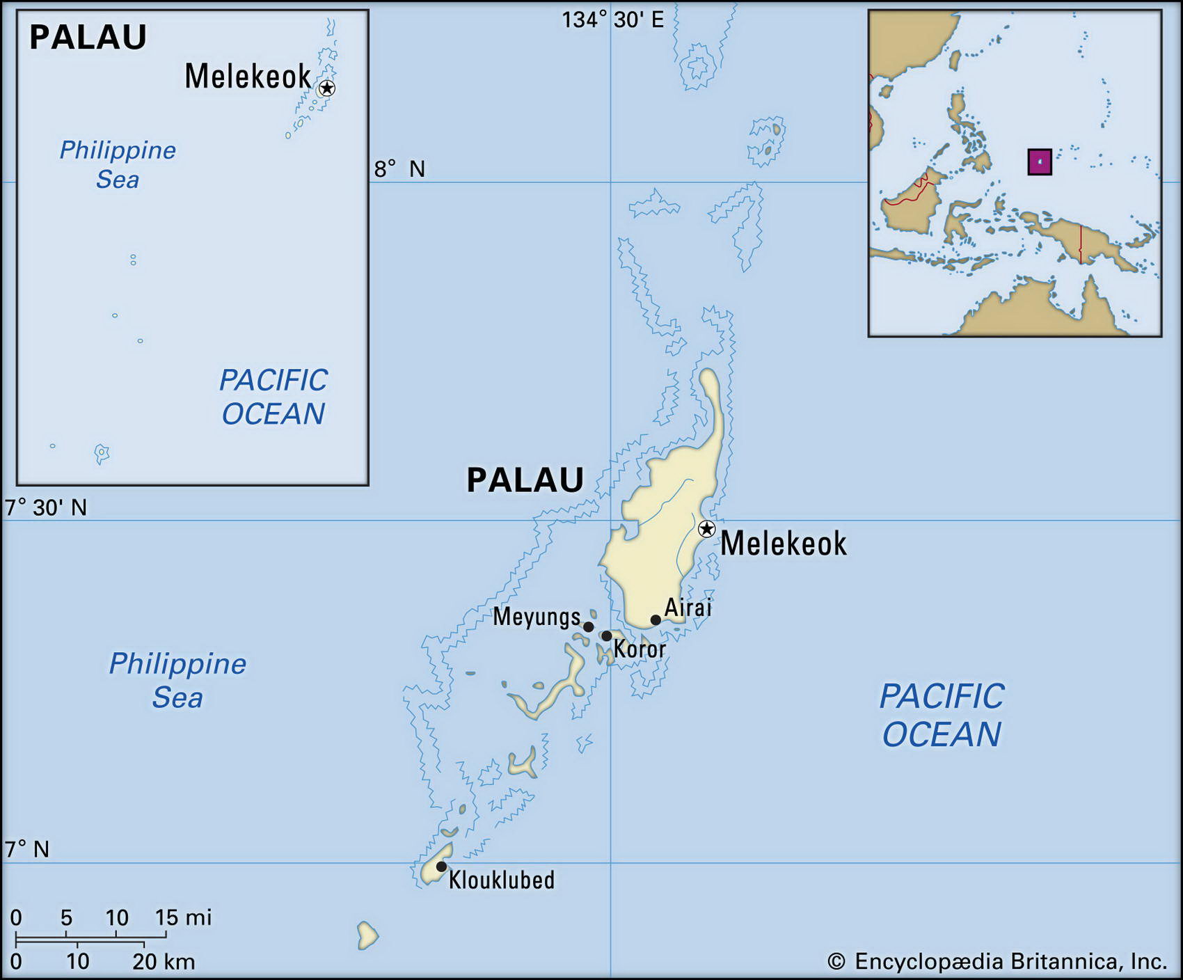
Map of Palau and geographical facts
Where Palau on the world map. Map of Palau
Map of Palau with cities. Where Palau is on the world map. The main geographical facts about Palau - population, country area, capital, official language, religions, industry and culture.

Fact File Palau
Official name Republic of Palau
Form of government Republic in free association with the USA; two legislative bodies (Senate and House of Delegates)
Capital Koror
Area 458 sq km (177 sq miles)
Time zone GMT+10 hours
Population 19,400
Projected population 2015 26,000
Population density 42.4 per sq km (109.6 per sq mile)
Life expectancy 69.2
Infant mortality (per 1,000) 16.2
Official languages Palauan, English
Other languages Sonsoral, Angaur, Japanese, Tobi
Literacy rate 92 %
Religions Roman Catholic 41 %, indigenous Modekngei religion 25 %, Protestant 25 %, other 9%
Ethnic groups Palauan (mixed Polynesian, Melanesian, Malayan) 83%, Filipino 10%, other 7 %
Currency US dollar
Economy Government, agriculture, fishing, tourism
GNP per capita US$ 9,000
Climate Tropical, with wet season May to November
Highest point Mt Ngerchelchauus 242 m (794 ft) Map reference Page 138
Palau consists of several groups of islands in the northwest Pacific, about 750 km (450 miles) east of the Philippine island of Mindanao. The westernmost of the Micronesian Caroline chain, and settled by Southeast Asian migrants from about 1000 вс, the islands have in the past 100 years been successively occupied and controlled by Spain, Germany, Japan, and the USA. After Spain's defeat in the 1898 Spanish-American War they were sold to Germany. Japan seized and held the islands from the outbreak of the First World War until the Second World War, when Japanese and US forces fought for control over them. In 1978 Palau rejected incorporation into the neighboring Federated States of Micronesia (a union of the rest of the Caroline Islands); in 1981 it adopted a constitution banning nuclear weapons and military bases in the area; and in 1982 it entered into a Compact of Free Association with the USA which contained military provisions in conflict with its constitution. After a lengthy political stalemate, in 1993 voters finally approved the Compact, which provides US$ 500 million in aid over fifteen years in exchange for the right of the USA to maintain military facilities there. In 1994 Palau became the 185th member of the UN, and in 1995 it joined the South Pacific Forum.
Palau, an archipelago of six separate groups of islands, consists of 26 islands and over 300 islets. The terrain varies from the mountainous main island of Babelthuap to low coral islands usually fringed by reefs. Natural resources consist of forests, minerals (including gold), marine products, and deep-seabed minerals. The rural people live by subsistence agriculture, growing coconuts, cassava, and sweet potatoes (though the rugged terrain of the larger islands makes farming difficult), and by fishing. Industries include tourism, craft items made from shell, wood, and pearls, and some commercial fishing. Exports include trochus shell, tuna, copra, and handicrafts. The government is the main employer, and relies heavily on aid from the USA. As a result, the population has a per capita income twice that of the Philippines.