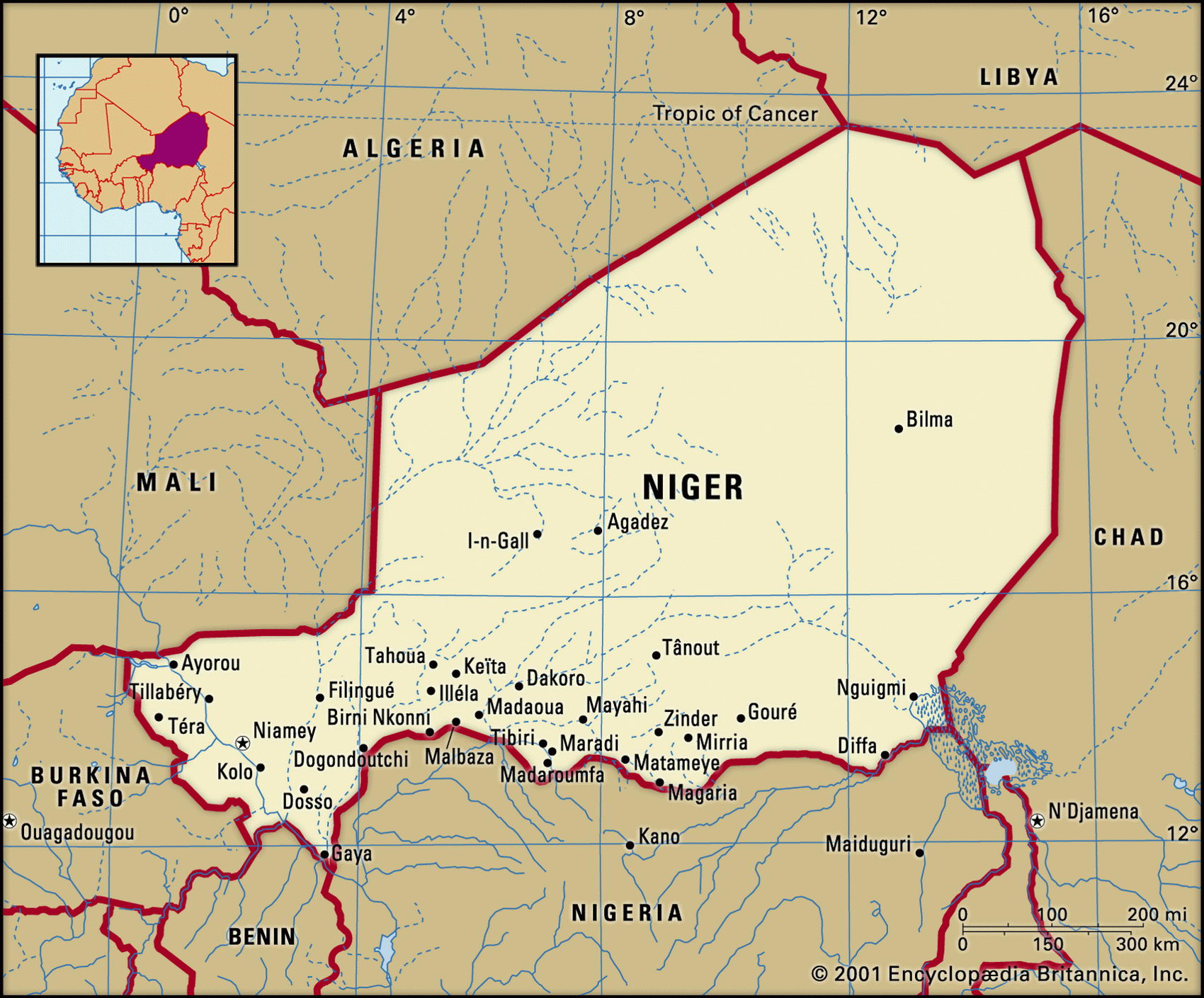
Map of Niger and geographical facts
Niger on the world map. Map of Niger
Map of Niger with cities. Where Niger is on the world map. The main geographical facts about Niger - population, country area, capital, official language, religions, industry and culture.

Niger Fact File
Official name Republic of Niger
Form of government Republic with single legislative body (National Assembly)
Capital Niamey
Area 1,267,000 sq km (489,189 sq miles)
Time zone GMT + 1 hour
Population 10,640,000
Projected population 2015 18,482,000
Population density 8.4 per sq km (21.8 per sq mile)
Life expectancy 41.2
Infant mortality (per 1,000) 122.2
Official language French
Other languages Hausa, Djerma, Fulani and others
Literacy rate 15.3%
Religions Muslim 80%, Christian and indigenous beliefs 20%
Ethnic groups Hausa 56%, Djerma 22%, Fula 8.5%, Tuareg 8%, Beri Beri 4.3%, other (including 4,000 French expatriates) 1.2%
Currency CFA (Communaute Financiere Africaine) franc
Economy Agriculture 85%, services 12%, industry 3%
GNP per capita US$ 820
Climate Mainly arid; tropical in south, with wet season June to October
Highest point Mont Bagzane 2,022 m (6,634 ft)
Map reference Pages 361, 362, 365
Niger is two-thirds desert, which may seem strange for a country that is named after a great river (the name "Niger" comes from the Tuareg word n'eghirren, for flowing water), but the River Niger only cuts across the extreme southwest of this large, landlocked country. Elsewhere, there is an arid landscape of stony basins, drifting sands, and a northern highland that forms part of the mountain chain stretching from Algeria to Chad.
The home of the Sokoto Empire of the Fulani in the nineteenth century, the region became part of French West Africa in 1922, and received independence in I960. Then followed three decades of dictatorial civilian and military rule. Despite the multi-party elections held in 1993, continuing unrest caused by Tuareg rebels in the north and power struggles within the government led to the reimposition of military rule in 1996. With elections in 1999 the country returned to democracy in the so-called Fifth Republic.
Niger's central geographic feature is the Massif de Г Air. In these mountains, which rise out of the Saharan plains to jagged peaks up to 1,900 m (6,230 ft) high, there is sometimes sufficient rain for thorny scrub to grow. Formerly nomads grazed their camels, horses, cattle, and goats in this area, but devastating droughts in 1973 and 1983 destroyed their livelihood. To the east and west of the Massif de Г Air are the Saharan Desert plains of Tenere du Tafassasset and the Western Talk. Sand and sandy soil cover most of the desert plains to the north and east, an area which is virtually rainless and, aside from small numbers of people living at the occasional palm-fringed oasis, uninhabited. Plant life includes kapok and baobab trees. Buffalo, antelope, lion, hippopotamus, and crocodiles are found in Niger but their survival today is more a matter of chance than good management.
With its gross domestic product growth barely matching the growth of its population, Niger is one of the most impoverished countries in Africa. More than 95 percent of its people earn a living from farming and trading. Where the Niger River crosses the country in the far southwest there are fertile arable soils: crops include yams, cassava, and maize, and rice in areas where the river floods. On the drier land toward Lake Chad (Lac Tchad) millet and sorghum are grown. The drought that has affected extensive areas of the Sahel has reduced Niger from self-sufficiency to being an importer of food. Tin and tungsten are mined, and there are reserves of iron ore, manganese, and molybdenum. During the 1970s, when prices were high, uranium became the main source of revenue, and it continues to be the country's most valuable export. Between 1983 and 1990, however, revenues fell by fifty percent. At present the government of Niger relies on aid for both operating expenses and for public investment.