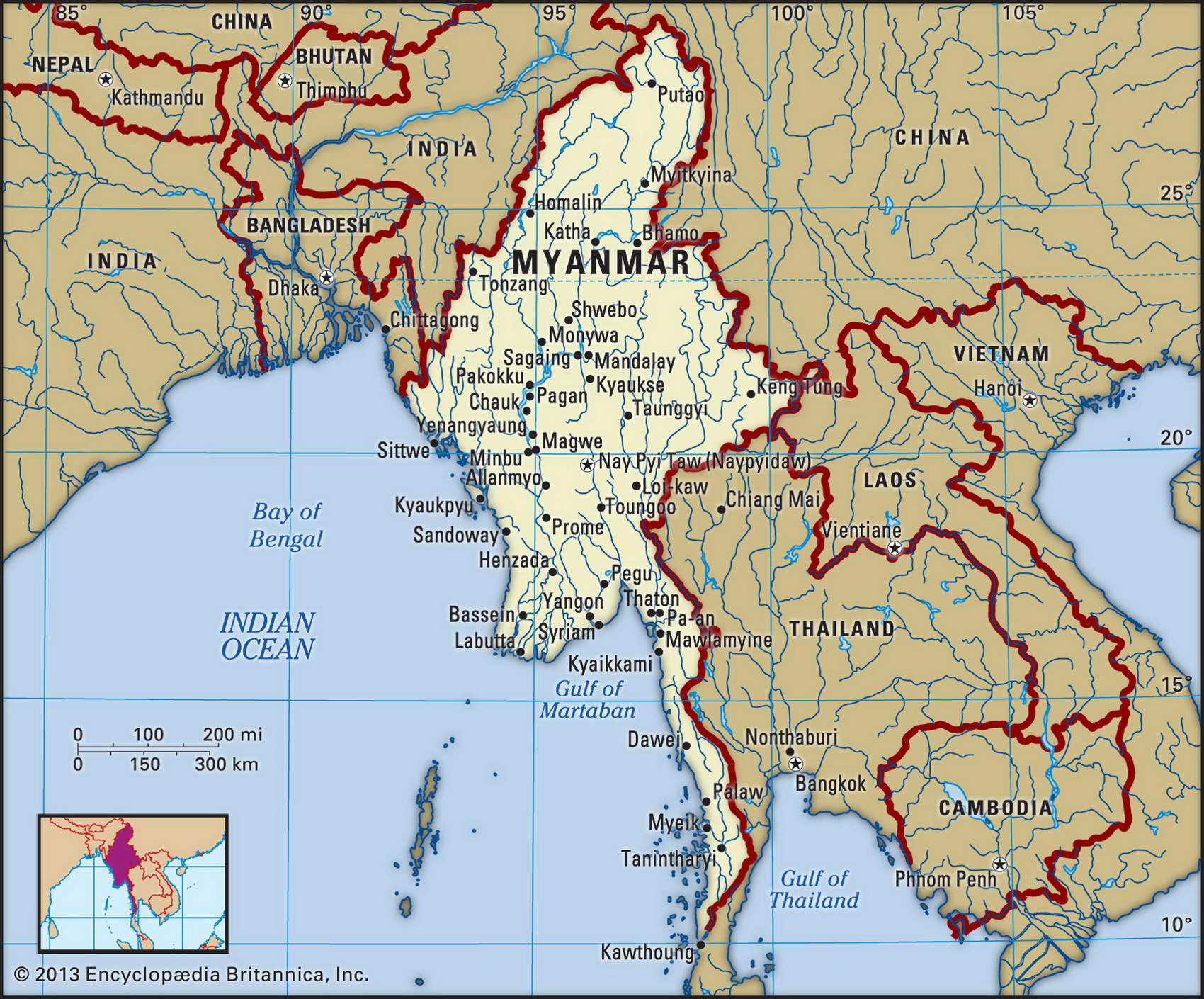
Map of Myanmar (Burma) and geographical facts
Where Myanmar on the world map. Map of Myanmar (Burma)
Map of Myanmar (Burma) with cities. Where Myanmar (Burma) is on the world map. The main geographical facts about Myanmar (Burma) - population, country area, capital, official language, religions, industry and culture.

Myanmar (Burma) Fact File
Official name Union of Myanmar (Burma)
Form of government Military regime; legislative body (People's Assembly) has never convened since military takeover in 1988
Capital Yangon (Rangoon)
Area 678,500 sq km (261,969 sq miles)
Time zone GMT + 6.5 hours
Population 42,239,000
Projected population 2015 46,322,000
Population density 62.3 per sq km (161.2 per sq mile)
Life expectancy 55.4
Infant mortality (per 1,000) 72.1
Official language Burmese
Other languages Indigenous languages (Shan, Kachin, Karen), English
Literacy rate 83.1 %
Religions Buddhist 89%, Christian 4% (Baptist 3%, Roman Catholic 1 %), Muslim 4%, other 3 %__
Ethnic groups Burman 68%, Shan 9%, Karen 7%, Rakhine 4%, Chinese 3%, Mon 2%, other 7%
Currency Kyat
Economy Agriculture 64%, services 27%, industry 9%
GNP per capita US$ 1,500
Climate Tropical monsoon; dry zone around Mandalay; moderate temperature on Shan Plateau
Highest point Hkakabo Razi 5,881 m (19,294 ft)
Map reference Pages 202, 205
Ruins of a Thai Buddhist temple (left page bottom). Landscape near Chiang Mai, in Thailand (top center). Two hill tribe women from the mountains of northern Thailand (above). Buddhist temple ruins at Pagan in Myanmar (bottom).
Better known for the name of its Nobel Prize winning opposition leader Aung San Suu Kyi than for that of its prime minister, Myanmar is struggling to overcome fifty years of ethnic strife, one-party socialist government, and military rule. With an ancient literary tradition and style of script going back to the Mon civilization (third century вс), Myanmar was at various times ruled by the eleventh century Tibeto-Burman Dynasty of Anarutha the Great, by the Mongols under Khublai Khan (1287), and by the British, who incorporated the country into its Indian Empire in 1886.
After the country gained independence from Great Britain in 1948, General Ne Win's Burmese Socialist Program Party swiftly abolished all private enterprise and private trade, nationalized industry, and placed the country under military control. Within a short time, one of the region's richest countries had become an impoverished backwater. For decades, a substantial portion of the government's energy and 35 percent of its budget has been directed towards efforts to suppress ethnic insurgent movements led by Karens, Shans, Kachins, Mons, and others. In order to fund their resistance, these groups grew opium poppies, a traditional crop, which has led to the country becoming the world's largest opium producer.
Situated on the Bay of Bengal between Bangladesh and Thailand, Myanmar consists of central lowlands, where 75 percent of the population lives, enclosed by mountains to the north, bordering China, and west, bordering India, and the Shan Plateau to the east forming a frontier with Laos. The western mountains run southwest along the Indian border and form a series of forested ridges, ending in the Arakan Yoma Range (Pegu Yoma). From the mountains in the north the Irawaddy River flows south 2,100 km (1,300 miles), passing the ancient city of Mandalay and the capital of Yangon (Rangoon) on its way to the Andaman Sea. While the coast has a wet climate, the inner region, sheltered from the seasonal monsoon, has an annual rainfall of less than 100 cm (40 in). Here, in narrow valleys, small-scale irrigation supports such crops as rice, sugarcane, cotton, and jute.
Myanmar is quite rich in natural resources, having fertile soils and good fisheries, along with teak, gems, and natural gas and oil. / Recently there has been some liberalization of the economy, most notably of small scale enterprise. Twenty-five percent, however, remains under state control, and the key industries—in energy, heavy industry, and foreign trade—consist of twenty military-run enterprises. A recent boom in trade with China has filled the north with Chinese goods and foreign visitors. Economic weaknesses include a shortage of both skilled labor, and trained managers and technicians. Price controls have led to an economy that is permeated by the black market. Published estimates of Myanmar's foreign trade are therefore greatly understated.