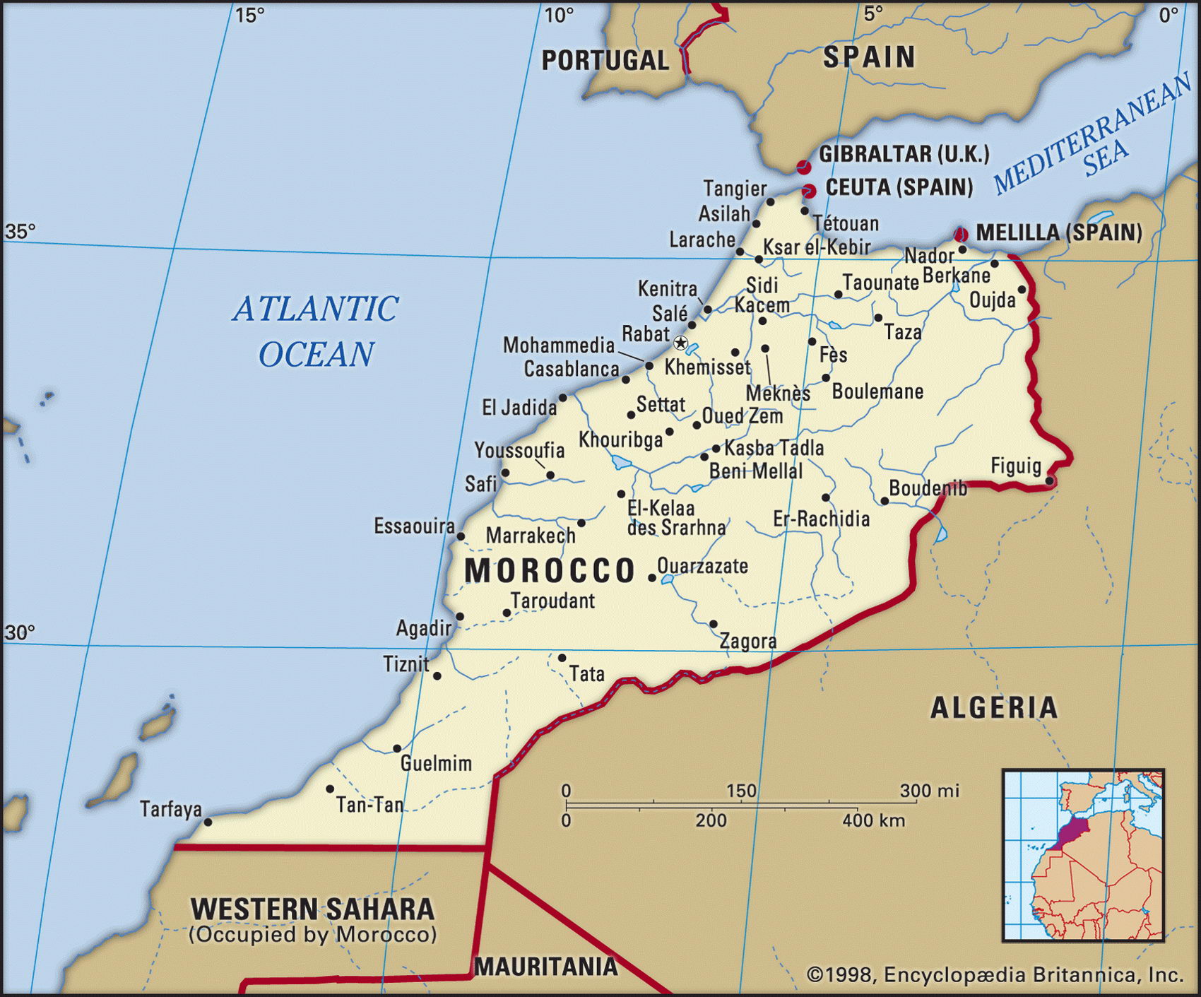
Map of Morocco and geographical facts
Morocco on the world map. Map of Morocco
Map of Morocco with cities. Where Morocco is on the world map. The main geographical facts about Morocco - population, country area, capital, official language, religions, industry and culture.

Morocco Fact File
Official name Kingdom of Morocco
Form of government Constitutional monarchy with single legislative body (Chamber of Representatives)
Capital Rabat
Area 446,550 sq km (1 72,41 3 sq miles)
Time zone GMT
Population 31,168,000
Projected population 2015 37,680,000
Population density 69.8 per sq km (180.8 per sq mile)
Life expectancy 69.7
Infant mortality (per 1,000) 46.5
Official language Arabic
Other languages Berber languages, French, Spanish
Literacy rate 43.7%
Religions Muslim 98.7%, Christian 1.1 %, Jewish 0.2%
Ethnic groups Arab-Berber 99.1 %, Jewish 0.2 %, other 0.7%
Currency Moroccan dirham
Economy Agriculture 46%, services 29%, industry 25 %
GNP per capita US$ 3,700
Climate Temperate along northern coast, arid in south, cooler in mountains
Highest point jebel Toubkal 4,165 m (13,665 ft)
Map reference Pages 360-61
Morocco's earliest inhabitants were the Berbers, who still live in the country today. At one time under Carthaginian rule, and then a part of the Roman Empire, the Berbers were overrun by Arabs in the seventh century ad and converted to Islam. The country's name derives from the Arabic Maghrib al-aqsa ("the farthest west"), and because of the protective barrier of the Atlas Mountains, Morocco has always been less a part of the Arab world than the other North African states. Under political pressure from Spain and France during the nineteenth century, Morocco became a French protectorate in 1912. About 35 percent of the people live in the highlands and are Berber-speaking, while the Arab majority live in the lowlands.
Under the rule of King Hassan II (1961-99) and since of his son Mohammed VI, Morocco has followed generally pro-Western policies. Hassan's popularity at home owed a good deal to Morocco's disputed territorial claim to the phosphate-rich resources of Western Sahara across the southern border. A costly armed struggle with the Polisario Front guerrilla movement of Western Sahara led to a ceasefire in 1992, by which time 170,000 of the native-born Sahrawis of the region had become refugees in Algeria. Sovereignty is still unresolved and a UN-organized referendum on its final status has been repeatedly postponed .
More than one-third of Morocco is mountainous. Three parallel ranges of the Atlas Mountains run southwest to northeast, where a plateau stretches toward the Algerian border. Most of the people living in the mountains are peasant cultivators and nomadic herders. Modern economic development is found mainly on the Atlantic plains and the plateaus—the fertile Moulouyan, Rharb, Sous, and High (Haut) Atlas plains constituting virtually all of Morocco's cultivable land. In the Rharb and Rif regions extensive areas are covered with cork oak, while on the northern slopes there are forests of evergreen oak and cedar. Wildlife includes Cuvier's gazelle, the Barbary macaque, and the mouflon (a wild sheep), while desert animals such as the fennec fox live in the south.
In 1995 Morocco suffered its worst drought in 30 years. This seriously affected agriculture, which produces about one-third of Morocco's exports and employs about half the workforce. Irrigation is essential over most of the country, the chief crops being barley and wheat along with citrus fruit, potatoes, and other vegetables. Dates are grown in desert oases. Along the Atlantic coast fishing plays a major role. The country's natural resources are still largely undeveloped. It has coal, iron ore, and zinc, along with the world's largest reserves of phosphates. Debt servicing, unemployment, the high rate of population increase, as well as the unresolved territorial claim to Western Sahara are all long-term problems.