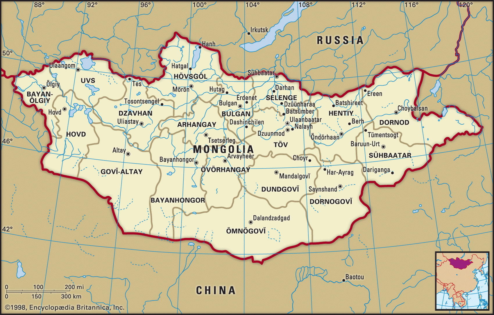
Map of Mongolia and geographical facts
Mongolia on the world map. Map of Mongolia
Map of Mongolia with cities. Where Mongolia is on the world map. The main geographical facts about Mongolia - population, country area, capital, official language, religions, industry and culture.

Mongolia Fact File
Official name Mongolia
Form of government Republic with single legislative body (State Great Hural)
Capital Ulaanbaatar
Area 1,565,000 sq km (604,247 sq miles)
Time zone GMT + 8 hours
Population 2,695,000
Projected population 2015 3,085,000
Population density 1.7 per sq km (4.5 per sq mile)
Life expectancy 64.6
Infant mortality (per 1,000) 52
Official language Khalka Mongol
Other languages Turkic, Russian, Chinese, Kazakh
Literacy rate 97.8%
Religions Tibetan Buddhist 90%, Shamanist, with small Muslim minority
Ethnic groups Mongol 90%, Kazakh 4%, Chinese 2%, Russian 2%, other 2%
Currency Tugrik
Economy Mainly agriculture with some industry
GNP per capita US$ 1,770
Climate Cold and arid
Highest point Tavan Bogd Uul 4,374 m (14,350 ft)
Map reference Pages 300-01
The world's largest and most thinly populated landlocked country, Mongolia has a reputation for isolation. Its deserts, severe climate, and widely scattered population of nomadic pastoralists have tended to keep it isolated from modern life. Historically, however, Mongolia enjoyed its hour of glory. In the thirteenth century the Mongol tribes were united under the leadership of Ghengis Khan (1162-1227), who then established the largest empire yet known, at its peak extending from eastern Europe to the Pacific Ocean and into northern India. The Mongol Empire collapsed in 1368, after which Mongolia (also known as
Outer Mongolia to distinguish it from Inner Mongolia, one of China's Autonomous Regions) fell under Chinese control. Following the Russian Civil War (1918-22) the Chinese were expelled. Today, after seventy years within the Soviet system, the country is trying to remake itself in a more democratic mold.
Mongolia can be divided into two regions. In the northwest lie the Mongolian Altai Mountains (Mongol Altayn Nuruu), along with the Hangayn (Hangayn Nuruu) and Hentiyn Ranges (Gov! Altayn Nuruu). Here, high mountains alternate with river valleys and lakes. Pastures support large herds of cattle and sheep, and wheat is cultivated. At the highest levels of the Altai in the northwest boreal forests cover the slopes. The second region is the southern half of the country. This is semidesert steppe changing further south to salt-pans, shallow depressions, and the arid stony wastes of the Gobi Desert.
While today more people live in towns than in the country, Mongolia nontheless remains a land of nomadic pastoralists. Herds of goats, sheep, yaks, camels, and horses still provide the base of the traditional economy, and Mongolia has the highest number of livestock per capita in the world. Cattle raising accounts for more than two-thirds of all production. Under the Soviets textiles and food processing were developed, and with aid from the USSR and Comecon (Council for Mutual Economic Assistance) mineral deposits such as copper, molybdenum, and coking coal were developed. Mongolia is the world's third biggest producer of fluorspar.
Recently, new laws have been passed regulating mining, banking, foreign investment, tourism, and economic planning. Mongolia continues to attract foreign aid, but suffers from the loss of Russian financial support. So far, foreign funds have not been found for the development of Mongolia's considerable oil and gas reserves.