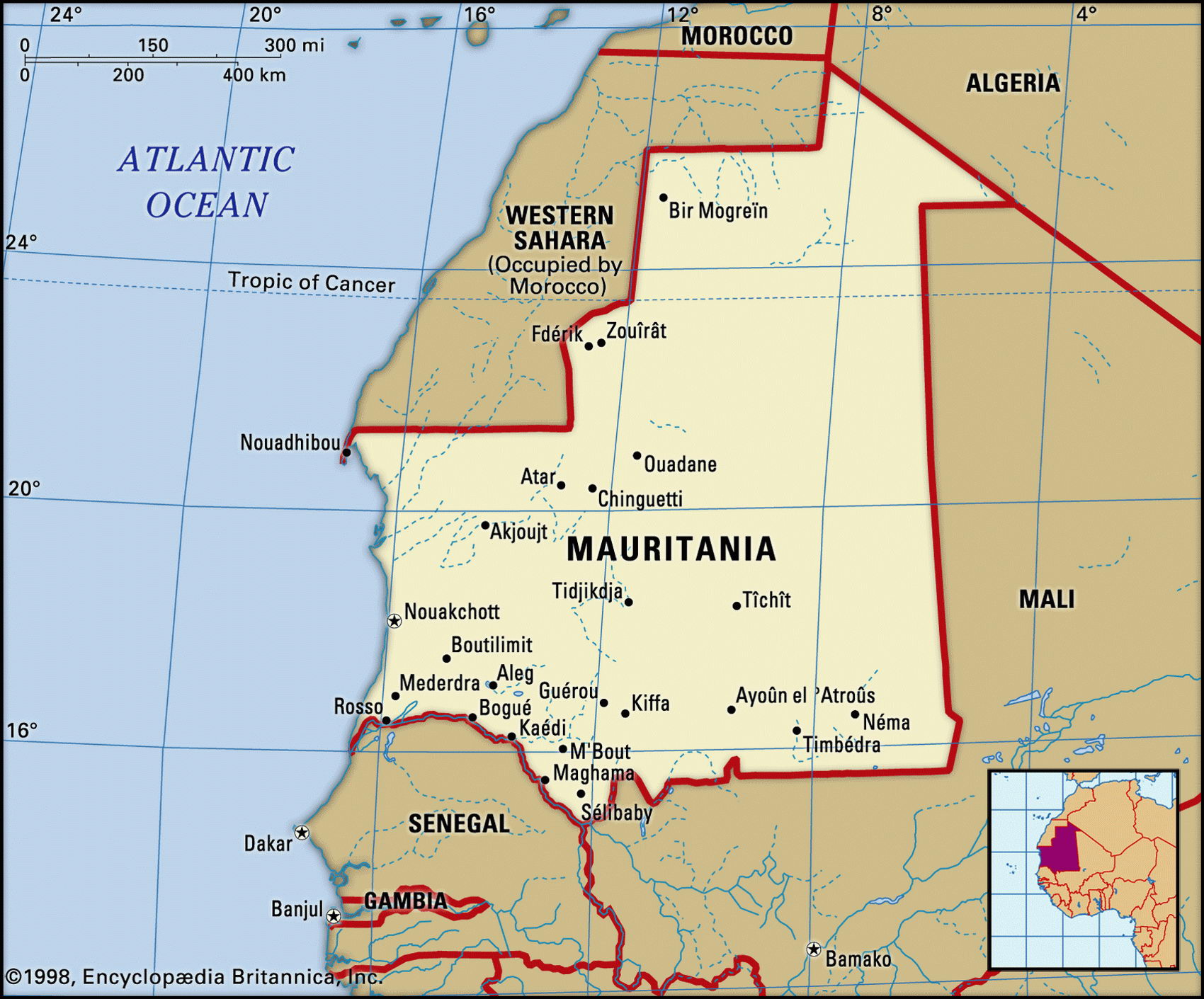
Map of Mauritania and geographical facts
Mauritania on the world map. Map of Mauritania
Map of Mauritania with cities. Where Mauritania is on the world map. The main geographical facts about Mauritania - population, country area, capital, official language, religions, industry and culture.

Mauritania Fact File
Official name Islamic Republic of Mauritania
Form of government Republic with two legislative bodies (Senate and National Assembly)
Capital Nouakchott
Area 1,030,700 sq km (397,953 sq miles)
Time zone GMT
Population 2,829,000
Projected population 2015 4,105,000
Population density 2.7 per sq km (7.1 per sq mile)
Life expectancy 51.5
Infant mortality (per 1,000) 73.5
Official languages French, Hasaniya Arabic
Literacy rate 41%
Religions Muslim 99%, other 1
Other languages Indigenous languages, Arabic
Ethnic groups Arab-Berber Moor 81 %, Wolof 7%, Toucouleur 5%, Soninke 3%, other (including Fulbe, Bambara, Sarakole) 4%
Currency Ouguiya
Economy Agriculture 69%, services 22%, industry 9%
GNP per capita US$ 1,800
Climate Mainly arid, with wet season in far south (May to September)
Highest point Kediet Ijill 910 m (2,987 ft) Map reference Pages 360, 364
Most of Mauritania consists of the wastes of the western Sahara Desert. Islam in the region dates from the Almoravid Empire of the twelfth century. Later, it was conquered by Arab bidan or "white" Moors (Maure in French, meaning Moor), nomads who subjugated and enslaved the black Africans of the south, producing a people of mixed Arab and African descent known as harratin or "black" Moors. Deep social tensions between the dominant "white" Moors, the "black" Moors, and the subordinate thirty percent of black African farmers in the south lie at the heart of Mauritanian politics. Slavery in Mauritania was not officially abolished until 1970, and it is estimated that tens of thousands of harratin still live as slaves. France entered the region early in the nineteenth century and established a protectorate in 1903. Independence finally came in I960.
Inland from the low-lying coastal plains of the Atlantic seaboard there are low plateaus—a tableland broken by occasional hills and scarps. The Sahara Desert to the north, which forms 47 percent of Mauritania's total land area, rises to the isolated peak of Kediet Ijill. In the southern third of the country there is just enough rain to support Sahelian thorn-bush and grasses. After rain, cattle herders drive their herds from the Senegal River through these grasslands and in good years the livestock outnumber the general population five to one. During the 1980s the whole area suffered severely from drought and the nomadic population, which had numbered three-quarters of the national population, fell to less than one-third, many nomads abandoning rural life entirely for the towns.
Farmers near the Senegal River grow millet, sorghum, beans, peanuts, and rice, using the late-summer river floods for irrigation. A hydroelectric project on the river is intended to provide water for the irrigated cultivation of rice, cotton, and sugarcane, but drought has also driven many subsistence farmers from the land. Off the coast, cooled by the Canaries current, lie some of the richest fishing grounds in the world. Although about 100,000 tonnes of fish are landed annually, the potential catch is estimated at about 600,000 tonnes. Exploitation by foreign fishing boats threatens this source of revenue.