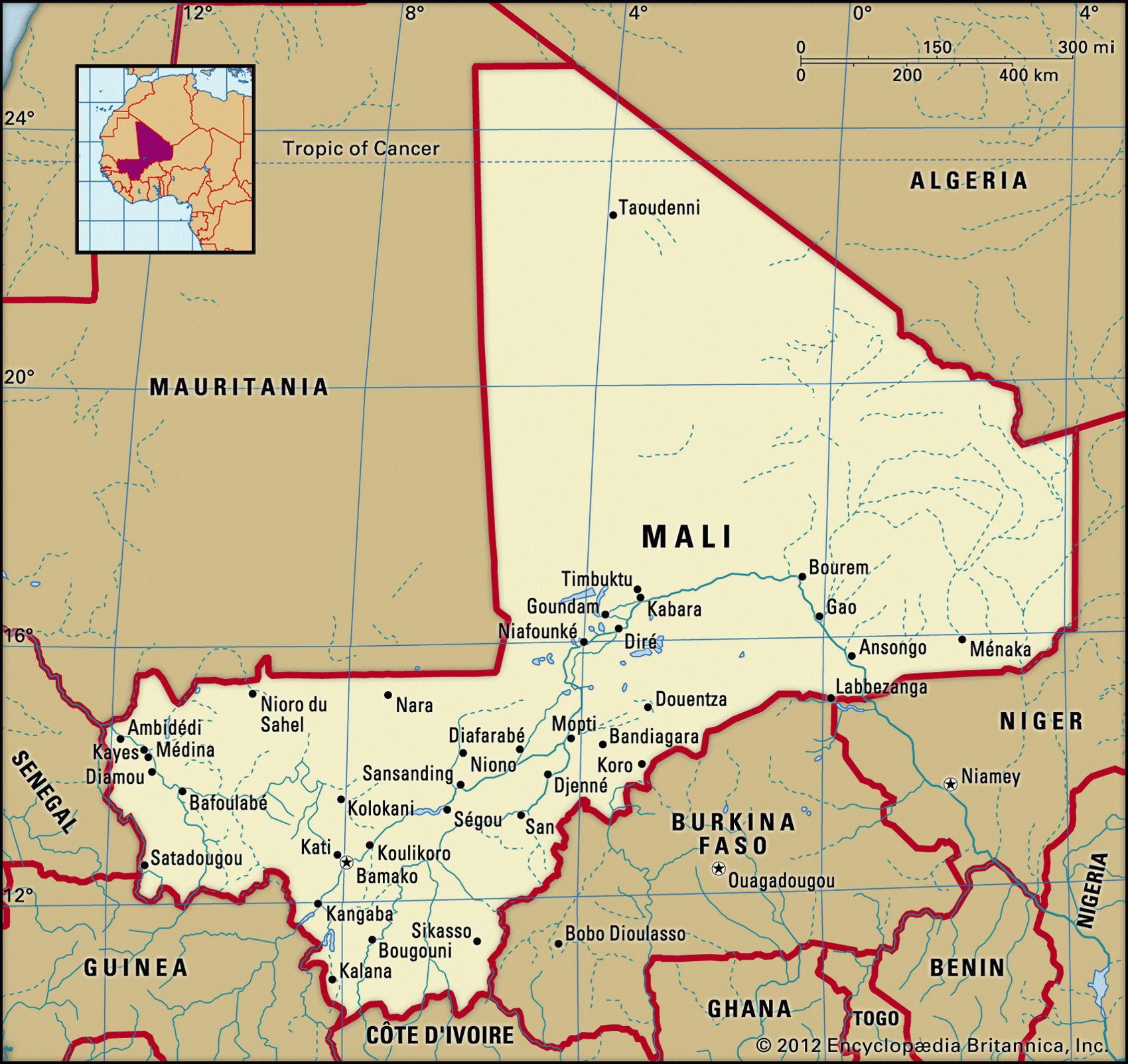
Map of Mali and geographical facts
Mali on the world map. Map of Mali with cities
Map of Mali with cities. Where Mali is on the world map. The main geographical facts about Mali - population, country area, capital, official language, religions, industry and culture.

Mali Fact File
Official name Republic of Mali
Form of government Republic with single legislative body (National Assembly)
Capital Bamako
Area 1,240,000 sq km (478,764 sq miles)
Time zone GMT
Population 10,341,000
Projected population 2015 17,657,000
Population density 8.3 per sq km (21.6 per sq mile)
Life expectancy 47.4
Infant mortality (per 1,000) 119.6
Official language French
Other languages Bambara and other indigenous languages
Literacy rate 38 %
Religions Muslim 90%, indigenous beliefs 9%, Christian 1 %
Ethnic groups Mande 50 %, Peul 17 %, Voltaic 12 %, Songhai 6%, Tuareg and Moor 10%, other 5%
Currency CFA (Communaute Financiere Africaine) franc
Economy Agriculture 85%, services 13%, industry 2%
GNP per capita US$ 840
Climate Subtropical in south and southwest; arid in north
Highest point Hombori Tondo 1,155 m (3,789 ft) Map reference Pages 361, 364-65
ali is a landlocked west African country, watered by the River Niger in the south and with vast stretches of the Sahara Desert lying to the north. It derives its name from the Malinke or Mandingo people whose empire flourished between the eighth and fourteenth centuries. Later it was a center of trade and Islamic scholarship, based on the city of Timbuktu (now Tombouctou). At the end of the nineteenth century it became a colony of French West Africa, achieving independence in I960. For the next thirty years the country was ruled by either civilian or military dictators. Demonstrations in 1991 in which about 100 people died were followed by the overthrow of the regime, and free elections were held for the first time in 1992.
There is a major ethnic division between the black African majority in the south and the minority of Arab Tuareg nomads in the north. Violent Tuareg guerrilla activity in northern Mali ended with a peace pact in 1995.
Mali's flat landscape consists mainly of plains and sandstone plateaus. The need for water is the main concern. The northern and virtually rainless Saharan plains are inhabited almost entirely by Tuareg nomads. The semiarid center—the Sahel— has in recent years suffered from devastating droughts. Such arable land as exists is found in the south, along the Senegal and Niger Rivers, the latter spreading out to form an inland delta before turning southward on its way to the border of Niger. These rivers provide water for stock and for irrigation. Rice is grown on irrigated land; millet, cotton, and peanuts grow elsewhere. Away from the rivers southern Mali is mostly savanna country where mahogany, kapok, and baobab trees grow, these being replaced further north by palms and scrub. Animal life includes lion, antelope, jackal, and hyena.
Some eighty percent of the labor force works in agriculture and fishing—dried fish is exported to Burkina Faso, Cote d'lvoire, and Ghana. With 65 percent of its land either desert or semidesert, however, and industry limited mainly to a single gold mine, salt production, and small-scale textiles and shoes, Mali is extremely poor. As well as gold there are phosphates, uranium, bauxite, manganese, and copper but development is hampered by poor transport facilities and the fact that the country is landlocked. With expenditures almost double its revenues, Mali is a major recipient of foreign aid.