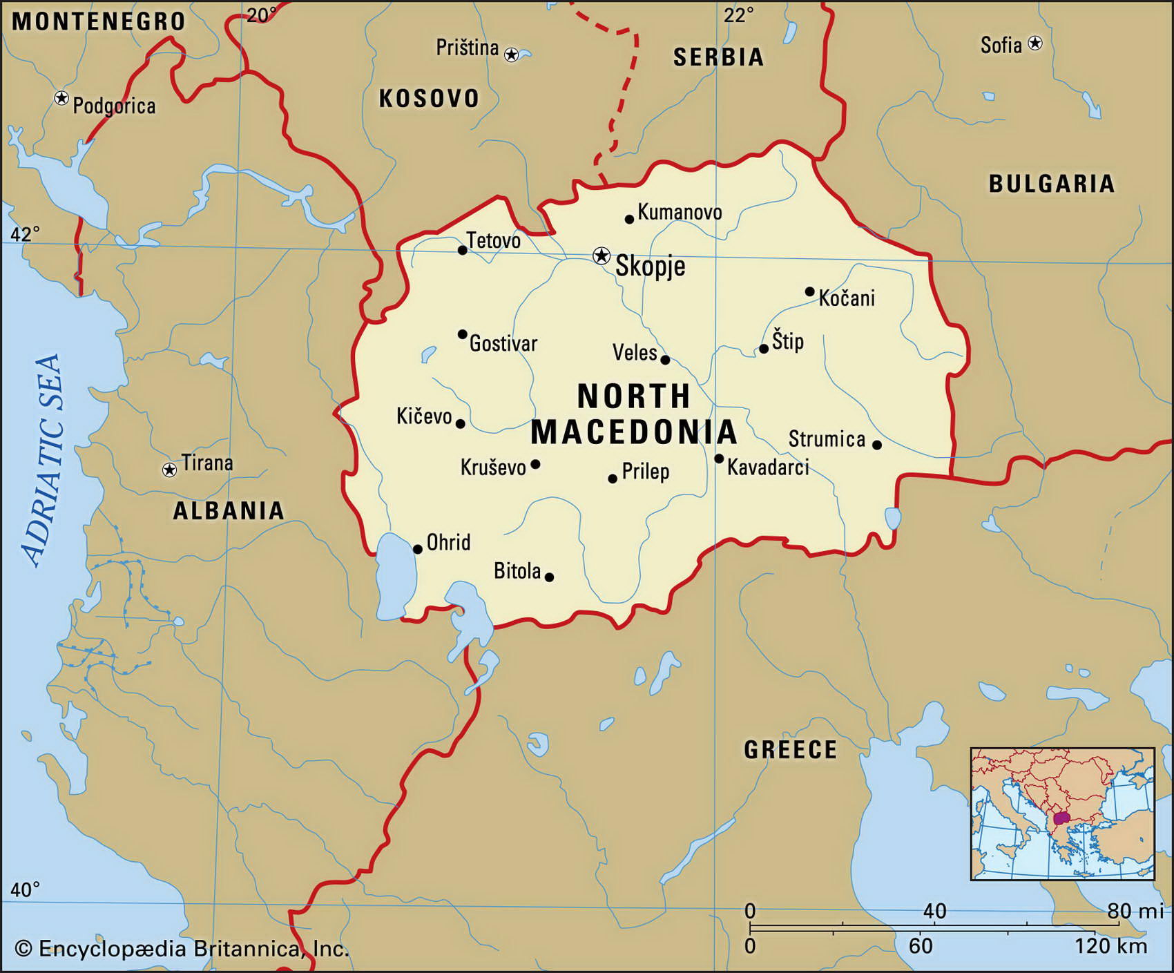
Map of Macedonia and geographical facts
Macedonia on the world map. Map of Macedonia
Map of Macedonia with cities. Where Macedonia is on the world map. The main geographical facts about Macedonia - population, country area, capital, official language, religions, industry and culture.

Macedonia Fact File
GNP per capita US$ 5,000
Official name Former Yugoslav Republic of Macedonia
Form of government Republic with single legislative body (Assembly)
Capital Skopje
Area 25,333 sq km (9,781 sq miles)
Time zone GMT+1 hour
Population 2,055,000
Projected population 2015 2,075,000
Population density 81.1 per sq km (210.1 per sq mile)
Life expectancy 74.3
Infant mortality (per 1,000) 12.5
Official language Macedonian
Other languages Albanian, Turkish, Serbian, Croatian
Literacy rate 94 %
Religions Eastern Orthodox 67%, Muslim 30%, other 3 %
Ethnic groups Macedonian 65%, Albanian 22%, Turkish 4 %, Serb 2 %, Gypsy 3 %, other 4 %
Currency Denar
Economy Services 58%, industry 38%, agriculture 14%
The town of Ohrid on the shore of Lake Ohrid in southwestern Macedonia (below). An old stone bridge spans a river in Montenegro, Serbia and Montenegro (right page top).
Climate Temperate, with cold winters and hot summers
Highest point Mt Korab 2,753 m (9,032 ft) Map reference Pages 296-97, 298
This small, landlocked Balkan country in southeastern Europe is bordered by Serbia and Montenegro to the north, Bulgaria to the east, Greece to the south, and Albania to the west. During the third century вс Macedonia was the heart of the Greek Empire. It later became a Roman province, but from the fourth century ad it was invaded numerous times. In the fourteenth century it came under Ottoman control. As the Ottoman Empire declined in the nineteenth century, Bulgaria, Greece, and Serbia contended for control of Macedonia and by the First World War it had been divided between them. Present-day Macedonia is essentially the region that was in Serbian hands at the end of the First World War. Macedonia was then incorporated into the Kingdom of Serbs, Croats, and Slovenes, which in 1929 became the Republic of Yugoslavia. In 1946 it became an autonomous republic within Yugoslavia. In 1991 Macedonia withdrew from Yugoslavia and it is now a multi-party democracy, governed by a legislative body with 120 elected members and a directly elected president. Tensions with neighbors remain high. Macedonia is also the name of a Greek province. This is why the official name of the country is "Former Yugoslav Republic of Macedonia".
Macedonia is largely isolated from its neighbors by mountains. Mountain ranges separate it from Greece in the south and the Korab Mountains in the west lie along the Albanian and Serbian borders. Much of the country is a plateau more than 2,000 m (6,500 ft) above sea level. The River Vadar rises in the northwest. It flows north, almost to the Yugoslavian border, then continues on a southeasterly course through the center of the country and into Greece.
One-quarter of the land is used for agriculture. Crops include cereals, fruits, vegetables, and cotton, and sheep and cattle are raised extensively. The country is self-sufficient in food and, thanks to its coal resources, in energy. Manufacturing industries have suffered since independence, partly because of trade embargoes imposed by Greece. Macedonia is the least developed of the former Yugoslav republics and is suffering a declining standard of living.