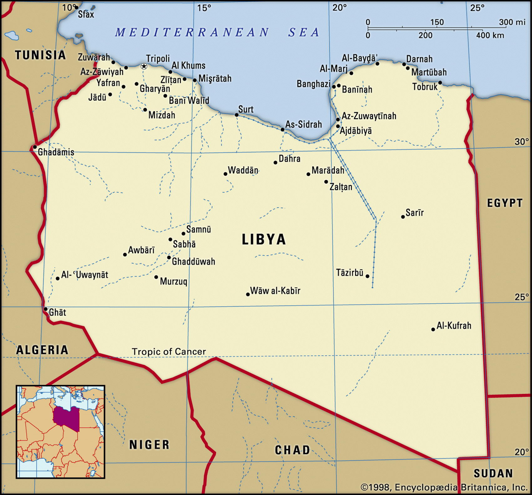
Map of Lybia and geographical facts
Lybia on the world map. Map of Lybia
Map of Lybia with cities. Where Lybia is on the world map. The main geographical facts about Lybia - population, country area, capital, official language, religions, industry and culture.

Libya Fact File
Official name Socialist People's Libyan Arab Jamahiriya
Form of government Republic with single legislative body (General People's Congress)
Capital Tarabulus (Tripoli)
Area 1,759,540 sq km (679,358 sq miles)
Time zone GMT + 2 hours
Population 5,369,000
Projected population 2015 7,058,000
Population density 3.1 per sq km (7.9 per sq mile)
Life expectancy 75.9
Infant mortality (per 1,000) 27.9
Official language Arabic
Other languages Berber languages, Italian, English
Literacy rate 76.2 %
Religions Sunni Muslim 97%, other 3%
Ethnic groups Berber and Arab 97%; other (including Greek, Maltese, Italian, Egyptian, Pakistani, Turkish, Indian, Tunisian) 3%
Currency Libyan dinar
Economy Services 51 %, industry 31 %, agriculture 18%
GNP per capita US$ 7,600
Climate Mainly arid; temperate along coast
Highest point Bikubiti 2,285 m (7,497 ft)
Map reference Page 362
First settled by the Greeks, and once part of the empire of Alexander the Great, Libya was ruled by the Romans for 500 years. Later, in ad 642, the region was conquered by the Arabs, and later still became part of the Ottoman Empire. It was occupied by Italy in 1911, and the years 1938
to 1939 saw Mussolini bring in 30,000 Italians to farm the Jefra Plain. Libya became independent in 1951. Since 1969, when he seized power, it has been a one-party socialist state ruled dictatorially by Colonel Muammar al Gaddafi. In 1992-99 the country suffered UN sanctions due to his support of terrorist cells.
The arid Saharan Plateau takes up a vast 93 percent of Libya's land area. The great expanse of the Sahara gives way to a fertile coastal strip along the Mediterranean coast, where the majority of the population lives, though only one percent of the total land area is arable. Tripoli stands on the Jefra Plain, Libya's most productive farming area. Cereals, particularly barley, are the most important crop. Sorghum is grown in the Fezzan to the south; wheat, tobacco, and olives are produced in the north; and dates and figs are cultivated at a few scattered oases in the desert. Predominantly low-lying, the desert terrain rises southward to Bikubiti in the Tibesti Range on the border with Chad. The country is without lakes or perennial rivers, and artesian wells supply nearly two-thirds of its water.
Oil provides almost all export earnings and about one-third of the gross domestic product. Though Libya's per capita gross domestic product is usually Africa's highest, the people suffer from periodic shortages of basic goods and foodstuffs caused by import restrictions. The largely state-controlled industrial sector (almost all the oil companies were nationalized in 1973) suffers from overstaffing and other constraints. However, oil revenues have enabled important state initiatives to be undertaken: the Great Manmade River Project being built to bring water from large aquifers under the Sahara to the coastal cities is one of the world's largest water development projects.