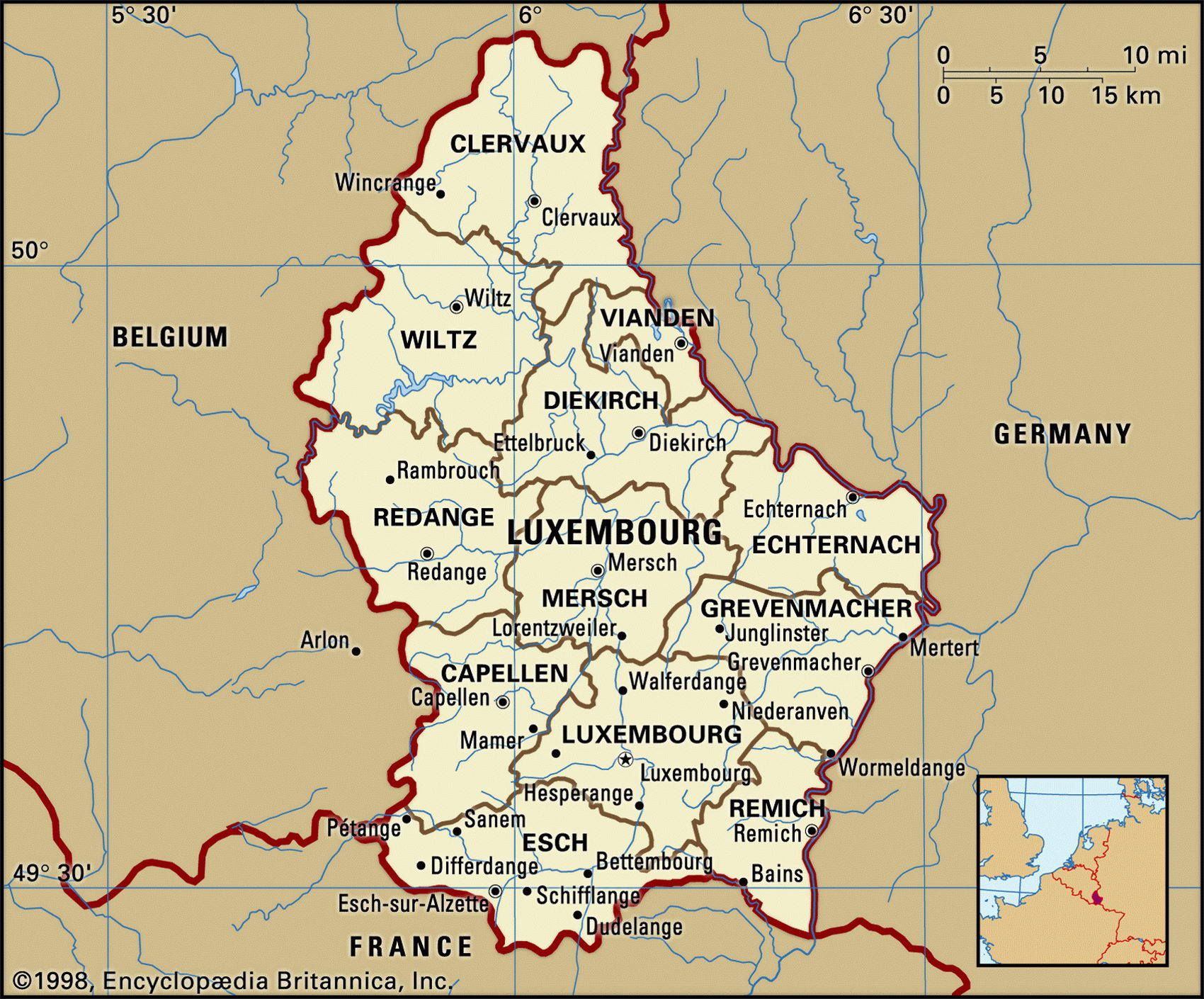
Luxembourg geographical facts. Map of Luxembourg with cities
Luxembourg on Europe map. Geographical facts about Luxembourg
Map of Luxembourg with cities and administrative borders. Where Luxembourg is on the map of Europe.

Luxembourg Fact File
Official name Grand Duchy of Luxembourg
Form of government Constitutional monarchy with single legislative body (Chamber of Deputies)
Capital Luxembourg
Area 2,586 sq km (998 sq miles)
Time zone GMT + 1 hour
Population 449,000
Projected population 2015 518,000
Population density 173.6 per sq km (449.9 per sq mile)
Life expectancy 77.5
Infant mortality (per 1,000) 4.7
Official language Luxembourgish
Other languages French, German
Literacy rate 100 %
Religions Roman Catholic 97%, Protestant and Jewish 3%
Ethnic groups Luxembourger 70%, other 30% (mainly French, Portuguese, Belgian, German, Italian, Duch, Spanish and others)
Currency Euro
Economy Services 77%, industry 19%, agriculture 4%
GNP per capita US$ 44,000
Climate Temperate, with cool winters and mild summers
Highest point Burgplatz 559 m (1,834 ft) Map reference Page 291
The Grand Duchy of Luxembourg is one of the smallest countries in Europe. Situated in northern Europe, it shares borders with Belgium to the west and France to the south. Three connecting rivers—the Our, Sure, and the Moselle—separate it from Germany to the east. Part of the Holy Roman Empire from the tenth century ad, Luxembourg became an independent duchy in 1354, one of hundreds of such states in medieval Europe. It is the only one to survive today as an independent nation. Throughout the intervening centuries, Luxembourg has come under Austrian, Spanish, French, and Dutch rule. In 1830 part of the duchy was taken over by Belgium when that country split from the Netherlands. Luxembourg separated from the Netherlands in 1890. Germany occupied Luxembourg during both world wars and annexed it in 1942. After the Second World War it became a founding member of NATO and in 1957 joined the European Economic Community. It has been a keen advocate of European cooperation and was the first country, in 1991, to ratify the Maastricht Treaty. Luxembourg is a constitutional monarchy, with the Grand Duke as head of state, and a prime minister as head of an elected 21-member Council of State. The country's official language, Luxembourgish, is a dialect of the German language and strongly influenced by French. In schools, both German and French are taught, the latter being the main language in the higher grades.
The northern part of Luxembourg is called the Oesling. Covering about one-third of the country's total area, it is part of the densely forested Ardennes mountain range. Numerous river valleys dissect this northern region and deer and wild boar abound. It is a rugged, picturesque area but has poor soils. In contrast, the southern two-thirds, known as the Gutland or Bon Pays (meaning good land), consists of plains and undulating hills covered with rich soils and extensive pastureland. The Gutland area is still strongly agricultural. Wheat, barley, potatoes, and grapes are the principal crops and more than 5 million cattle and 6 million pigs are raised.
Iron ore deposits in the south of the country contributed to the development of a thriving iron and steel industry. These deposits are now less abundant and industries such as food processing, chemical manufacturing and tire making now rival steel in importance. A growing service sector, especially in banking, has become increasingly central to the country's prosperity.
The people of Luxembourg are among the most affluent in Europe. Unemployment is low and salaries, especially among urban workers, are high.