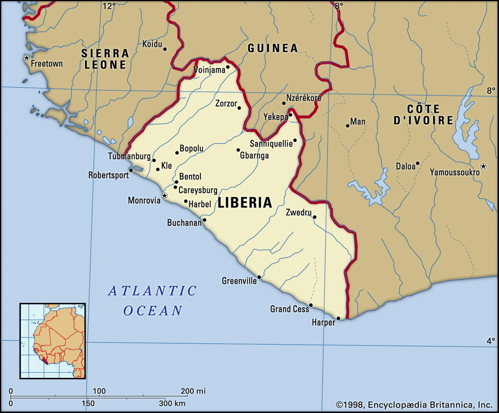
Map of Liberia and geographical facts
Liberia is on the world map. Map of Liberia
Map of Liberia with cities. Where Liberia is on the world map. The main geographical facts about Liberia - population, country area, capital, official language, religions, industry and culture.

Liberia Fact File
Official name Republic of Liberia
Form of government Republic with single transitional legislative body (Transitional Legislative Assembly)
Capital Monrovia
Area 1 11,370 sq km (43,000 sq miles)
Time zone GMT
Population 3,289,000
Projected population 2015 5,550,000
Population density 29.5 per sq km (76.5 per sq mile)
Life expectancy 51.8
Infant mortality (per 1,000) 130.2
Official language English
Other languages Indigenous languages
Literacy rate 38.3 c
Religions Indigenous beliefs 70%, Muslim 20%, Christian 10%
Ethnic groups Indigenous tribes 95% (including Kpelle, Bassa, Gio, Kru, Grebo, Mano, Krahn, Gola, Gbandi, Loma, Kissi, Vai, Bella), Americo-Liberian (descendants of repatriated slaves) 5 %
Currency Liberian dollar
Economy Agriculture 70%, services 25%, industry 5% GNP per capita US$ 1,100
Climate Tropical, with wet season May to September Highest point Mt Wuteve 1,380 m (4,528 ft)
Map reference Page 364
Settled by freed slaves after 1822, and a republic since 1847, the west African state of Liberia has always been a socially divided country. The coastal settlements of ex-slaves from the United States formed an elite with a Christian faith and an American colonial lifestyle. They had little in common with the long-established tribal peoples of the interior. During the long rule of the coastal Americo-Liberian elite the country was politically stable. It also made economic progress, the activities of the Firestone Rubber Company turning Liberia into a major rubber producer.
This ended in 1980 with a coup led by Master Sergeant Samuel Doe (a Krahn). When Doe was ousted by forces led by members of the Gio tribe in 1990, civil war began. Massacres and atrocities have marked succeeding years: famine threatens several regions, some 750,000 refugees have fled the country, organized economic life is at a standstill, and the rule of law has ended. In 1997 Charles Taylor was elected president but did not manage to control the rebel factions. Finally, in 2003, he was forced to abdicate. A transitional government of rebel, government, and civil society groups assumed control in October 2003. Chairman Gyude Bryant has a two-year mandate to oversee efforts to rebuild Liberia.
Liberia has three major geographic regions. Like its neighbors, it has a narrow sandy coastal strip of lagoons and mangrove swamps. Inland from the Atlantic Ocean are rolling hills covered in tropical rainforest, which rise to a plateau. This ascends to form a mountainous belt along the Guinean border. Most of the plateau region is grassland or forest—forests cover 39 percent of the land area. Only one percent of the country is arable.
Until the outbreak of civil war Liberia had been a producer and exporter of iron ore, rubber, timber, and coffee. Industries included rubber processing, food processing, construction materials, furniture making, palm oil processing, and diamond mining. Rice was the main staple, but some food was imported. The catch from coastal fisheries was supplemented by inland fish farms.
By the end of the 1990s war had destroyed much of the Liberian economy, especially the infrastructure in and around Monrovia. The business classes fled, taking with them their capital and expertise. With the collapse of the urban commercial part of the economy, many people have reverted to subsistence farming.