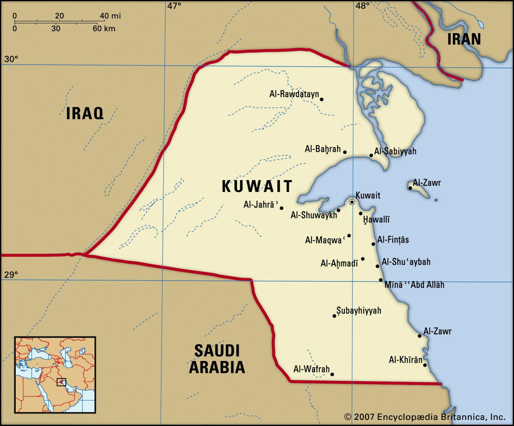
Map of Kuwait and geographical facts
Where Kuwait is on the world map
Map of Kuwait with cities. Where Kuwait is on the world map. The main geographical facts about Kuwait - population, country area, capital, official language, religions, industry and culture.

Kuwait Fact File
Official name State of Kuwait
Form of government Constitutional monarchy with single legislative body (National Assembly)
Capital Al Kuwayt (Kuwait)
Area 1 7,820 sq km (6,880 sq miles)
Time zone GMT + 3 hours
Population 2,112,000
Projected population 2015 2,766,000
Population density 118.5 per sq km (307.0 per sq mile)
Life expectancy 76.5
Infant mortality (per 1,000) 10.9
Official language Arabic
Other language English
Literacy rate 78.6%
Religions Muslim 85% (Sunni 45%, Shi'a 30%, other 10%), other (including Christian, Hindu, Parsi) 15%
Ethnic groups Kuwaiti 45 %, other Arab 35 %, South Asian 9%, Iranian 4%, other 7%
Currency Kuwaiti dinar
Economy Services 90%, industry 9%, agriculture 1 %
GNP per capita US$ 15,100
Climate Arid, with cool winters and hot, humid summers
Highest point Ash Shakayah 290 m (951 ft) Map reference Page 220
The Arab emirate of Kuwait lies in the northwest corner of the Persian Gulf, dwarfed by its neighbors Iraq, Iran, and Saudi Arabia. Beneath its surface lie huge oil reserves. It was settled by wandering Arab peoples in the eighteenth century. When Germany and Turkey were eyeing Kuwait possessively in the nineteenth century it formed a defensive alliance with Great Britain, becoming a British protectorate in 1914. In 1961, when it gained independence, Kuwait was claimed by Iraq.
A constitution was inaugurated by the as Sabah ruling family in 1962. Whenever the National Assembly has been critical, however, it has been suspended. In 1990, Iraq invaded. The Kuwaitis endured six months of brutality and the destruction of the city of Kuwait before a US-led international coalition expelled the Iraqis in 1991. During the occupation 400,000 residents fled the country; 200,000 Palestinian migrant workers were not allowed to return, as the Palestinian Liberation Organization had supported Iraq. The destruction of Kuwaiti oil wells by Iraq and deliberate oil-spills in the Gulf have caused environmental costs still difficult to assess. The damage done in the Third Gulf War in 2003 was much less severe.
Kuwait consists of an undulating sandy plateau which rises westward to an elevation of about 300 m (1,000 ft) on the Iraq-Saudi Arabia border. Along the border the plateau is cut to a depth of 45 m (150 ft) by the Wadi al Batin. In the northeast there are a few salt marshes and in the northwest is the Jal az-Zawr escarpment. Vegetation is mostly limited to salt-tolerant plants along the coast, though in modern urban areas green spaces have been produced by irrigating imported soil. The territory of Kuwait also includes nine islands, of which Bubiyan is the largest.
Kuwait owns ten percent of the world's proven crude oil reserves. Its petroleum sector currently accounts for nearly half of gross domestic product, ninety percent of export revenues, and seventy percent of government income. With the exception of fish, Kuwait depends almost wholly on food imports, though hothouses and hydroponics produce some fruit and vegetables. About 75 percent of potable water must be distilled or imported. The shortage of water constrains industrial activities, which at present include petrochemical production, food processing, desalination, construction materials, and salt. The World Bank has urged the government to push ahead with privatization, including in the oil industry.