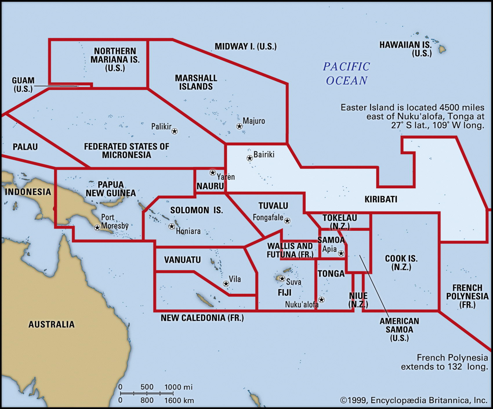
Map of Kiribati and geographical facts
Where Kiribati on the world map. Map of Kiribati
Map of Kiribati with cities. Where Kiribati is on the world map. The main geographical facts about Kiribati - population, country area, capital, official language, religions, industry and culture.

Fact File Kiribati
Official name Republic of Kiribati
Form of government Republic with single legislative body (National Assembly)
Capital Bairiki
Area 717 sq km (277 sq miles)
Time zone GMT+12/11 hours
Population 96,400
Projected population 2015 100,000
Population density 134.4 per sq km (348.0 per sq mile)
Life expectancy 60.5
Infant mortality (per 1,000) 52.6
Official language English
Other language Gilbertese
Literacy rate 90 %
Religions Roman Catholic 52.6%, Protestant (Congregational) 40.9%, other (including Seventh-Day Adventist, Baha'i, Church of God, Mormon) 6.5 %
Ethnic groups Predominantly Micronesian with small Polynesian and non-Pacific minorities
Currency Australian dollar
Economy Agriculture, copra production, fishing
GNP per capita US$ 840
Climate Tropical, moderated by trade winds
Highest point Unnamed location on Banaba Island 81 m (266 ft)
Map reference Page 139
The Republic of Kiribati (pronounced Kiribass) consists of 33 scattered coral atolls in three separate groups in the mid-Pacific, plus the volcanic island, Banaba. The three groups are the seventeen former Gilbert Islands in the west, the eight Phoenix Islands, and the eight Line Islands.
Banaba Island has provided the region with the most income. It is one of three great phosphate rock islands in the Pacific Ocean, the others being Nauru and Makatea. The people of Kiribati are Micronesian, though the Banabans pride themselves on being ethnically distinct.
Kiritimati Island (also known as Christmas Island), one of the Line Islands, was the site of the first British nuclear tests in the Pacific in 1957, but is now a favored location for tourist development. For Kiribati as a whole, it is difficult to see what else besides tourism can be developed as a national source of income— it is classified by the United Nations as a Least Developed Country. The phosphate deposits on Banaba had been exhausted by the time of independence in 1979. Copra (68 percent), seaweed (sixteen percent) and fish (fifteen percent) are now the main exports. A basic subsistence economy still flourishes, with small farms and gardens producing taro, breadfruit, and sweet potatoes. Kiribati imports little food but it depends heavily on foreign aid, largely from the UK and Japan. Aid has been 25 to fifty percent of gross domestic product in recent years.
Though Kiribati is a democracy, the political parties continue to be strongly influenced by a traditional chief system and have little formal organization. A major difficulty for Kiribati today is the problem of environmental degradation from the overpopulation of Tarawa, the island capital to which many Kiribati have migrated because of the lack of job opportunities elsewhere.