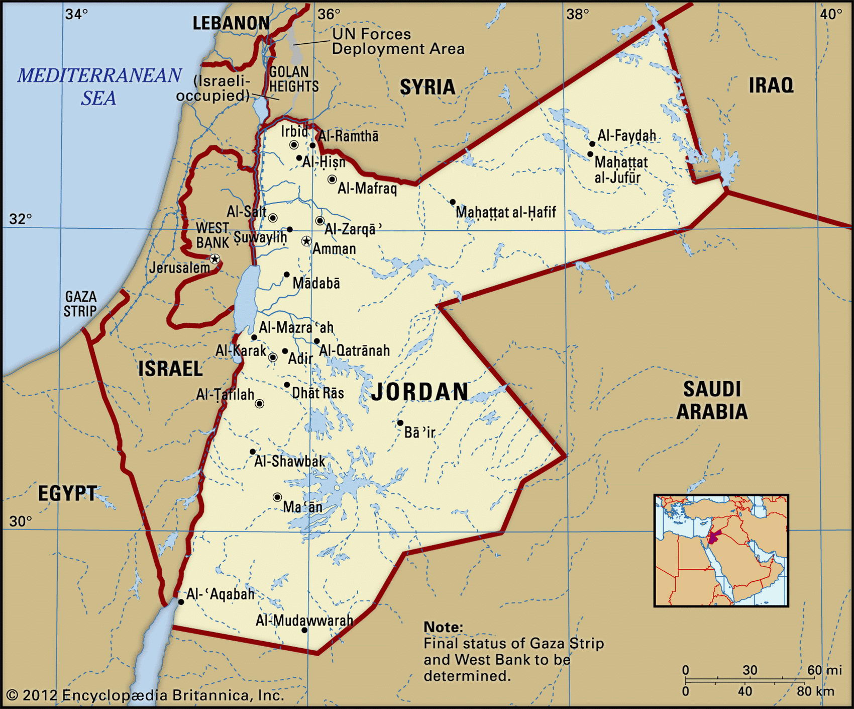
Map of Jordan and geographical facts
Where Jordan is on the world map
Map of Jordan with cities. Where Jordan is on the world map. The main geographical facts about Jordan - population, country area, capital, official language, religions, industry and culture.

Jordan Fact File
Official name Hashemite Kingdom of Jordan
Form of government Constitutional monarchy with two legislative bodies (House of Notables and House of Representatives)
Capital 'Amman
Area 89,21 3 sq km (34,445 sq miles)
Time zone GMT + 2 hours
Population 5,308,000
Projected population 2015 7,191,000
Population density 59.5 per sq km (154.1 per sq mile)
Life expectancy 77.7
Infant mortality (per 1,000) 19.6
Official language Arabic
Other language English
Literacy rate 86.6 %
Religions Sunni Muslim 92%, Christian 8%
Ethnic groups Arab 98%, Circassian 1 %, Armenian 1 %
Currency Jordanian dinar
Economy Services 64%, industry 26%, agriculture 10%
GNP per capita US$ 4,300
Climate Mainly arid, but northwest temperate with cool, wet winters and hot, dry summers
Highest point jabal Ramm 1,754 m (5,755 ft)
Map reference Page 225
The small Arab kingdom of Jordan, rich in historic associations and sites, lies between Saudi Arabia, Israel, and Syria, and also shares a border with Iraq. It has to deal with Israel on the one hand and with Israel's various Arab antagonists on the other, while accommodating huge numbers of refugees. After the Ottoman Turks were driven out during the First World War the British installed the Hashemite monarchy in 1921. In 1946 Jordan became independent, and King Hussein reigned from 1952 until his death in 1999.
Governing Jordan has not been easy, many problems being connected with what is known as the West Bank. As a result of the Six Day War in 1967, the territory west of the Jordan River, and formerly part of Jordan, came under Israeli control. This area, containing both Jerusalem and much of Jordan's most fruitful land, remains a trouble spot. With emigre Palestinians using Jordan as a base for guerrilla activities (they were expelled in 1970-71), through two Gulf Wars in which Jordan was sympathetic to Iraq (its major supplier of oil), and with the recent expansion of Israeli settlements in the area, the West Bank became impossible to regain or to administer. In 1988 Jordan ceded it to the PLO.
The Red Sea-Jordan section of the Rift Valley forms the country's western border. It contains the Jordan River valley, the Dead Sea (the lowest point on the earth's surface, at 400 m/1,312 ft below sea level), the Sea of Galilee, and Wad I al Arabah. Parts of the Jordan Valley and the highlands east of the Rift Valley are irrigated, making arable farming possible. Crops include vegetables, olives, and fruit. Eighty percent of Jordan's land area is desert. In the north it merges with the Syrian Desert and in the south with the deserts of Saudi Arabia. Less than 0.5 percent of the country is forested, mainly in the east. Vegetation ranges from Mediterranean plants in the mountains to grass, sagebrush and shrubs in the steppe country.
Jordan has poor water, oil, and coal supplies. In the late 1970s and early 1980s it received substantial Arab aid and the economy grew at more than ten percent a year. In the late 1980s reductions in aid and in worker remittances slowed and imports outstripped exports. In 1991 the Second Gulf War overwhelmed the country. Worker remittances came to a halt, trade contracted, and additional refugees arrived, further straining resources. Recovery since that time has been uneven. Poverty, debt, and unemployment are continuing problems.
One of the many rock-cut facades in the ancient city of Petra in lordan (below). Byblos Harbor in Lebanon (right page bottom). Krac des Chevaliers in Syria, a French Crusader castle built in the twelfth century (right page top).