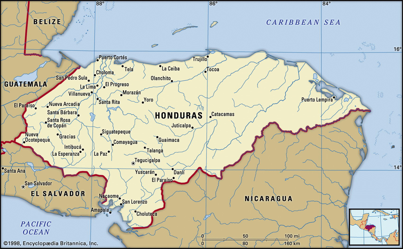
Map of Honduras and geographical facts
Honduras map with cities. Honduras on the world map
Map of Honduras with cities. Where Honduras is on the world map. The main geographical facts about Honduras - population, country area, capital, official language, religions, industry and culture.

Honduras Fact File
Official name Republic of Honduras
Form of government Republic with single legislative body (National Congress)
Capital Tegucigalpa
Area 112,090 sq km (43,278 sq miles)
Time zone GMT-6 hours
Population 6,561,000
Projected population 2015 8,703,000
Population density 58.5 per sq km (151.6 per sq mile)
Life expectancy 68.8
Infant mortality (per 1,000) 30.5
Official language Spanish
Other languages Indigenous languages, English Creole
Literacy rate 74 %
Religions Roman Catholic 97%, Protestant and other beliefs 3 %
Ethnic groups Mixed indigenous-European 90%, indigenous 7%, African 2%, European 1 %
Currency Lempira
Economy Agriculture 60%, services 24%, industry 16%
GNP per capita US$ 2,600
Climate Tropical on plains, cooler in mountains
Highest point Cerro Las Minas 2,849 m (9,347 ft)
Map reference Page 428
Honduras is the second largest of the Central American countries. Its mountainous mass lies across the isthmus north of Nicaragua, with Guatemala to the west and El Salvador to the southwest. The Caribbean shoreline runs eastward from the Guatemalan border to the flat and almost uninhabited Mosquito Coast. In the west are the historic ruins of Copan, a site of the ancient Maya civilization which ended long before the Spaniards arrived in 1522. Gold first drew the Spanish to Honduras and when they discovered it in the west they founded Tegucigalpa in 1524. The Honduran mountains are highly metalliferous and silver is still an important export. Independent from Spain since 1821, the country has had decades of military rule with only the occasional elected government. The challenge for the present administration is to reduce the role of the military in political and economic life.
At least 75 percent of Honduras is mountainous. From the central highlands several river valleys run northwest to the coast, where the plains along the Caribbean shore broaden toward the east. The lower valleys have been reclaimed and the forests have been replaced by banana plantations. On the Pacific side there is a short stretch of coast in the Gulf of Fonseca. The adjacent lowlands are used for growing cotton. Rainforest in the northeast provides sanctuary for a great variety of wildlife.
The original "banana republic", Honduras was the world's leading exporter during the 1920s and 1930s. Bananas still account for nearly a quarter of all exports but coffee is now the largest earner. The country depends heavily on the USA for trade: fifty-three percent of its exports and fifty percent of its imports are with the USA. Most of the workforce are farmers, many of them at a subsistence level: food staples are corn, beans, and rice. Small-scale manufactures include furniture, textiles, footwear, chemicals, and cement. Subject to an International Monetary Fund (IMF) restructuring program in the 1990s, Honduras has faced difficulties, with its already poor people subject to sharp tax increases. In 1998, Hurricane Mitch killed more than 9,000 people in Central America, devastating crops and leaving thousands homeless.