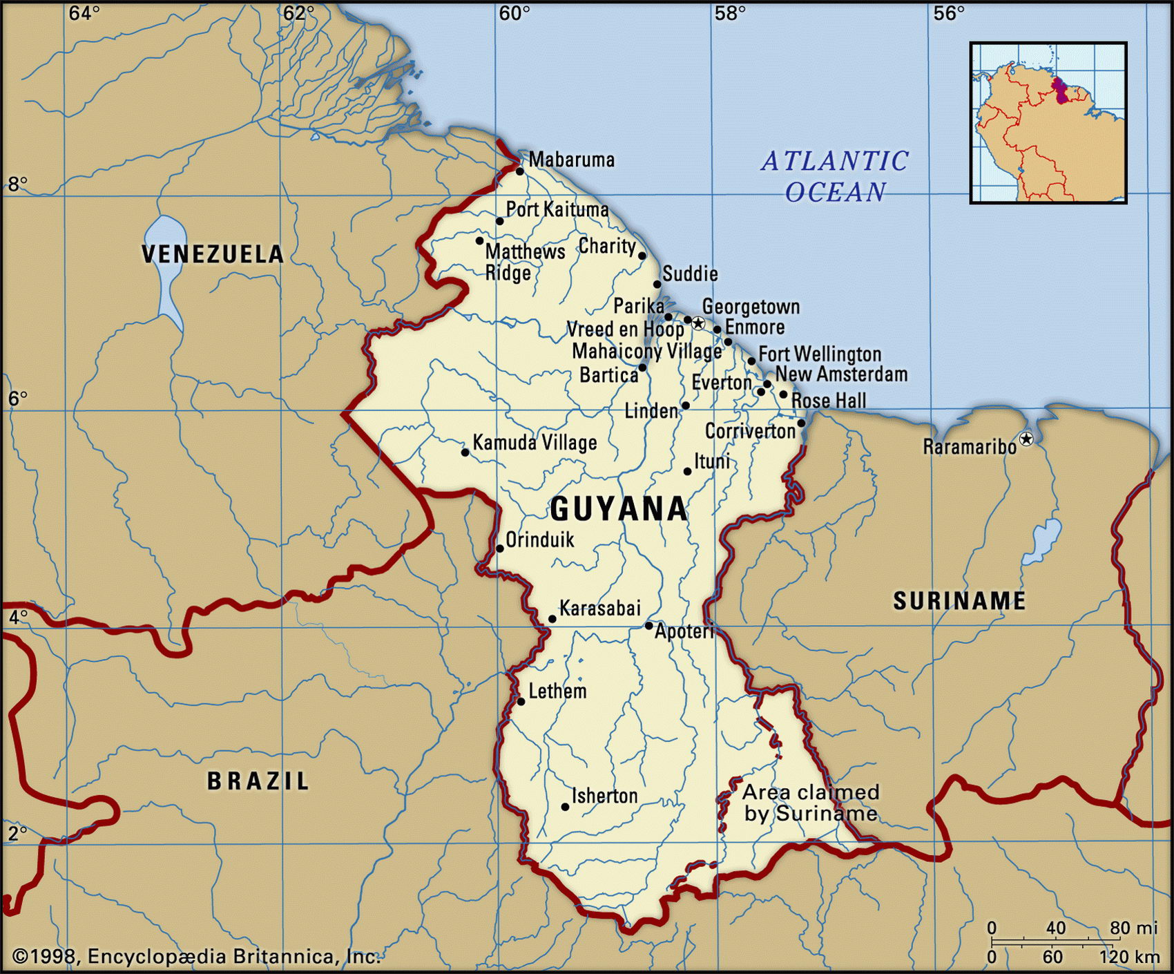
Map of Guyana and geographical facts
Guyana on the world map. Map of Guyana with cities
Map of Guyana with cities. Where Guyana is on the world map. The main geographical facts about Guyana - population, country area, capital, official language, religions, industry and culture.

Guyana Fact File
Capital Georgetown
Time zone GMT - 3 hours
Population 698,000
Official language English
Literacy rate 97.5
Official name Cooperative Republic of Guyana
Form of government Republic with single legislative body (National Assembly)
Area 214,970 sq km (83,000 sq miles)
Projected population 2015 749,000
Population density 3.2 per sq km (8.4 per sq mile)
Life expectancy 62.6
Infant mortality (per 1,000) 38.4
Other languages Amerindian languages, Hindi, Urdu
Religions Protestant 34%, Hindu 34%, Roman Catholic 18%, Muslim 9%, other 5c
Ethnic groups East Indian 51 %, African and mixed indigenous-African 43%, indigenous 4%, European and Chinese 2%
Currency Guyana dollar
Economy Industry 44%, agriculture 34%, services 22%
GNP per capita US$ 3,600
Climate Tropical with two rainy seasons (May to mid-August, mid-November to mid-January)
Highest point Mt Roraima 2,810 m (9,219 ft) Map reference Page 451
Guyana means "the land of many waters". In l6l6 it was settled by the Dutch, who built dikes, reclaimed coastal land, and planted sugarcane. When the indigenous people refused to work in the sugar plantations the Dutch, and later the British, imported slaves from Africa and indentured labor from India. The contrast between the communities descended from these two immigrant groups defines today's Guyanese political life. Beginning in 1953, and sharpened by independence in 1966, a struggle for dominance continues between the Afro-Guyanese and the numerically superior Indo-Guyanese. Until the early 1990s Guyana was ruled mostly by leftist governments. In the country's first free and fair elections in 1992 Cheddi Jagan was elected president. After his death in 1997 he was succeeded by his wife Janet who resigned in 1999 due to poor health. Her successor, Bharrat Jagdeo, was reelected in 2001.
Some 95 percent of the people live on the coastal strip, and there is concern about flooding because of poor dike maintenance. The savannas, river valleys, and forested plateaus of the interior are largely unpopulated. There are, however, settlements of two neglected minorities in the forests—blacks descended from escaped slaves; and Carib, Warrau, and Arawak Amerindians.
Numerous rivers, including the country's main river, the Essequibo, flow down from the mountains in the west through tropical forests inhabited by a rich assortment of wildlife including sloth, jaguar, tapir, and capybara. There is diamond dredging in many of the rivers, and in 1995 there was a major cyanide spill at the Omai gold mine near the Essequibo. The effects of mining activities on the wildlife is of major concern to conservationists.
The mining of high-quality bauxite and sugar production accounts for eighty percent of exports. Other resources include gold, diamonds, uranium, manganese, oil, copper, and molybdenum. Under successive governments, state ownership and government controls have stunted development and made adaptation to market fluctuations difficult. The bauxite industry remains a state monopoly. Recent deregulation has, however, shown benefits. Though weak infrastructure hampers tourist development, the spectacular scenery and wildlife of the interior is attracting visitors.
Riverboats in Puerto Colombia, Colombia (left page top). A view of Caracas, the capital of Venezuela (left).