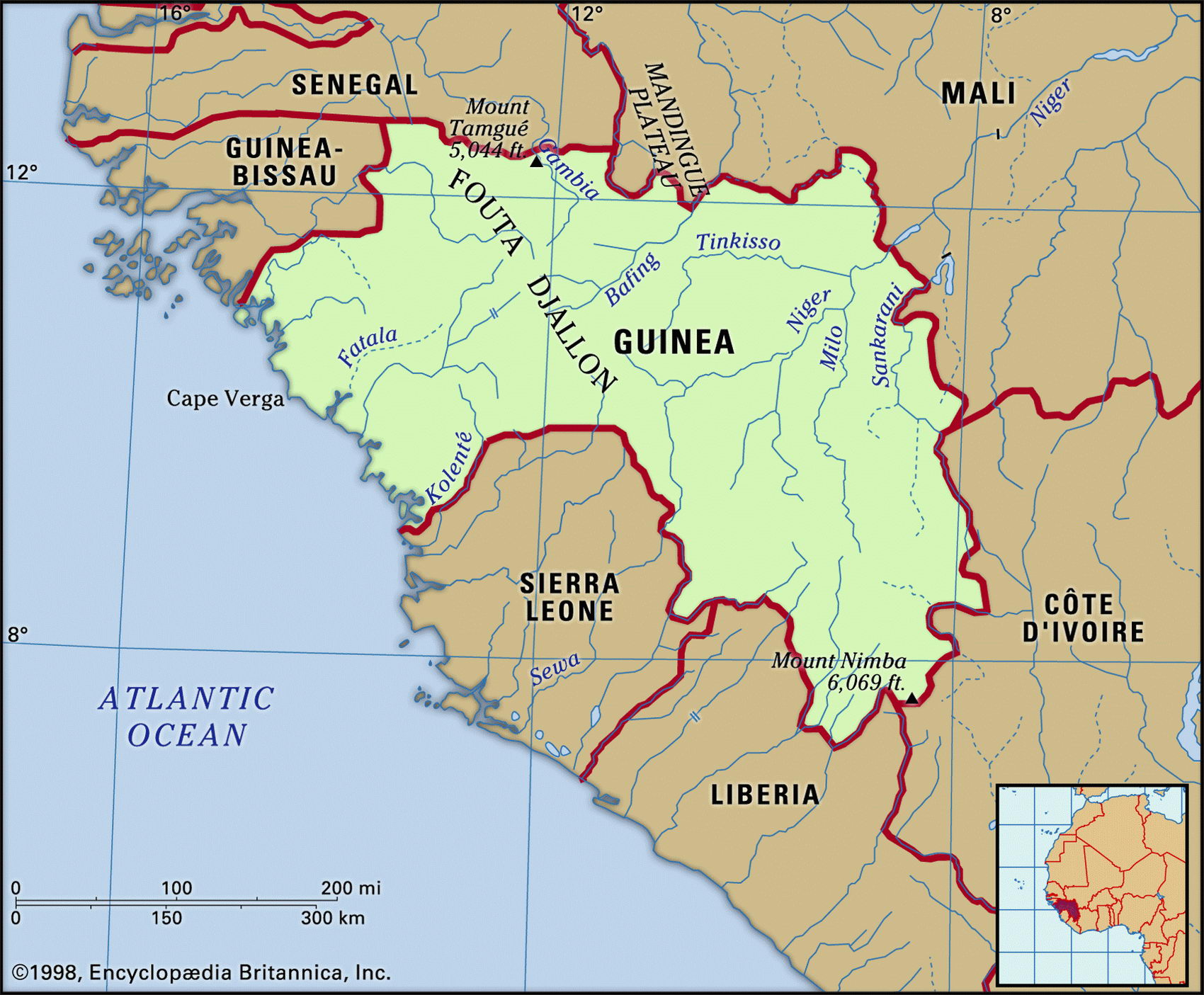
Guinea mapMap of Cuba and geographical facts

Guinea Fact File
Official name Republic of Guinea
Form of government Republic with single legislative body (People's National Assembly)
Capital Conakry
Area 245,860 sq km (94,926 sq miles)
Time zone GMT
Population 7,776,000
Projected population 2015 11,300,000
Population density 31.6 per sq km (81.9 per sq mile)
Life expectancy 46.3
Infant mortality (per 1,000) 127.1
Official language French
Other languages Malinke languages, Fulbe and others
Literacy rate 35.9%
Religions Muslim 85%, Christian 8%, indigenous beliefs 7%
Ethnic groups Fulbe 40%, Malinke 30%, Soussou 20%, smaller tribes 10%
Currency Guinean franc
Economy Agriculture 80%, industry and commerce 11 %, services 9%
GNP per capita US$ 1,970
Climate Tropical, with wet season May to November
Highest point Mt Nimba 1,752 m (5,748 ft) Map reference Page 364
Guinea is on the African Atlantic coast to the north of Sierra Leone and Liberia. A slave-trading center from the fifteenth century, it became the colony of French Guinea in 1890. After achieving independence in 1958 it was for 25 years a one-party Marxist dictatorship under Ahmed Sekou Toure. A member of the Malinke tribe, he centralized and nationalized, attempted to enforce the use of local languages in place of French, and paid large numbers of state informers to monitor village and family life. Guinea now ranks last or near last on most international social development scales. Women face many disadvantages, including the practice of genital mutilation, which is widespread.
In the past twenty years governmental efforts at reform have led to a number of improvements, and in 1995 Guinea's first multi-party elections took place. The country has had to bear the additional burden of several hundred thousand refugees who have fled from the civil wars in Liberia and Sierra Leone. Many of these people are now returning home.
From mangrove swamps and lagoons along the coast, the land rises through densely forested foothills to the Fouta Djalon Highlands in the east. These highlands—from which the Gambia, Senegal, and Niger Rivers flow north and northeast—form a barrier between the coast and the grassland and savanna woodland of the Upper Niger Plains. Typical wildlife on the savanna includes lion and leopard, while crocodile and hippopotamus are found in the rivers.
The eighty percent of the workforce who live from agriculture are spread fairly evenly through the countryside. Those who live on the wet Atlantic coastal plain, much of which has been cleared for farming, cultivate bananas, palm oil, pineapples, and rice. Cattle are raised by nomadic herders in the interior.
Guinea possesses more than 25 percent of the world's reserves of high-grade bauxite, and three large bauxite mines contribute about eighty percent of the country's export revenue. Since it opened in 1984, the Aredor diamond mine has also been extremely profitable. Good soil and high yields give the country a prospect of self-sufficiency in food but the years of stifling state controls that were imposed by Toure have made market reforms difficult to implement, and what little infrastructure exists is greatly in need of modernizing. Corruption and harassment obstruct business growth. Aside from the bauxite industry, there is little foreign investment.