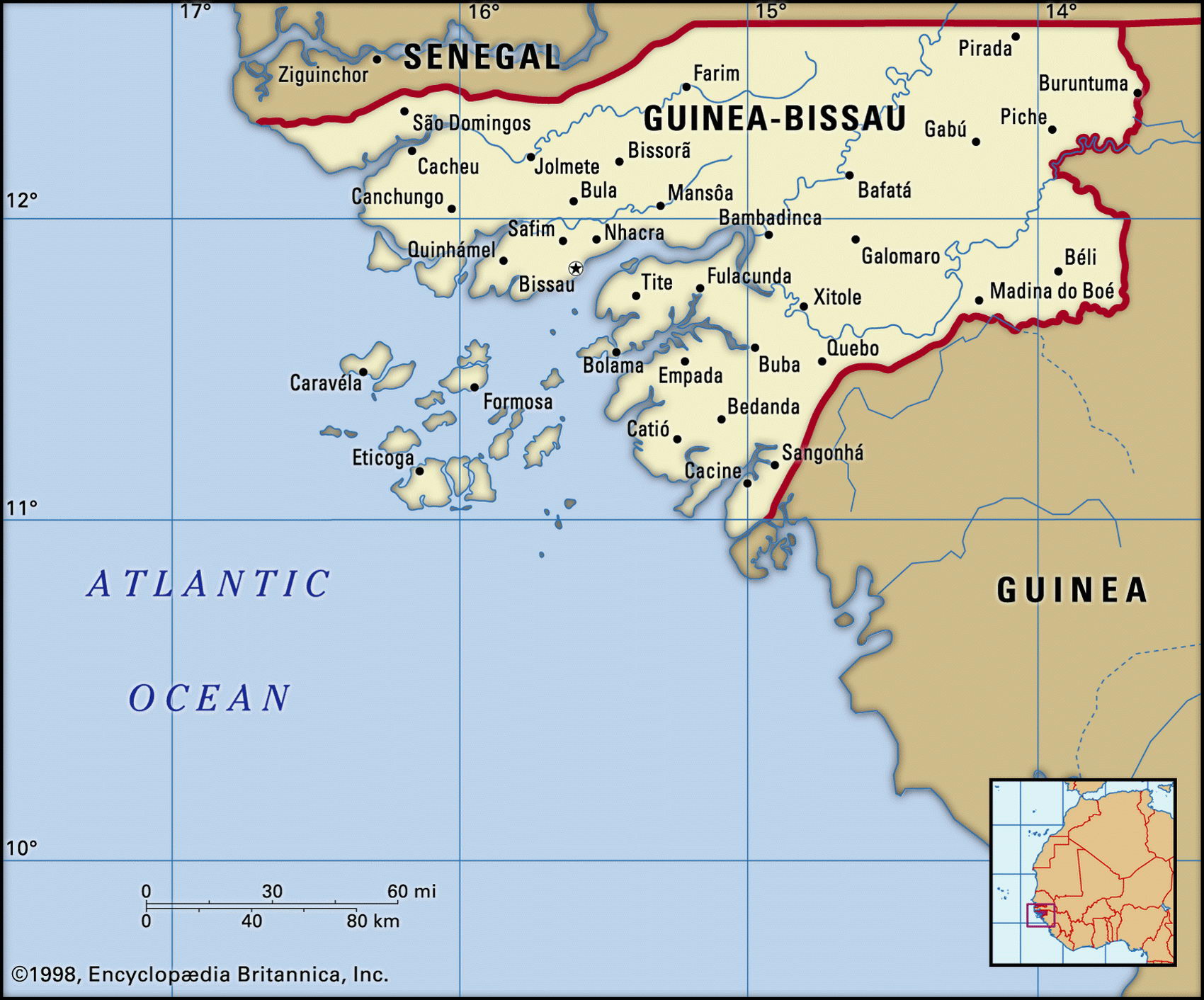
Guinea-Bissau mapMap of Cuba and geographical facts

Guinea-Bissau Fact File
Official name Republic of Guinea-Bissau
Form of government Republic with single legislative body (National People's Assembly)
Capital Bissau
Area 36,120 sq km (1 3,946 sq miles)
Time zone GMT
Population 1,346,000
Projected population 2015 1,727,000
Population density 37.3 per sq km (96.5 per sq mile)
Life expectancy 49.8
Infant mortality (per 1,000) 109.5
Official language Portuguese
Other languages Crioulo (blend of Portuguese and West African languages), Fulbe, and other indigenous languages
Literacy rate 34 %
Religions Indigenous beliefs 65%, Muslim 30%, Christian 5%
Ethnic groups Indigenous 99% (including Balanta 30%, Fula 20%, Manjaca 14%, Mandinga 13%, Papel 7%), European and mixed 1 %
Currency CFA (Communaute Financiere Africaine) franc
Economy Agriculture 90%, industry and services 10%
GNP per capita US$ 900
Climate Tropical, with wet season June to November
Highest point Unnamed location in northeast 300 m (984 ft)
Map reference Page 364
Guinea-Bissau is a small west African state between Guinea and Senegal. A large part of the country consists of mangrove swamps, estuaries, and islands, and it is both poor and underdeveloped. After the French and British used the area as a slave-trading station in the seventeenth and eighteenth centuries, Portugal named it Portuguese Guinea and claimed it as a colony in 1879. Independence, achieved in 1974, came following twelve years of guerrilla war.
One-party rule plus attempted coups and assassinations marked the next seventeen years. Moves towards multi-party democracy, designed to allow for ethnic divisons and inequalities, began in 1990. The contrast between the limited opportunities available to the 99 percent of the population which is African and the privileges of the tiny Afro-Portuguese elite is a major cause of tension. The existence of the opposition Democratic Front was made legal in 1991. Women face significant disadvantages and female genital mutilation is widespread.
Three main waterways—the Geba, Corubal, and Cacheu Rivers—mark the landscape. These wander across the plains toward broad estuaries and mangrove swamps on the coast. Here, the seasonal rainfall is especially heavy. Rice, the staple food, is grown on the floodplains and in the swamps, as well as on the offshore islands of the Arquipelago dos Bijagos, but not enough is produced to make the country self-sufficient. An area of upland savanna lies toward the border with Guinea in the southeast.
Mineral resources include phosphates, bauxite, and offshore oil but their development has been hampered by political instability, state controls, and (in the case of oil) disputes with Guinea and Senegal. Agriculture and fishing employ ninety percent of the workforce. Cashew nuts, peanuts, and palm kernels are the main exports. Economic reforms featuring monetary stability and private sector growth have been undertaken but progress is being hampered by the burden of high foreign debt and the many cultural and institutional constraints.